Regional overview
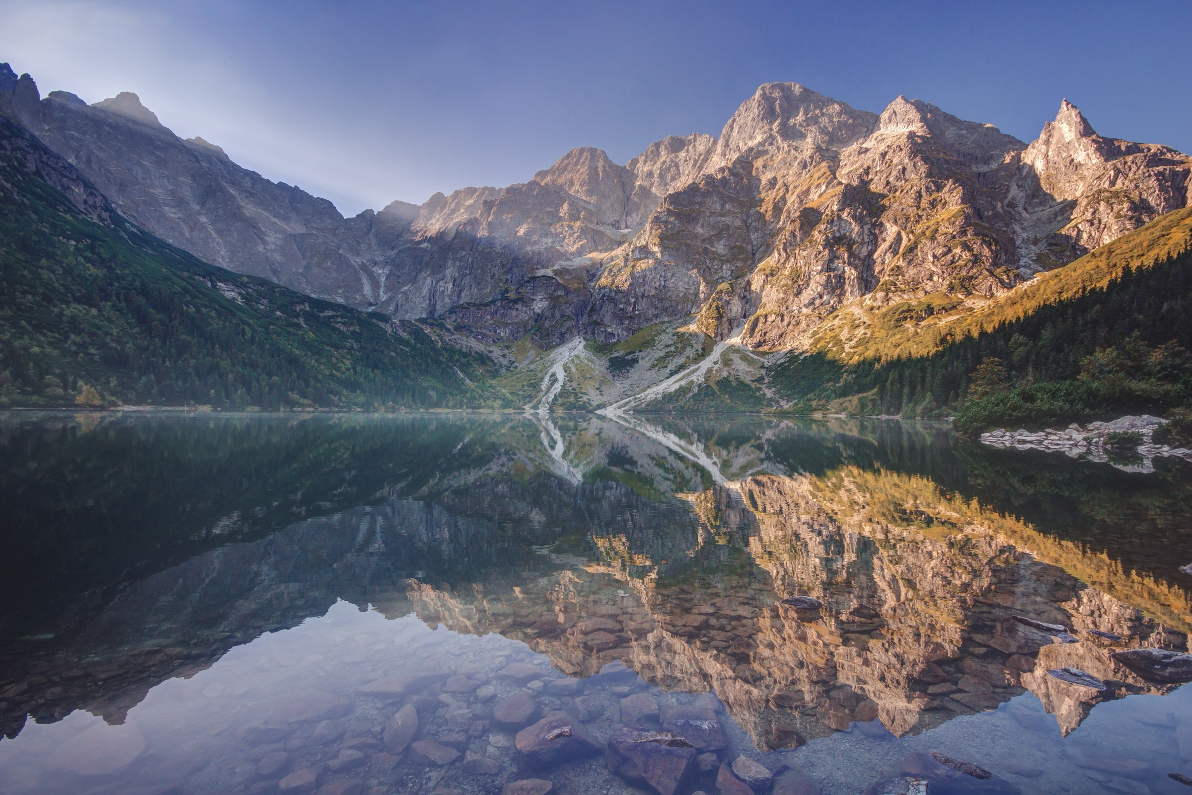
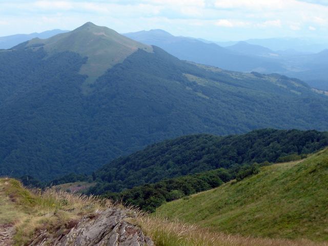
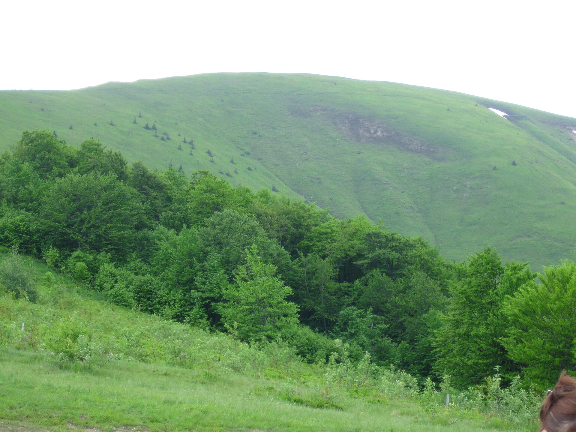
The Bieszczady and Ukrainian Carpathians form a lower, wilder-feeling part of the Carpathian arc, with long forest approaches, open grassy ridges known as połoniny or polonynas, and broad summit views rather than sharp alpine terrain. The Polish Bieszczady are protected by Bieszczady National Park, with extensive beech forests and open montane meadows.
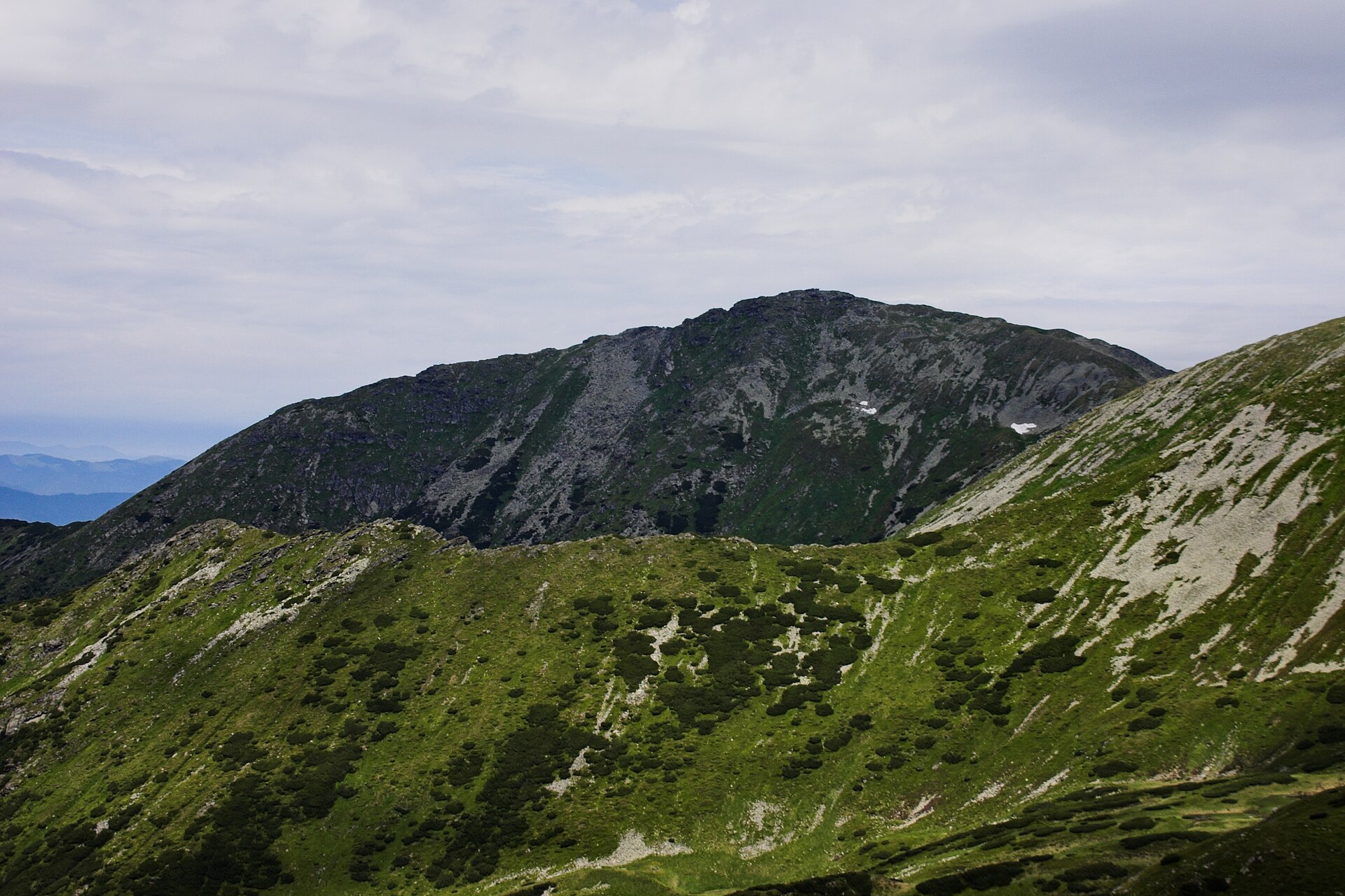
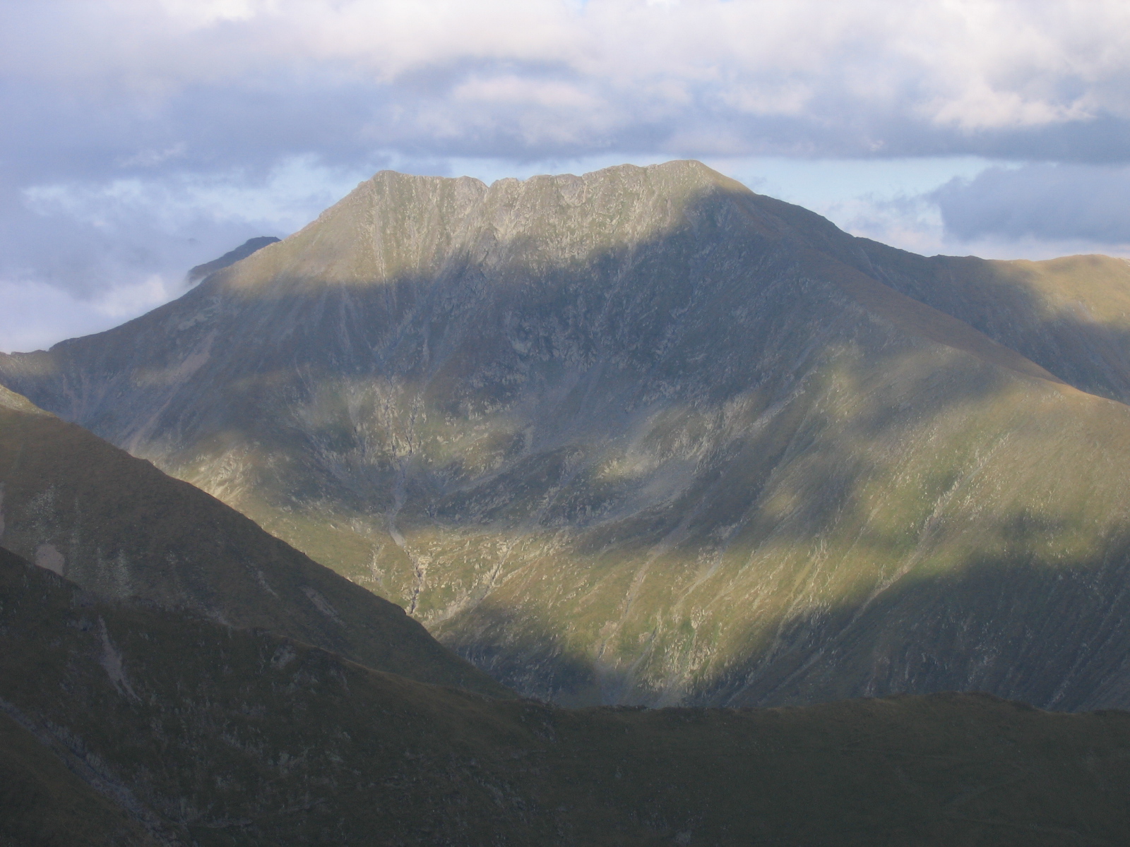
The Ukrainian selection focuses on the Chornohora and Borzhava ranges. Chornohora contains Ukraine’s highest summits, including Hoverla and Pip Ivan Chornohirskyi, while Borzhava is a long grassy ridge system above Pylypets and Volovets.
Typical hiking season is late spring to autumn on lower ridges and June to October for the higher Chornohora routes. Early summer snow, thunderstorms, strong wind and poor visibility can make the open ridges significantly more serious.
In the Polish national park, dogs are allowed only on specially designated trails and roads. In the Ukrainian national park, walkers should remain on marked routes, avoid fires and check current access, park and group-registration requirements.
Selection rationale
These five hikes give a balanced cross-section of the region: the highest and most iconic summit in the Polish Bieszczady, a classic Bieszczady meadow traverse, Ukraine’s highest mountain, the historic White Elephant observatory on Pip Ivan, and a representative Borzhava ridge day. All are feasible as day hikes for fit walkers in normal summer conditions, but the Ukrainian Chornohora routes are long, weather-sensitive mountain days.
Summary table
| # | Hike | Country | Route type | Distance | Gain | Max elevation | Difficulty |
|---|---|---|---|---|---|---|---|
| 1 | Tarnica from Wołosate | Poland | Out-and-back | 8.8–10.0 km | ~607 m | 1,346 m | Moderate–strenuous |
| 2 | Połonina Wetlińska Traverse | Poland | Point-to-point | 12.2 km | Approx. 770–870 m, secondary | ~1,229 m, secondary | Moderate–strenuous |
| 3 | Hoverla from Zaroslyak | Ukraine | Out-and-back / short loop variant | 7.4–10.5 km | ~750–1,100 m, variant-dependent | 2,061 m | Moderate–strenuous |
| 4 | Pip Ivan Chornohirskyi via Vukhatyi Kamin and Smotrych | Ukraine | Loop / long circuit | 12.5–21.3 km, source-dependent | 1,360–1,556 m | 2,028–2,048 m | Strenuous |
| 5 | Borzhava Ridge: Pylypets, Hemba and Velykyi Verkh | Ukraine | Loop / lift-assisted variant possible | 10.6–17.3 km | 737–1,000 m | 1,598 m | Moderate–strenuous |
1. Tarnica from Wołosate
Snapshot
Itinerary
The route starts in Wołosate and follows the blue-marked trail from the former Boyko village area and cemetery towards the Przełęcz pod Tarnicą. The official Bieszczady National Park page gives the Wołosate–Tarnica nature trail as 4.40 km, with an ascent time of 2 hr 05 min and descent time of 1 hr 05 min. The path is described as an earthen trail, with clay sections that become slippery after rain. From the pass below Tarnica, the route leaves the blue trail and follows the short yellow-marked summit spur to Tarnica, the highest summit of the Polish Bieszczady. Return is by the same route to Wołosate.
Why it is essential
Tarnica is the highest summit in the Polish Bieszczady and the most recognisable summit objective in Bieszczady National Park. The Wołosate approach gives the shortest standard ascent and a compact introduction to the open summit ridges that define the Polish part of the region.
Equipment
- Sturdy boots
- Weatherproof layer
- Warm layer
- Water and food
- Map or GPS
- Navigation backup
- Sun protection
- Trekking poles useful on the descent
- Microspikes may be needed outside summer if snow or refrozen mud remains
Hazards and notes
The upper approach is exposed to wind and poor visibility, and clay sections are slippery after rain. The route lies inside Bieszczady National Park; park ticketing and current trail rules should be checked before departure. Dogs are restricted in the national park and are not generally allowed on unspecified trails.
GPX / KML links
| Source | URL | Format | Notes |
|---|---|---|---|
| Bieszczady National Park official route page | bdpn.gov.pl | Official route description / map | Official page; no downloadable GPX located. Suitable for route verification |
| TrasaDlaBobasa route page | trasadlabobasa.pl | Source map; GPX button indicated | Direct GPX URL unresolved; use as secondary verification. Terms not checked |
Sources
- Bieszczady National Park — Wołosate–Tarnica nature trail
- TrasaDlaBobasa — The shortest trail to Tarnica
- Wikimedia Commons — Tarnica, Bieszczady
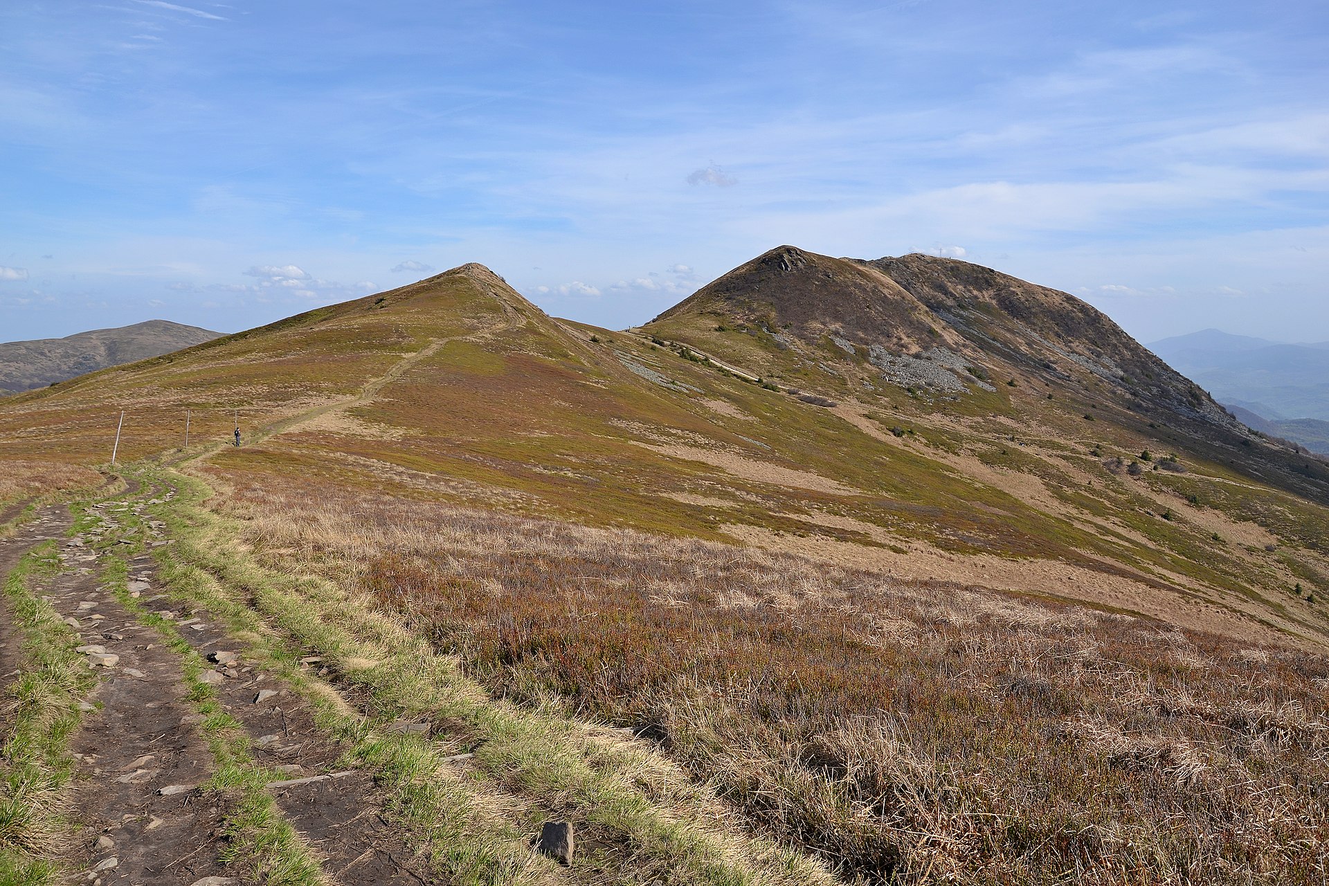
2. Połonina Wetlińska Traverse
Snapshot
Itinerary
The official Bieszczady National Park route starts at Brzegi Górne and finishes at Wetlina. The route follows the red trail over Połonina Wetlińska to Przełęcz Orłowicza, then descends on the yellow trail to Wetlina–Stare Sioło. The park gives a distance of 12.20 km and describes the path as an earthen trail with clay sections that may be slippery after rain. The traverse crosses one of the classic open meadow ridges of the Polish Bieszczady. Variants may start at Przełęcz Wyżna, Górna Wetlinka or Smerek; these change both distance and ascent.
Why it is essential
Połonina Wetlińska is one of the defining ridge walks of the Bieszczady. It represents the region’s characteristic open grassland ridges, long views and non-technical but weather-exposed walking.
Equipment
- Sturdy boots
- Weatherproof layer
- Warm layer
- Water and food
- Map or GPS
- Navigation backup
- Sun protection
- Trekking poles useful on the long descent
- Tick protection recommended in season
Hazards and notes
The ridge is exposed to wind, lightning and poor visibility. Mud and clay can make descents slippery after rain. The route is inside Bieszczady National Park; ticketing, trail closures and dog restrictions should be checked before departure. Dogs are restricted to specified routes and roads in the park.
GPX / KML links
| Source | URL | Format | Notes |
|---|---|---|---|
| Bieszczady National Park official route page | bdpn.gov.pl | Official route description / map | Official page; no downloadable GPX located. Suitable for route verification |
| Wikiloc secondary route | wikiloc.com | User route / likely downloadable track depending on account access | Use as secondary geometry/statistics reference. User-generated trail terms not checked |
Sources
- Bieszczady National Park — Połonina Wetlińska nature trail
- Wikiloc — Połonina Wetlińska, Bieszczady National Park
- Wikimedia Commons — Połonina Wetlińska
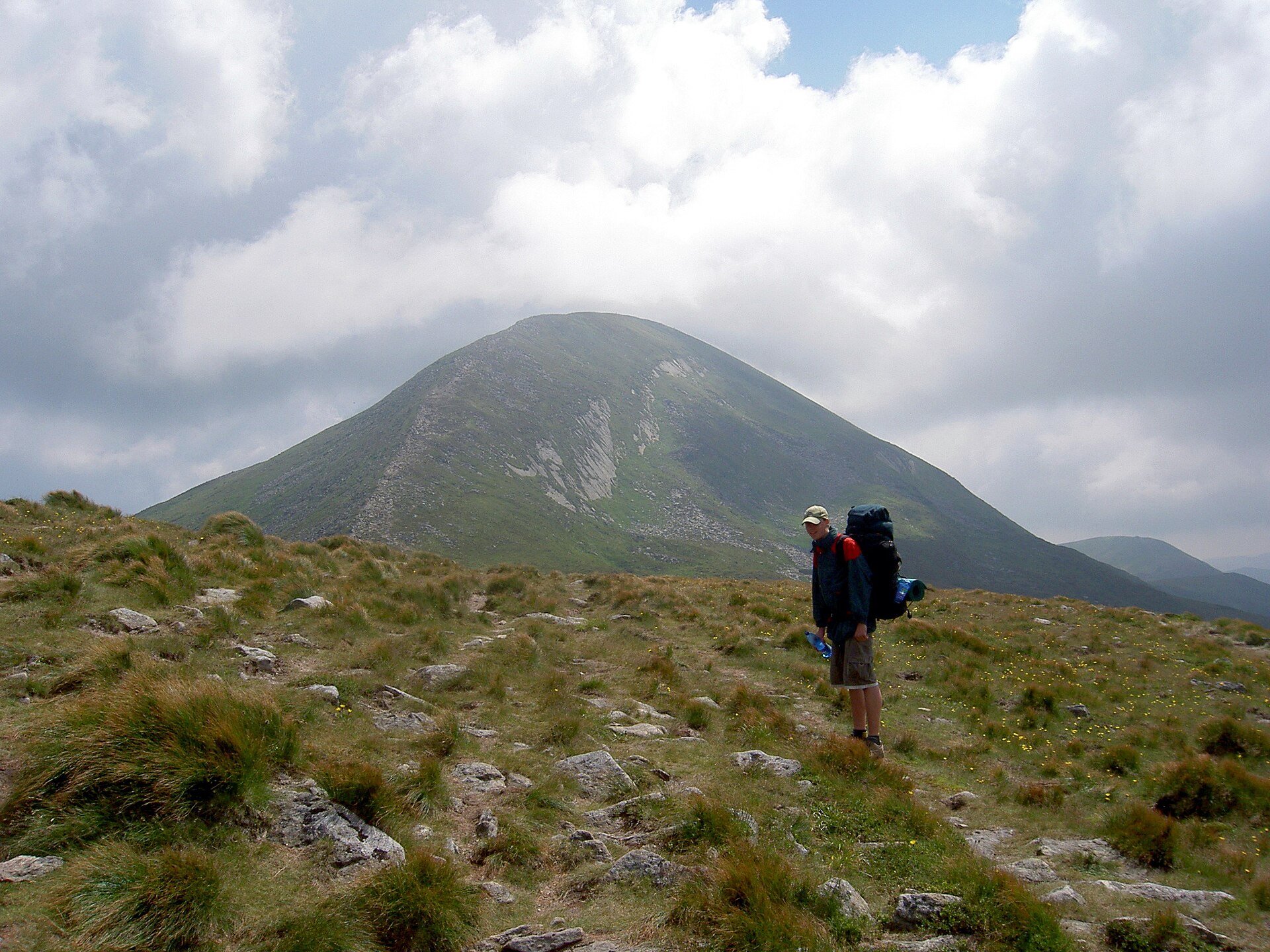
3. Hoverla from Zaroslyak
Snapshot
Itinerary
The official Carpathian National Nature Park route describes the Hoverla mountain trail as a one-day route of 10.5 km, with elevations from about 950 m to 2,061 m. The route is marked blue and green and has an estimated duration of 5 hr. The common day-hike variant starts near the Zaroslyak sports base and climbs through forest to the open upper slopes of Hoverla. Marked blue and green route options are used locally; the green route is commonly described as the shorter, steeper ascent. Descent is usually by the same route or by the alternative marked trail.
Why it is essential
Hoverla is the highest mountain in Ukraine and the single most famous summit hike in the Ukrainian Carpathians. It is a logical anchor hike for any catalogue entry covering Chornohora.
Equipment
- Sturdy boots
- Weatherproof layer
- Warm layer
- Water and food
- Map or GPS
- Navigation backup
- Headtorch
- Sun protection
- Trekking poles recommended
- Microspikes may be necessary when snow or refrozen sections remain
Hazards and notes
The upper mountain is open and highly weather-sensitive. Fog, thunderstorms, strong wind and lingering snow can make navigation and footing serious. The official park rules require staying on marked routes, avoiding fires and registering tourist groups with the rescue service where applicable. Park fees, checkpoint arrangements and wartime/local access conditions need current confirmation before publication.
GPX / KML links
| Source | URL | Format | Notes |
|---|---|---|---|
| Carpathian National Nature Park official Hoverla trail | cnnp.if.ua | Official route description | No downloadable GPX located. Suitable for route verification |
| Karpaty.rocks Hoverla route | karpaty.rocks | GPX route page | Use as temporary source-route link; replace later. Site terms unresolved |
| Karpaty.rocks GPX URL | karpaty.rocks | GPX | Temporary GPX link; replace later. Terms unresolved |
Sources
- Carpathian National Nature Park — Hoverla mountain trail
- Carpathian National Nature Park — Hoverla (UA)
- Karpaty.rocks — Zaroslyak to Hoverla
- Karpaty.rocks — Hoverla GPX
- Wikimedia Commons — Hoverla
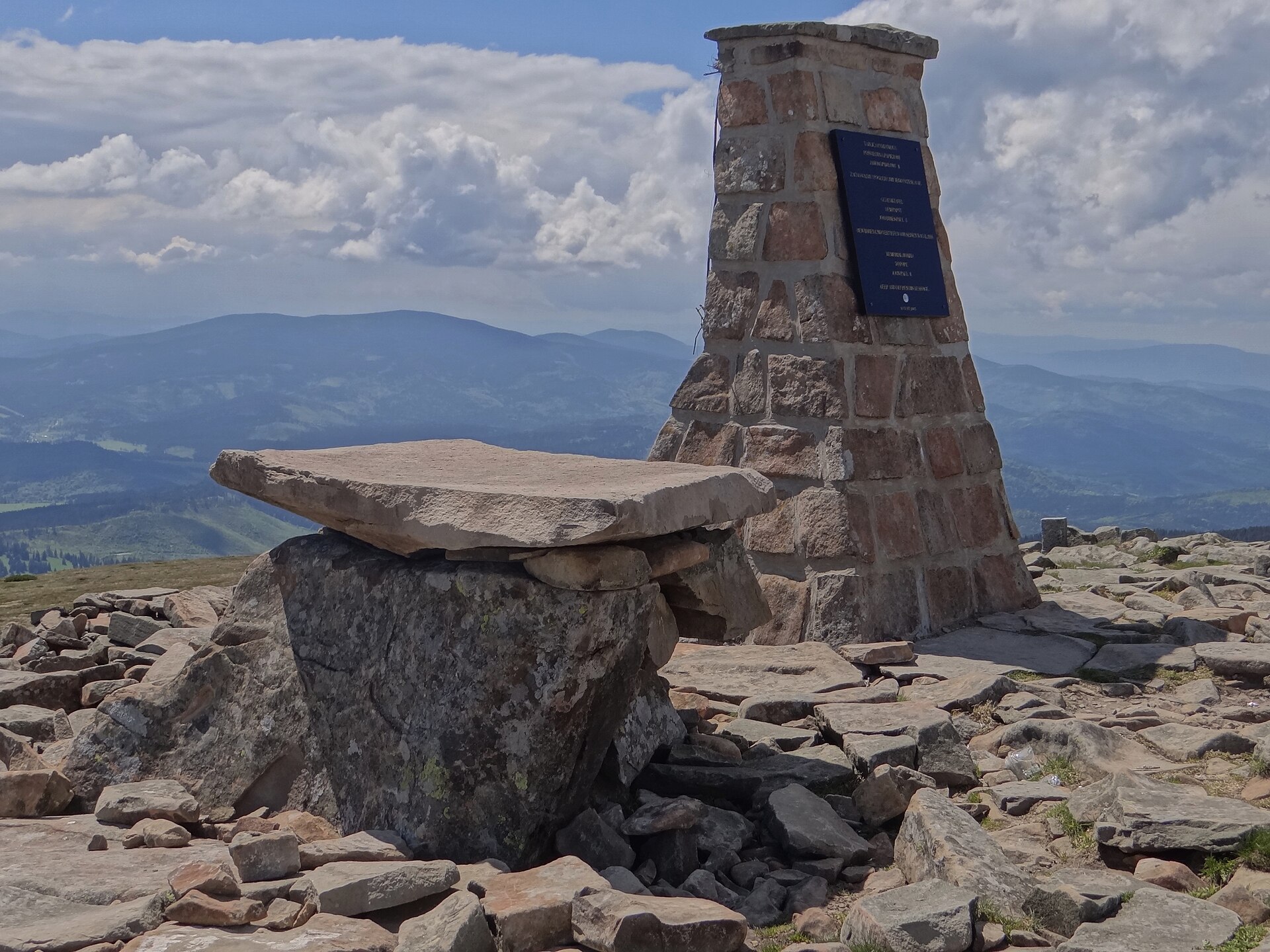
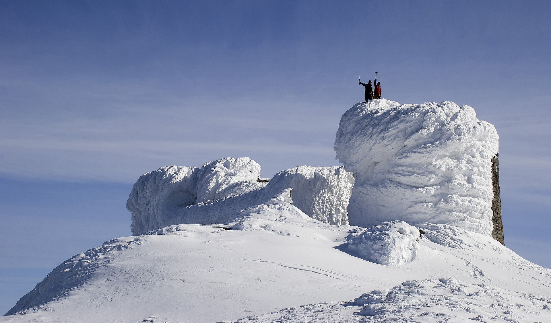
4. Pip Ivan Chornohirskyi via Vukhatyi Kamin and Smotrych
Snapshot
Itinerary
The official Carpathian National Nature Park page for the Dzembronia–Pip Ivan eco-trail gives a one-day route of 9.6 km between about 900 m and 2,026 m, passing through the Bystryskyi protected division and Polonyna Smotrych towards Pip Ivan. The park’s route list also includes a Dzembronia – Vukhatyi Kamin – Pip Ivan – Smotrych – Dzembronia circuit of 12.5 km. The full day-hike circuit commonly used by experienced walkers starts in Dzembronia, climbs towards Vukhatyi Kamin, continues to Pip Ivan Chornohirskyi and the White Elephant observatory, then returns by Smotrych.
Why it is essential
Pip Ivan combines a major Chornohora summit, a long high-level ridge approach and the historic White Elephant observatory. It is one of the most distinctive mountain objectives in the Ukrainian Carpathians, but it is a much more committing day than Hoverla.
Equipment
- Sturdy boots
- Weatherproof layer
- Warm layer
- Hat and gloves outside midsummer
- Water and food
- Map or GPS
- Navigation backup
- Headtorch
- Trekking poles recommended
- Microspikes may be needed if snow remains
- Emergency bivvy layer recommended because of the length and remoteness
Hazards and notes
This is a long, exposed mountain route with serious consequences in fog, storms or early-season snow. Some secondary sources describe parts of the longer circuit as unmarked or only partly marked. Park rules require staying on authorised routes and avoiding damage, fires and off-route travel. Border-zone, wartime and local access restrictions need current confirmation before publication.
GPX / KML links
| Source | URL | Format | Notes |
|---|---|---|---|
| Carpathian National Nature Park Dzembronia–Pip Ivan trail | cnnp.if.ua | Official route description | No downloadable GPX located. Suitable for route verification |
| Carpathian National Nature Park route list | cnnp.if.ua | Official route list | Confirms named circuit but statistics differ from secondary sources |
| Karpaty.rocks Dzembronia–Vukhatyi Kamin–Pip Ivan–Smotrych route | karpaty.rocks | GPX route page | Use as temporary source-route link; replace later. Site terms unresolved |
| Karpaty.rocks GPX URL | karpaty.rocks | GPX | Temporary GPX link; replace later. Terms unresolved |
Sources
- Carpathian National Nature Park — Dzembronia–Pip Ivan trail
- Carpathian National Nature Park — Route list
- Karpaty.rocks — Dzembronia via Vukhatyi Kamin, Pip Ivan and Smotrych
- Karpaty.rocks — Pip Ivan GPX
- Wikimedia Commons — White Elephant observatory
5. Borzhava Ridge: Pylypets, Hemba and Velykyi Verkh
Snapshot
Itinerary
The route starts in Pylypets and climbs towards the Borzhava ridge, either on foot or with a lift-assisted start depending on local lift operation. The ridge route links Hemba or Gemba with Velykyi Verkh before descending back towards Pylypets. A shorter Pylypets–Hemba–Velykyi Verkh–Pylypets route is about 10.6 km, with roughly 737 m of ascent and 1,167 m of descent. Fuller walking circuits via Ryapetska, Velykyi Verkh and Gimba are reported at about 16–17.3 km and around 8 hr.
Why it is essential
Borzhava is one of the classic grassy ridge landscapes of the Ukrainian Carpathians. This route gives a representative day on the broad open crest, with major local summits and the possibility of a shorter lift-assisted itinerary.
Equipment
- Sturdy boots
- Weatherproof layer
- Warm layer
- Water and food
- Map or GPS
- Navigation backup
- Sun protection
- Trekking poles useful on grassy descents
- Extra warm layers and traction may be needed in shoulder season
Hazards and notes
The Borzhava ridge is broad and exposed, so fog and wind can make navigation difficult. Winter conditions are significantly more serious and avalanche-prone. Lift operation, descent options and local transport need current confirmation.
GPX / KML links
| Source | URL | Format | Notes |
|---|---|---|---|
| Karpaty.rocks Pylypets–Hemba–Velykyi Verkh route | karpaty.rocks | Route page with GPX-download link indicated | Direct GPX URL not resolved; use as temporary source-route link. Site terms unresolved |
| Vpohid route page | vpohid.com.ua | Route-map / guide page | Secondary route verification. Terms not checked |
| Kuluar Borzhava route description | kuluarpohod.com | Guide route description | Secondary route verification. Terms not checked |
Sources
- Karpaty.rocks — Pylypets via Hemba and Velykyi Verkh
- Vpohid — Borzhava route
- Kuluar — Hiking routes of Borzhava
- Kuluar — Borzhava meadow
- Wikimedia Commons — Mount Gemba
Region-level sources
| Source | Use | URL |
|---|---|---|
| Bieszczady National Park official website | Polish Bieszczady route verification, park character, official trail distances and times | bdpn.gov.pl |
| Bieszczady National Park — Wołosate–Tarnica | Tarnica route verification | bdpn.gov.pl |
| Bieszczady National Park — Połonina Wetlińska | Połonina Wetlińska route verification | bdpn.gov.pl |
| Bieszczady National Park — Dogs in the park | Dog access rules | bdpn.gov.pl |
| Carpathian National Nature Park — Hoverla trail | Hoverla official trail verification | cnnp.if.ua |
| Carpathian National Nature Park — Dzembronia–Pip Ivan | Pip Ivan official trail verification | cnnp.if.ua |
| Carpathian National Nature Park route list | Named-circuit verification | cnnp.if.ua |
| Karpaty.rocks | Ukrainian GPX/source-route candidates and secondary route statistics | karpaty.rocks |
| TrasaDlaBobasa | Secondary Tarnica route statistics and GPX-button evidence | trasadlabobasa.pl |
| Wikiloc | Secondary Połonina Wetlińska route-file candidate | wikiloc.com |
| Vpohid | Secondary Ukrainian route variants and access notes | vpohid.com.ua |
| Kuluar | Borzhava ridge variant, season and winter-risk notes | kuluarpohod.com |
| Wikimedia Commons | Licence-compatible image candidates and attribution metadata | commons.wikimedia.org |