Regional overview
The Beskids and Outer Western Carpathians form a broad mountain belt across the Czech Republic, Poland and Slovakia. The walking character is generally non-technical mountain hiking: long forest approaches, open summit ridges, lookout towers, national-park paths, limestone gorges, and occasional rocky or protected sections.
Main hiking centres include Zawoja and Krowiarki for Babia Góra, Szczawnica and Krościenko for the Pieniny, Wisła for Barania Góra, Ostravice for Lysá hora, and Pustevny / Trojanovice for Radhošť.
The normal season is late spring to autumn, but early or late snow, strong wind, wet roots, forestry closures and national-park restrictions can make otherwise straightforward routes more serious.
Selection rationale
These five hikes were selected to represent the region’s main hiking identities: the highest Beskid summit, a Pieniny limestone ridge and gorge viewpoint, the Vistula-source mountain of the Silesian Beskids, the highest Czech Beskid summit, and the cultural Radhošť–Pustevny ridge.
Summary table
| # | Hike | Country | Route type | Distance | Gain | Max elevation | Difficulty |
|---|---|---|---|---|---|---|---|
| 1 | Babia Góra / Diablak via Perć Akademików | Poland / Slovakia border | Loop | 12.2 km | 795 m | 1,725 m | Hard |
| 2 | Trzy Korony and Sokolica ridge | Poland | Public-transport traverse / loop variant | 12–15 km approx. | 750–900 m approx. | 982 m | Moderate–hard |
| 3 | Barania Góra from Wisła Czarne | Poland | Loop or out-and-back variant | 14–16 km approx. | 750–900 m approx. | 1,220 m | Moderate–hard |
| 4 | Lysá hora from Ostravice | Czech Republic | Out-and-back | 14.8 km | 910 m | 1,323 m | Hard |
| 5 | Pustevny – Radegast – Radhošť ridge | Czech Republic | Out-and-back | 8.0 km | 243 m | 1,129 m | Moderate |
Note on route files. Route links are source references and may be replaced with project-owned GPX/KML files later.
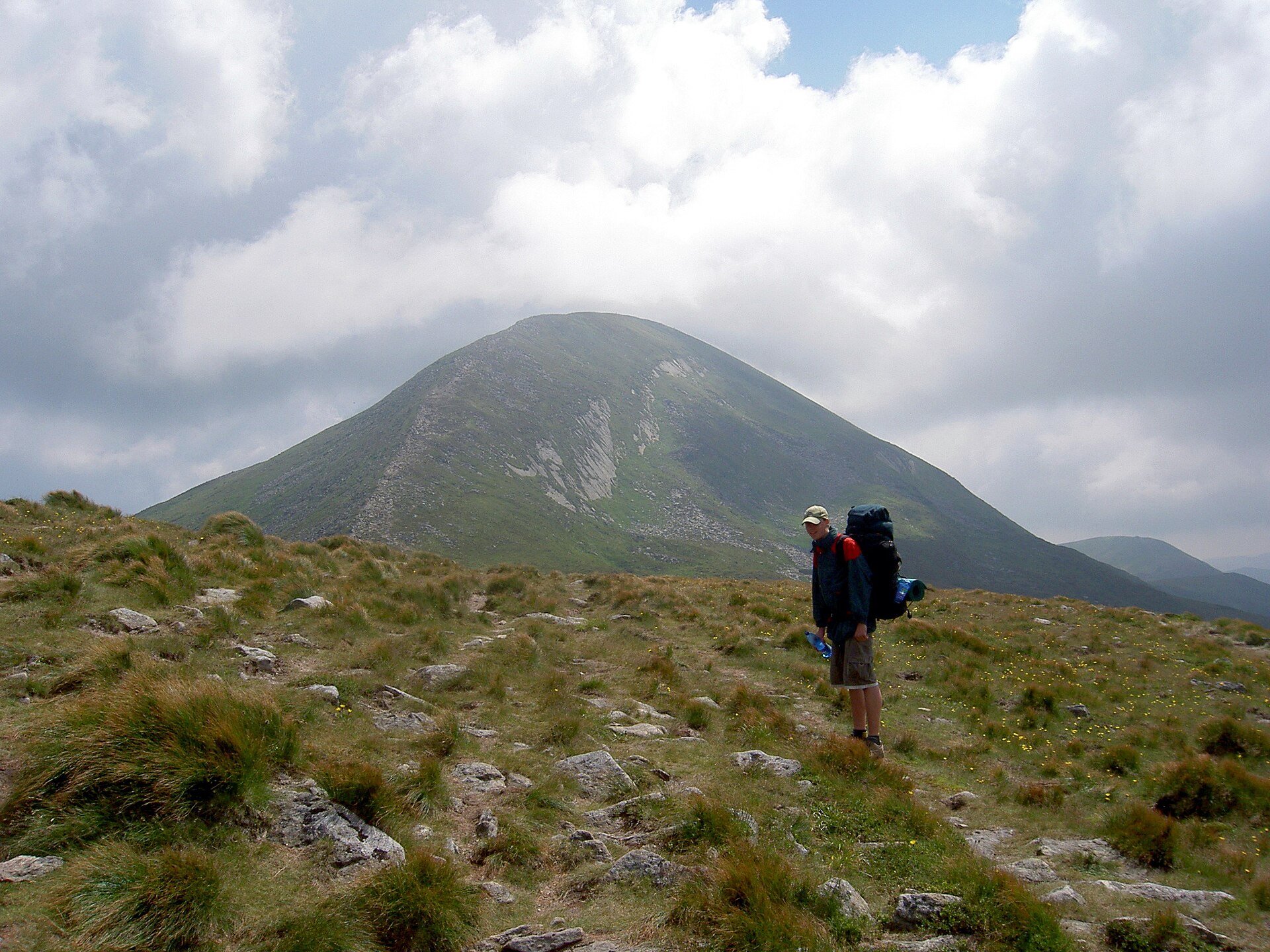
1. Babia Góra / Diablak via Perć Akademików
Snapshot
Itinerary
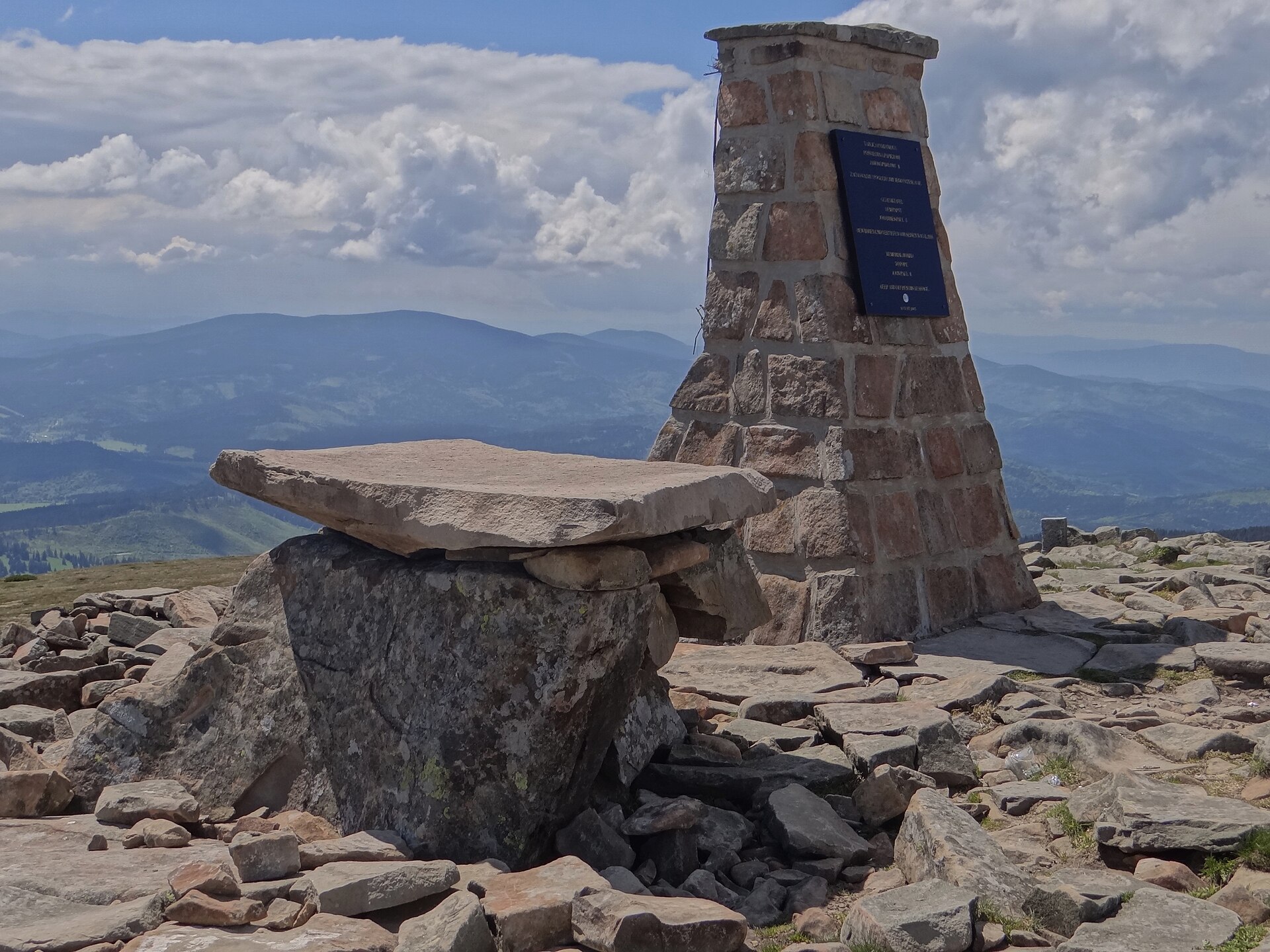
The route starts at Polana Krowiarki and follows marked paths towards Markowe Szczawiny before taking the yellow-marked Perć Akademików towards Diablak, the highest point of Babia Góra. This upper section is short but steep and includes chains and metal aids. The return is normally made on the red ridge trail over Gówniak and Sokolica back towards Krowiarki.
Why it is essential
Babia Góra is the region’s dominant high summit and one of the best-known mountains in the Western Beskids. The Perć Akademików variant adds the region’s most alpine-feeling marked walking line, while the ridge return gives wide views across the Beskids, Tatras and Slovak side in clear weather.
Equipment
- Sturdy boots
- Weatherproof layer
- Warm layer
- Map/GPS
- Food and water
- Headtorch for late starts
- Trekking poles for descent
- Microspikes may be needed if snow remains
Hazards and notes
Perć Akademików is steep and protected with chains and brackets. The route should be treated as one-way uphill in normal use. The section is seasonally closed. The summit is exposed to strong wind and sudden weather. Dogs are not allowed on the referenced national-park route. Avoid Perć Akademików in snow or ice unless properly equipped and experienced.
GPX / KML links
| Source | URL | Format | Notes |
|---|---|---|---|
| AllTrails — Polana Krowiarki / Perć Akademików / Babia Góra | alltrails.com | Source route page | AllTrails terms; direct GPX access not verified. Route source found; reusable geometry unresolved. |
| Waymarked Trails / OSM map area | waymarkedtrails.org | Source map | OSM/ODbL-derived map. Useful for manual cross-checking; full loop GPX not verified. |
External links
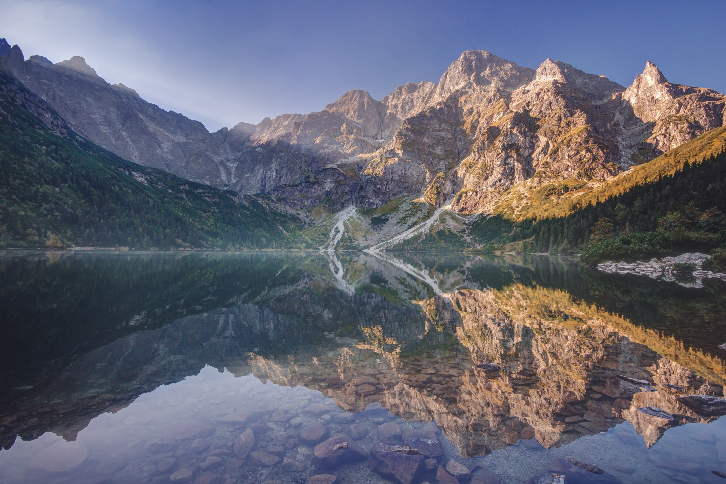
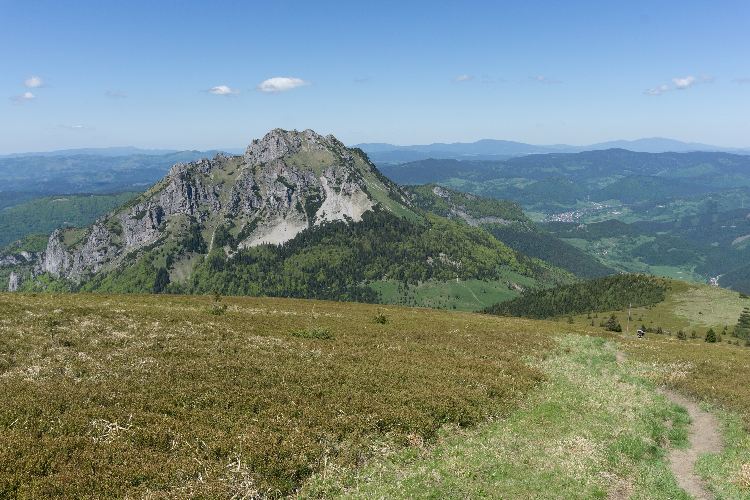
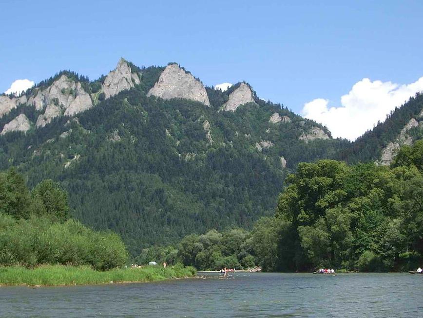
2. Trzy Korony and Sokolica ridge
Snapshot
Itinerary
A classic line links the Pieniny’s two most famous viewpoints: Trzy Korony and Sokolica. From Krościenko or Szczawnica, marked trails climb towards Przełęcz Szopka and the Trzy Korony summit platform, then continue along the blue ridge over Zamkowa Góra, Czerteż and Czertezik towards Sokolica. The descent can be made towards the Dunajec crossing and Szczawnica, or adapted into a longer loop with local transport.
Why it is essential
This route represents the limestone face of the Outer Western Carpathians: narrow ridges, river-gorge viewpoints, mixed forest and the Dunajec below. It also links two nationally recognised Pieniny viewpoints in a single day.
Equipment
- Hiking shoes or boots
- Weatherproof layer
- Warm layer
- Food and water
- Sun protection
- Map/GPS
- Trekking poles useful on polished descents
Hazards and notes
The summit platforms can be crowded. An entrance fee may apply in the tourist season. The Sokolica viewpoint has fall exposure and guard rails. Wet limestone, polished steps and queues can slow the route. Check Pieniny National Park notices, river-crossing status and any seasonal restrictions before departure.
GPX / KML links
| Source | URL | Format | Notes |
|---|---|---|---|
| Waymarked Trails / OSM map area | waymarkedtrails.org | Source map | OSM/ODbL-derived map. Useful for manual GPX creation; full custom route GPX unresolved. |
External links
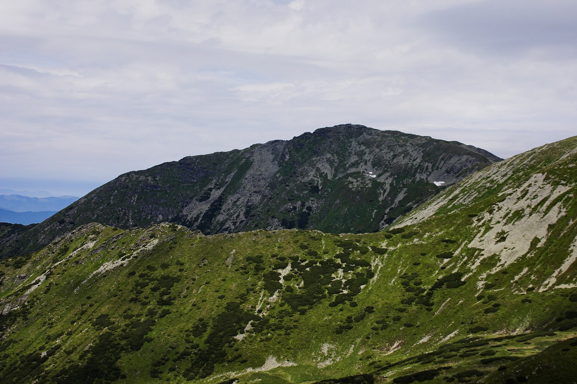
3. Barania Góra from Wisła Czarne
Snapshot
Itinerary
From Wisła Czarne, the route follows forested valleys towards the upper slopes of Barania Góra, passing near the Vistula source area and often linking with the Przysłop area and PTTK hut. The final summit area is wooded but has a lookout tower. The return can retrace the ascent or use a marked loop via Przysłop, depending on current trail conditions and chosen start point.
Why it is essential
Barania Góra combines an important hydrological landmark — the sources of the Vistula — with one of the main summits of the Silesian Beskids and a historic long-distance-trail setting.
Equipment
- Sturdy footwear
- Waterproof layer
- Warm layer
- Water and food
- Map/GPS
- Trekking poles
- Tick protection recommended in forest and meadow sections
Hazards and notes
Navigation is mostly on marked forest trails, but junctions around Wisła Czarne, Przysłop and summit approaches require attention. In winter, snow and ice may persist on shaded forest tracks. The summit reserve and source area should be treated as protected terrain; stay on marked paths.
GPX / KML links
| Source | URL | Format | Notes |
|---|---|---|---|
| Waymarked Trails / OSM map area | waymarkedtrails.org | Source map | OSM/ODbL-derived map. Useful for manual GPX creation; downloadable full-route GPX unresolved. |
External links
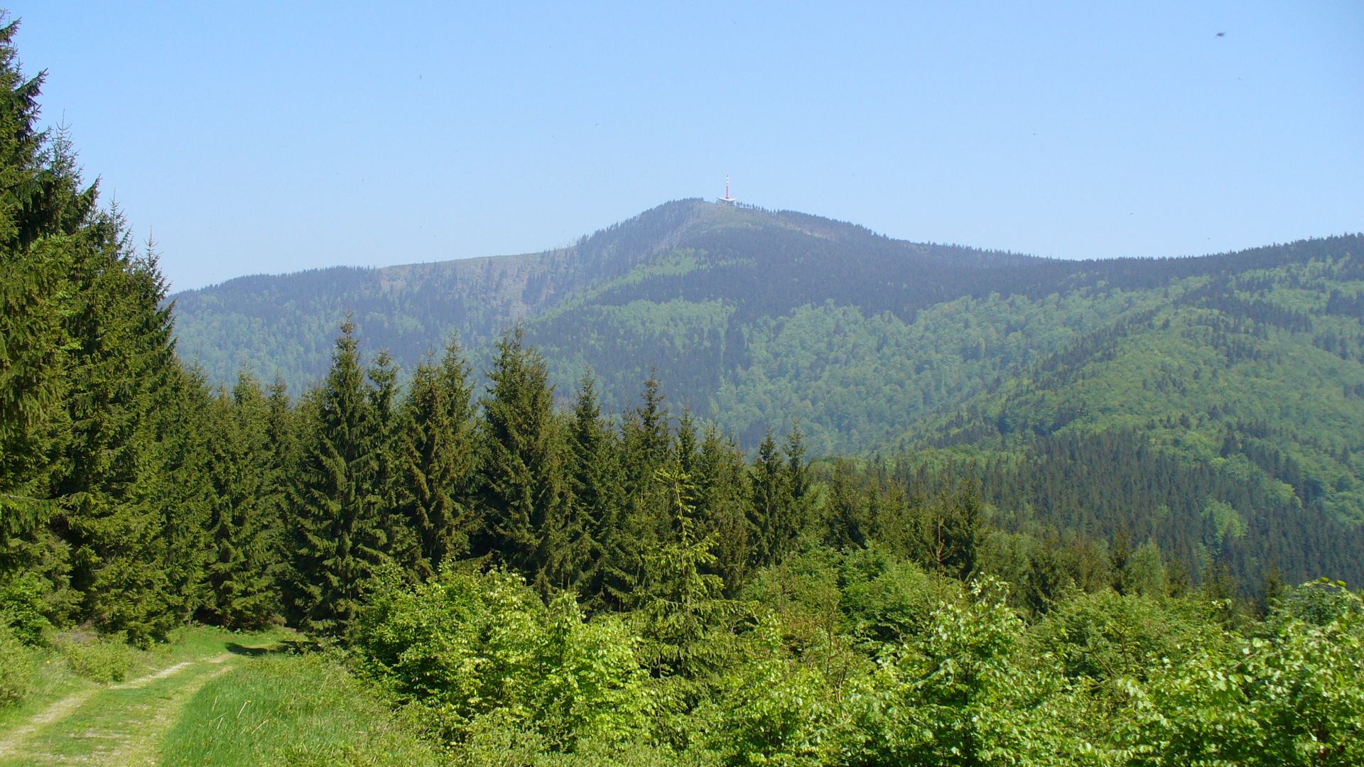
4. Lysá hora from Ostravice
Snapshot
Itinerary
The route climbs from Ostravice through forest and increasingly open upper slopes to Lysá hora, the highest summit of the Moravian-Silesian Beskids. The standard return follows the same line back to Ostravice.
Why it is essential
Lysá hora is the highest Czech summit in the Beskids and one of the region’s most visited mountain objectives. It gives a clear Czech-side counterpart to the Polish Beskid classics.
Equipment
- Sturdy boots
- Waterproof layer
- Warm layer
- Food and water
- Map/GPS
- Trekking poles
- Microspikes may be needed in winter or shoulder season
Hazards and notes
The ascent is long and sustained. Weather can deteriorate quickly on the summit. Lysá hora is known for heavy precipitation. In winter, snow, ice and wind can make the otherwise simple route much more serious.
GPX / KML links
| Source | URL | Format | Notes |
|---|---|---|---|
| AllTrails — Lysá Hora | alltrails.com | Source route page | AllTrails terms; direct GPX access not verified. Route source found; reusable geometry unresolved. |
| Waymarked Trails / OSM map area | waymarkedtrails.org | Source map | OSM/ODbL-derived map. Useful for cross-checking; full GPX not verified. |
External links
5. Pustevny – Radegast – Radhošť ridge
Snapshot
Itinerary
From Pustevny, the route follows the broad ridge east towards the Radegast statue and onward to Radhošť. The summit area contains the chapel of Saints Cyril and Methodius and associated pilgrimage landmarks. The same ridge is followed back to Pustevny.
Why it is essential
This is the cultural ridge walk of the Czech Beskids: Jurkovič architecture at Pustevny, the Radegast association, and the Radhošť pilgrimage summit in one short mountain day.
Equipment
- Hiking shoes
- Waterproof layer
- Warm layer
- Water and food
- Sun protection
- Microspikes may be useful in winter or icy conditions
Hazards and notes
The route is not technically difficult. Winter ice, mist and crowds around Pustevny can be issues. Access depends on current road, bus and cable-car arrangements, which should be checked before publication.
GPX / KML links
| Source | URL | Format | Notes |
|---|---|---|---|
| AllTrails — Pustevny / Radhošť | alltrails.com | Source route page | AllTrails terms; direct GPX access not verified. Route source found; reusable geometry unresolved. |
| Waymarked Trails / OSM map area | waymarkedtrails.org | Source map | OSM/ODbL-derived map. Useful for cross-checking; full GPX not verified. |
External links
External links
| Source | URL |
|---|---|
| AllTrails — Polana Krowiarki / Perć Akademików / Babia Góra | alltrails.com |
| Perć Akademików route reference | de.wikipedia.org |
| Trzy Korony | en.wikipedia.org |
| Pieniny | en.wikipedia.org |
| Barania Góra | de.wikipedia.org |
| AllTrails — Lysá Hora | alltrails.com |
| Lysá hora | en.wikipedia.org |
| AllTrails — Pustevny / Radhošť | alltrails.com |
| Radhošť | en.wikipedia.org |