Regional overview
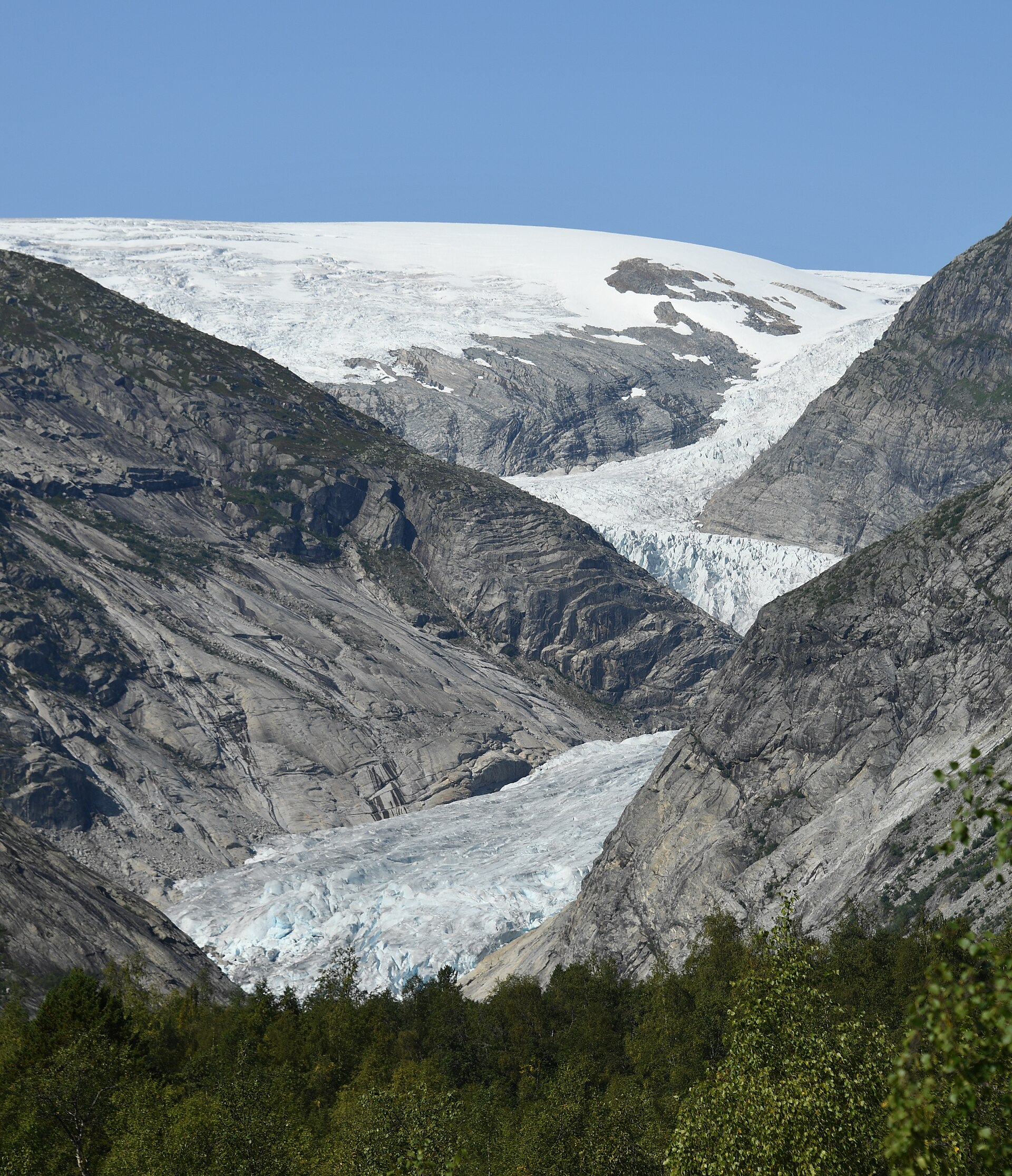
This region covers some of Norway’s most dramatic west-coast mountain walking: the Romsdal ridges above Åndalsnes, the steep Sunnmøre Alps rising directly from fjords, and the glacier-carved valleys around Jostedalsbreen. Jostedalsbreen is the largest ice cap on mainland Europe, with glacier arms, narrow valleys, waterfalls and rivers forming much of the area’s hiking character.
The main hiking centres are Åndalsnes and Isfjorden for Romsdal, Øye/Hjørundfjord and Geiranger for Sunnmøre, and Loen, Olden and Jostedalen for Jostedalsbreen. The terrain is often steep, rocky and weather-sensitive. Even non-technical day hikes can involve long ascents, exposed paths, wet slabs, lingering snow and rapid changes in visibility.
The normal hiking season is late June to September, extending into October on lower fjord routes in good conditions. Early summer snow remains a serious factor on high routes such as Slogen and Skåla, while glacier-front routes require strict respect for barriers and local safety signage.
Selection rationale
These five hikes were selected to represent the region’s essential walking types: a classic Romsdal ridge traverse, a Sunnmøre alpine summit, a historic Geirangerfjord farm route, a major fjord-to-summit ascent beside Jostedalsbreen, and an accessible glacier-view hike. The set avoids selecting five similar ridge or summit routes from the same trailhead.
Summary table
| # | Hike | Country | Route type | Distance | Gain | Max elevation | Difficulty | Verification |
|---|---|---|---|---|---|---|---|---|
| 1 | Romsdalseggen Ridge | Norway | Point-to-point | 10.0–10.3 km | 960–970 m | c. 1,177–1,222 m on most route sources; Fjord Norway gives 1,329 m | Demanding mountain ridge hike | Partially verified |
| 2 | Slogen from Øye | Norway | Out-and-back | 7.4 km | 1,527 m | 1,564 m | Very demanding / black | Verified |
| 3 | Skageflå and Homlong from Skagehola | Norway | Boat-assisted point-to-point | 4.4–6.5 km | c. 560–595 m | c. 552–559 m | Demanding / red | Partially verified |
| 4 | Skåla / Skålatårnet from Tjugen, Loen | Norway | Out-and-back | 15.4 km | c. 1,800 m | 1,848 m | Very demanding | Partially verified |
| 5 | Nigardsbreen glacier viewpoint | Norway | Out-and-back | 4.8–5.4 km | 180–273 m | c. 388–410 m | Easy to moderate; serious glacier-front hazards if barriers are ignored | Partially verified |
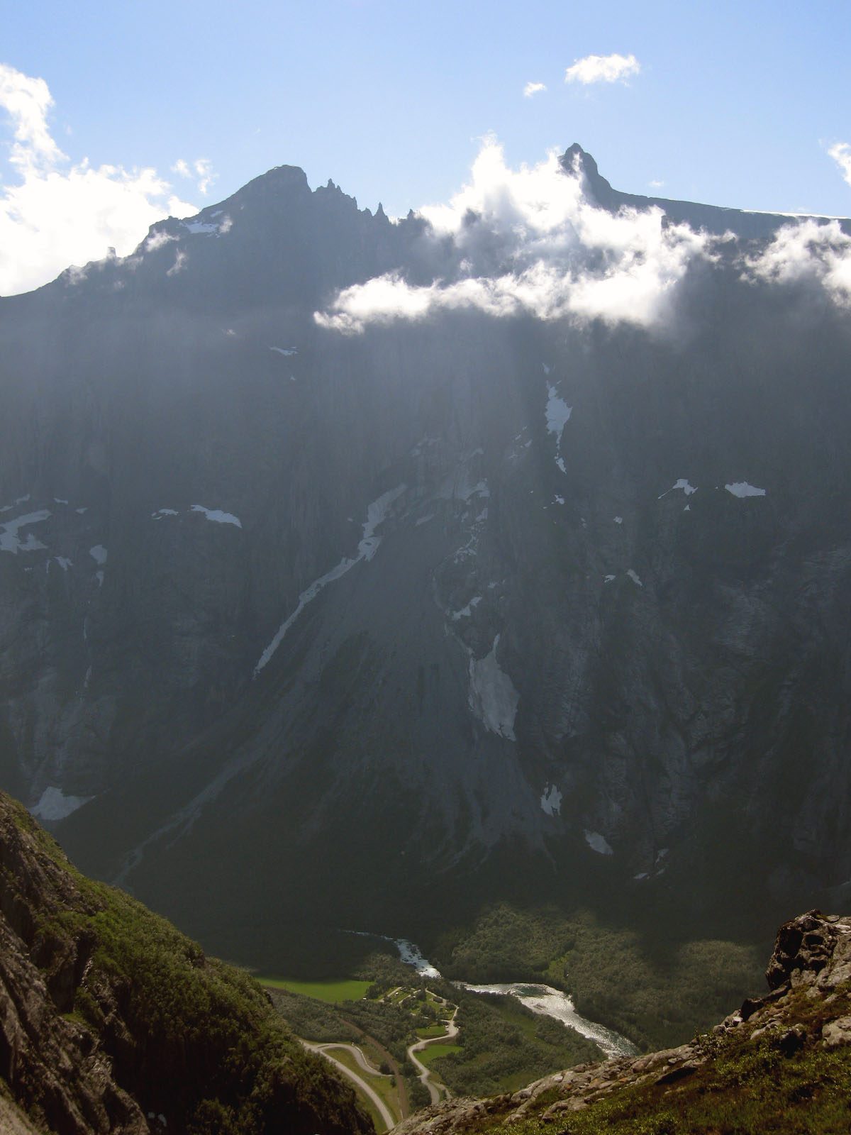
1. Romsdalseggen Ridge
Snapshot
Itinerary
The classic route starts from Venjedalssetra or nearby Vengedalen after the seasonal transfer from Åndalsnes. It climbs steadily towards the ridge above Romsdalen, then traverses the high ground with views towards Trollveggen, Romsdalshorn, the Rauma valley and the fjord landscape around Åndalsnes. The descent towards Åndalsnes is long and steep, passing the Nesaksla / Rampestreken area before reaching town. Official tourism sources describe the normal Romsdalseggen route as about 10 km with roughly 970 m of ascent and 5–8 or 7–8 hours of walking. Outdooractive gives a similar distance but lists about 1,202 m of descent, reflecting the point-to-point descent to Åndalsnes.
Why it is essential
Romsdalseggen is the representative ridge hike of Romsdal: a high, scenic traverse above one of Norway’s most famous mountain valleys, with sustained views rather than a single summit objective. It also gives a strong contrast to the glacier and fjord-farm hikes elsewhere in this regional set.
Equipment
- Mountain hiking equipment
- Sturdy boots with reliable grip
- Weatherproof and warm layers
- Map/GPS and navigation backup
- Trekking poles recommended for the long descent
- Headtorch for late starts or slow parties
- Extra food and water
Hazards and notes
This is a weather-sensitive ridge route. Fog, rain, wind or early-season snow can make navigation and exposure more serious. Official guidance stresses preparation, suitable equipment and checking weather/local conditions before departure. The seasonal bus may be cancelled in poor weather or low traffic, and pre-booking is recommended.
GPX / KML links
| Source | URL | Format | Notes |
|---|---|---|---|
| Topo GPS route 214967 | topo-gps.com | GPX / ZIP | Terms not fully reviewed. Downloadable route source found, but distance differs from the standard official 10 km route; use as geometry reference only |
| Outdooractive Romsdalseggen Ridge | outdooractive.com | GPX/KML/FIT via platform | Platform terms apply. Useful secondary route source; reuse terms not confirmed |
| Wikiloc Romsdalseggen variant | wikiloc.com | GPS track | Wikiloc terms apply. User-generated track found; not treated as authoritative |
Sources
- Visit Norway / Fjord Norway route description
- Outdooractive Romsdalseggen Ridge
- Romsdalseggen bus access information
- Wikimedia Commons photo page
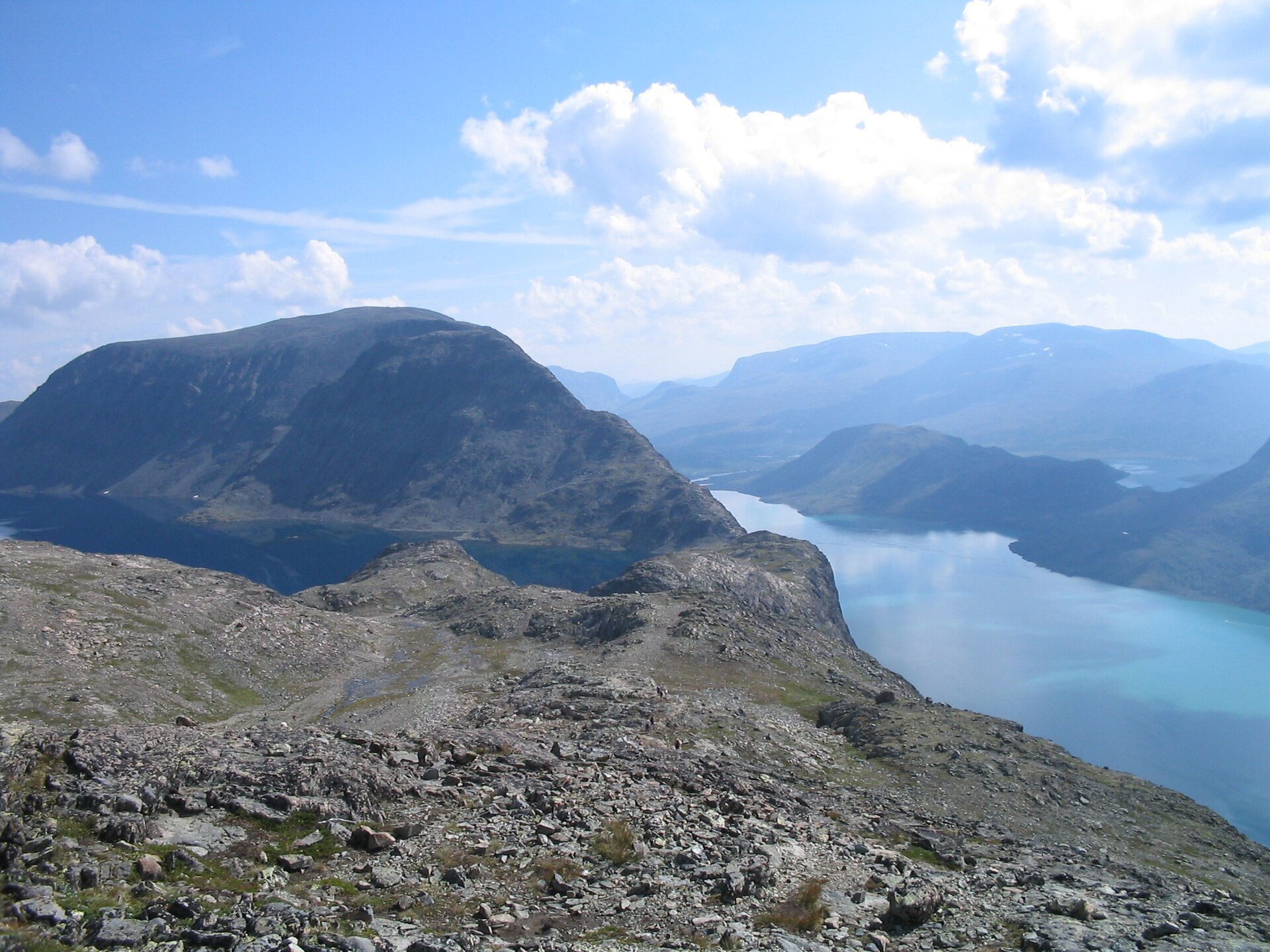
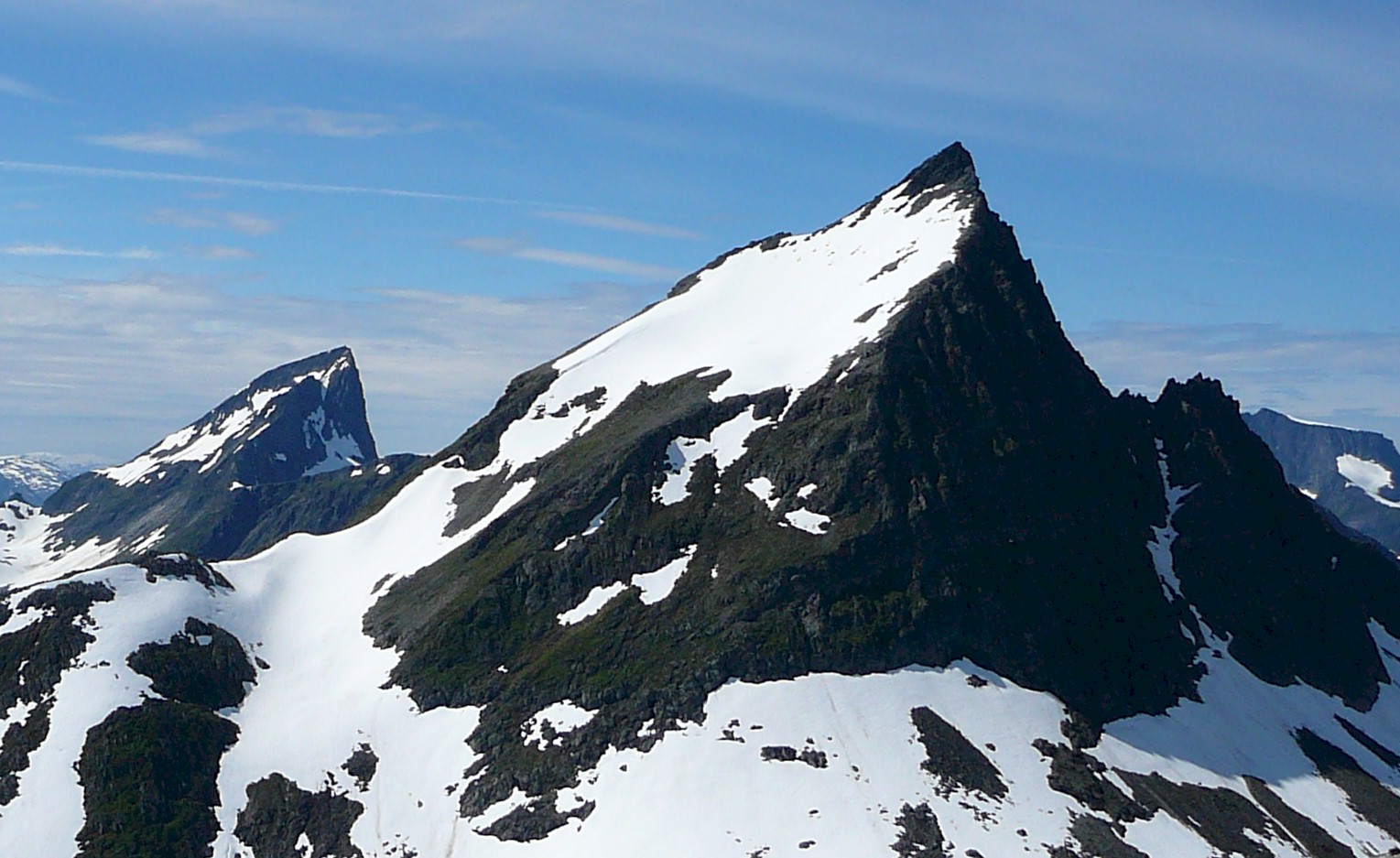
2. Slogen from Øye
Snapshot
Itinerary
The route starts near Øye and follows the path known as Slogråsa through lower terrain before climbing steeply towards the upper mountain. Morotur describes the path as easy to follow all the way to the summit, although it is not signed or waymarked. A water source is noted around 600 m, but it may be dry. Higher up, the route reaches the ridge area and turns into steeper rocky ground. The final section requires hands for support in places, with Morotur noting inclinations up to about 60 degrees and a small summit plateau. Descent follows the same route.
Why it is essential
Slogen is one of the defining Sunnmøre Alps summits: steep, fjord-facing and visually prominent above Norangsfjorden and Hjørundfjord. Morotur describes it as one of the most visited peaks in the Sunnmøre Alps and places it among Norway’s notable mountain hikes.
Equipment
- Mountain hiking equipment
- Sturdy boots
- Extra warm and waterproof layers
- Navigation backup
- Gloves useful for cold rock or early-season snow
- Sufficient water; the only noted spring may be dry
- Trekking poles useful for the lower descent, but less useful on the final rocky section
Hazards and notes
The final ascent is steep and exposed enough to require care, though it is not a climbing route in normal summer conditions. Early-season snowfields can make the route significantly more serious, especially if hard or icy. Morotur warns that slipping on hard snowfields can be dangerous. The summit area is small and unsuitable for large groups in poor conditions.
GPX / KML links
| Source | URL | Format | Notes |
|---|---|---|---|
| Morotur official route API | morotur.no | GeoJSON | Public route API; detailed reuse terms not identified. Official route geometry found; attribution to Morotur / Møre og Romsdal recommended pending terms check |
| HorizonRando Slogen guide | horizonrando.fr | GPX source page | Site terms not fully reviewed. Downloadable GPX/source page found as secondary geometry |
Sources
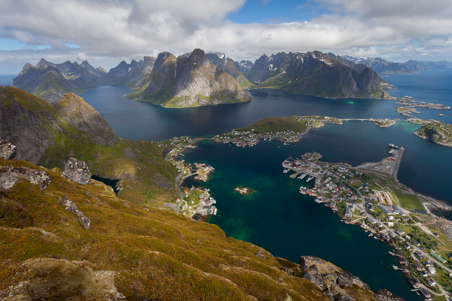
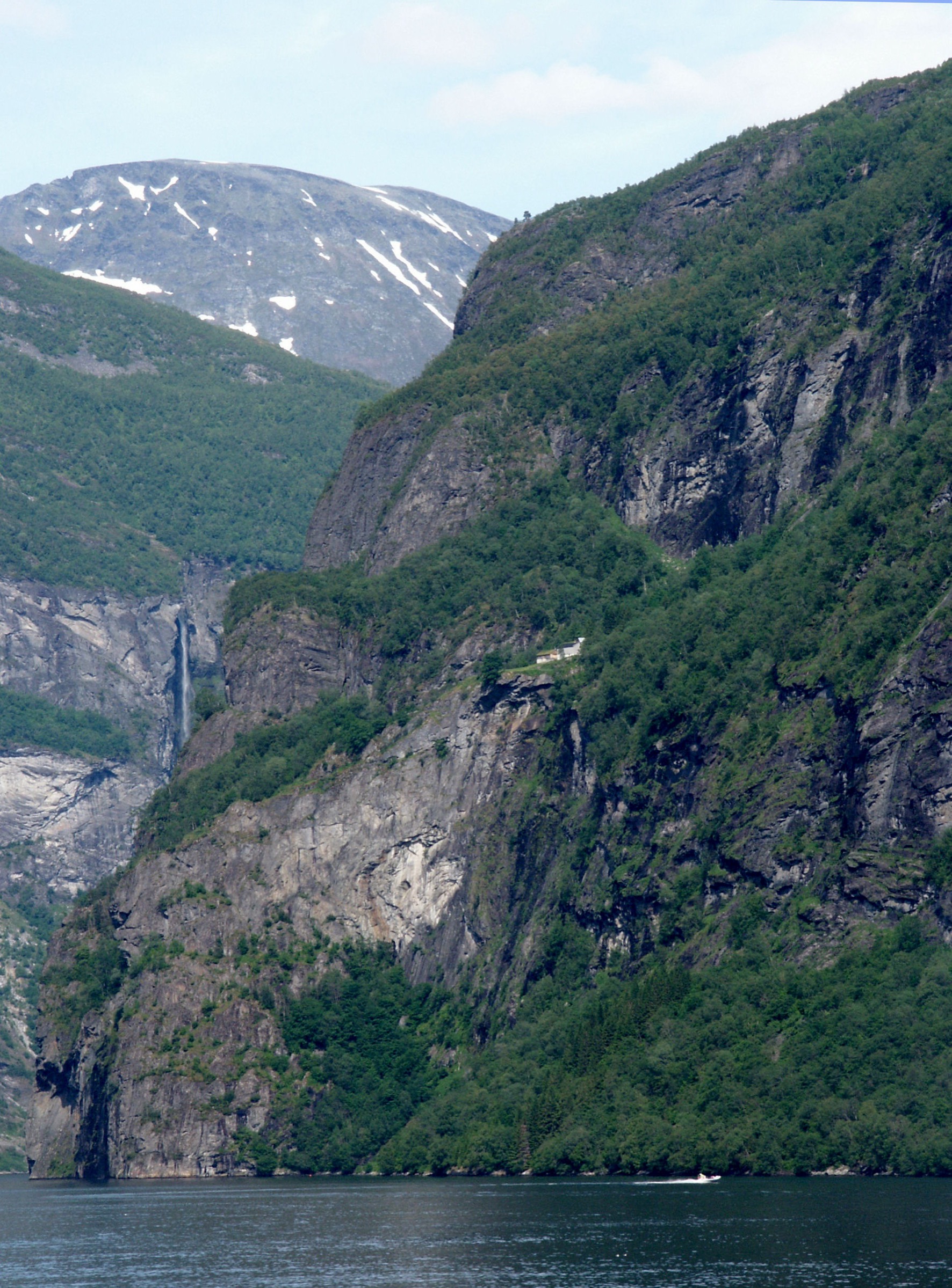
3. Skageflå and Homlong from Skagehola
Snapshot
Itinerary
The route begins with a boat transfer from Geiranger to Skagehola. From the landing, a steep path climbs to the abandoned mountain farm of Skageflå, about 250 m above the fjord. Several exposed sections are secured, but the path remains steep and requires care. From Skageflå, the full day-hike version continues uphill towards Homlongsætra, reaching the high point around 550 m, before descending to Homlong and returning by road or path towards Geiranger. Official route material describes the Skagehola–Skageflå–Homlongsætra–Homlong–Geiranger route as about 6.5 km and 3–4 hours.
Why it is essential
Skageflå represents the cultural and historical side of the western fjord mountains. It is one of the best-known abandoned farms on Geirangerfjord, combining a steep fjord path, UNESCO-listed fjord scenery and the historic farm terraces above the water.
Equipment
- Standard to mountain hiking equipment
- Hiking shoes or boots with good grip
- Weatherproof layer
- Water and food; there are no facilities on the route
- Map/GPS or downloaded route
- Trekking poles optional, but may be awkward on the steeper secured sections
Hazards and notes
The path from Skagehola is steep, with exposed sections. Morotur states that dangerous parts are fenced, but this remains a route for sure-footed walkers and is not ideal for poor weather or walkers uncomfortable with exposure. Boat schedules must be checked before departure. No food, drink or toilet facilities should be assumed on the route.
GPX / KML links
| Source | URL | Format | Notes |
|---|---|---|---|
| Morotur official route API | morotur.no | GeoJSON | Public route API; detailed reuse terms not identified. Official route geometry found; attribution and terms check recommended |
| Outdooractive Skageflå Mountain Farm | outdooractive.com | GPX/KML/FIT via platform | Platform terms apply. Useful secondary route source; stats differ from official full-route description |
| Komoot Skagehola–Skageflå–Homlongsætra–Homlong | komoot.com | GPX via platform | Platform terms apply. Downloadable tour source found; not treated as authoritative |
| Wikiloc Geiranger–Skageflå–Homlong | fr.wikiloc.com | GPS track | Wikiloc terms apply. User-generated route source found |
Sources
- Official Skageflå / FjordGuiding route description
- Morotur Skageflå route
- Outdooractive Skageflå Mountain Farm
- Wikimedia Commons photo page
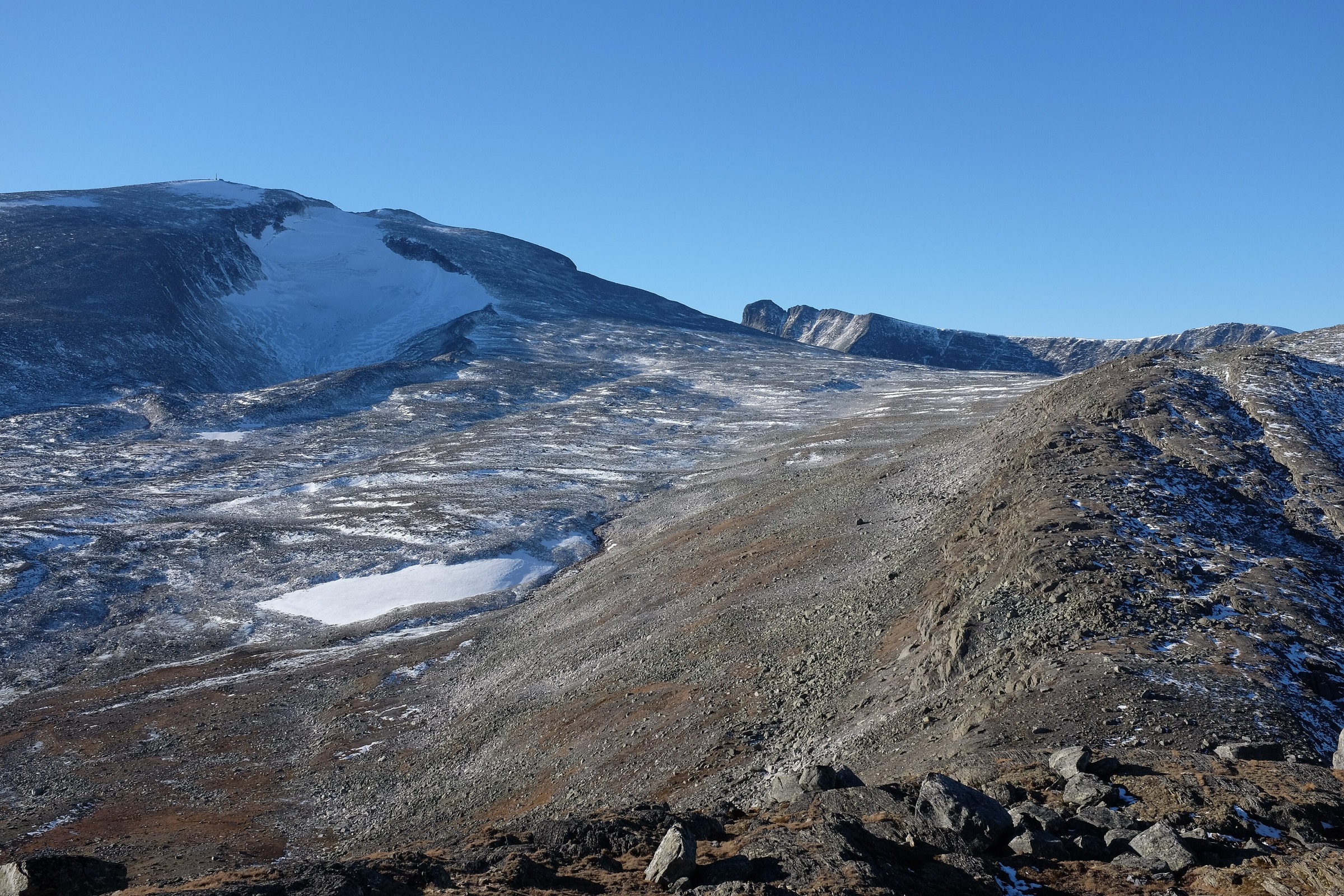
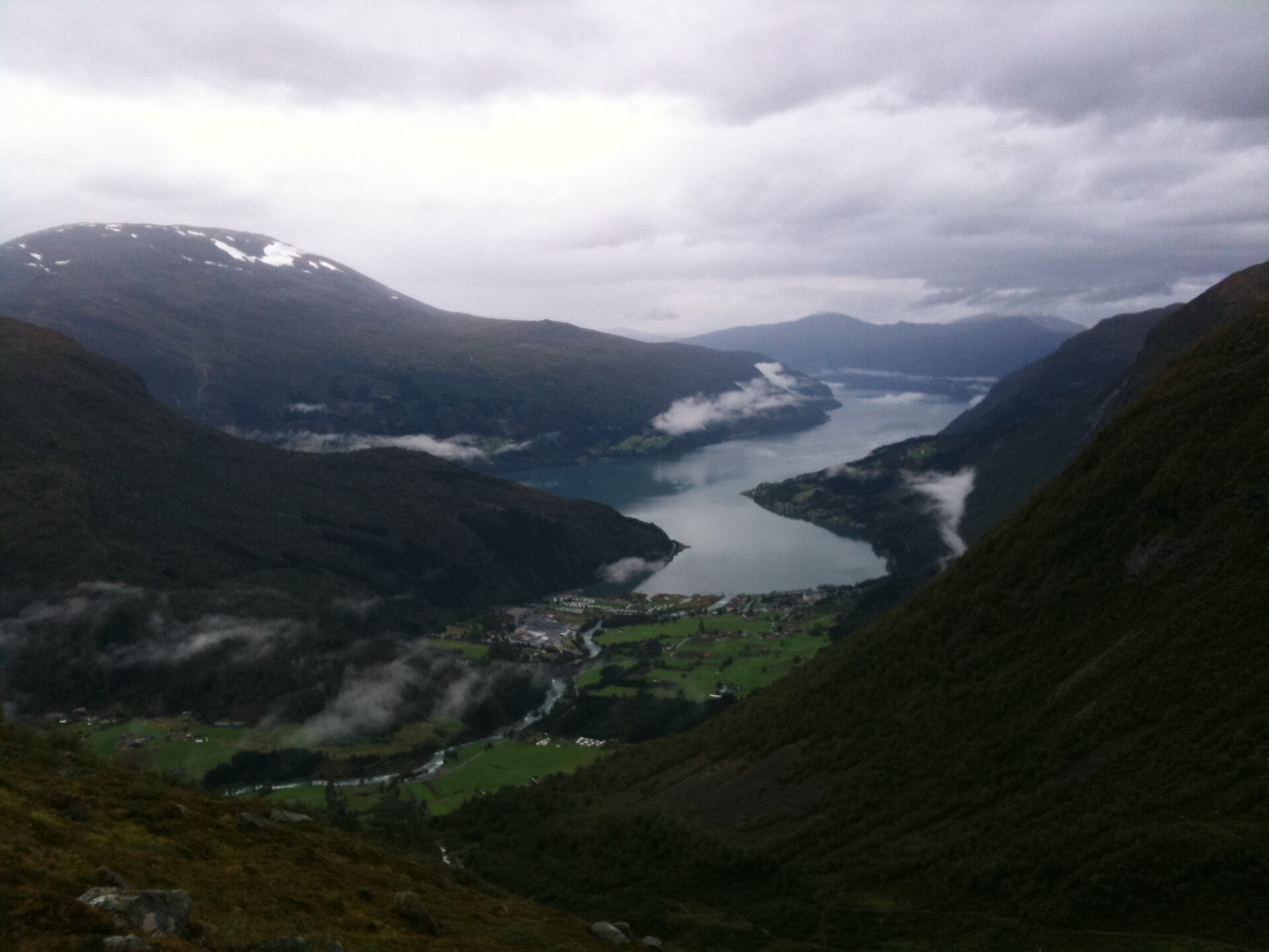
4. Skåla / Skålatårnet from Tjugen, Loen
Snapshot
Itinerary
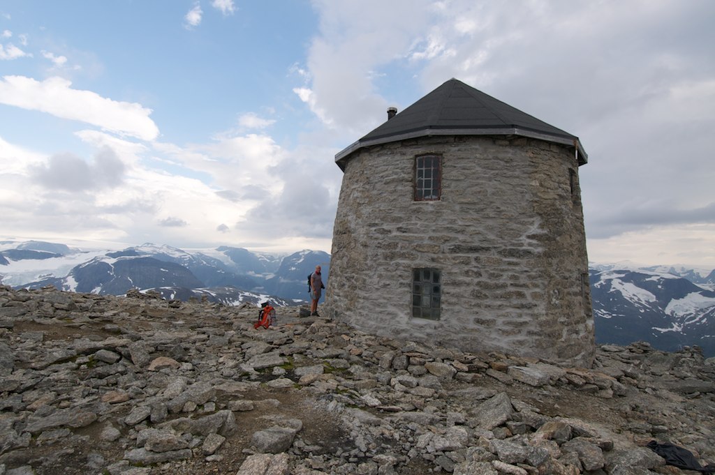
The route starts at Tjugen near Loen and climbs from near fjord level towards Skåla and the Skålatårnet / Skålabu huts. The lower section follows forest road and trail beside the Fosdøla valley, then continues through increasingly open mountain terrain. Higher up, the route passes the Skålavatnet area before climbing stone steps and rocky slopes towards the summit ridge. DNT/UT describes the route as about 15.4 km return, very demanding, with approximately 1,800 m of ascent. The route is famous for the long continuous climb from the fjord area to the 1,848 m summit, and the stone path has been restored in places, including work by Sherpas.
Why it is essential
Skåla is the major fjord-to-summit ascent of the Jostedalsbreen side of the region. It combines a long, historically important mountain path, high views over Nordfjord, and the landmark Skålatårnet hut built in 1891.
Equipment
- Full mountain hiking equipment
- Sturdy boots
- Waterproof and windproof clothing
- Warm layer, hat and gloves even in summer
- Map/GPS and compass
- Food and plenty of water
- Headtorch
- Trekking poles strongly recommended for the descent
- Microspikes may be necessary if early-season snow remains
Hazards and notes
This route is physically demanding because of the sustained 1,800 m ascent and descent. DNT notes that snow can remain well into summer, especially from around 1,100 m upwards, and that weather can change quickly. Winter ascents are a different undertaking and require winter mountain and avalanche competence. The marked route avoids major exposed sections, but terrain outside the trail is steep.
GPX / KML links
| Source | URL | Format | Notes |
|---|---|---|---|
| UT.no / DNT route proposal | ut.no | Source-map / route page | DNT/UT terms not fully reviewed. Authoritative route description and statistics; direct GPX availability not confirmed |
| PaTurNorge Skålatårnet from Loen | paturnorge.no | GPX download indicated | Premium / site terms apply. Downloadable GPX indicated, but access and reuse terms unresolved |
| Wikiloc Skåla, Loen | fr.wikiloc.com | GPS track | Wikiloc terms apply. User-generated track found; not authoritative |
| Outdooractive Skåla | outdooractive.com | Platform route source | Platform terms apply. Useful cross-check, but listed maximum elevation appears inconsistent with the 1,848 m summit |
Sources
- UT.no / DNT Skålatårnet route
- UT.no Skålatårnet hut page
- Skåla / Skåla Opp context
- Wikimedia Commons Loen from Skåla photo page
- Wikimedia Commons Skålatårnet photo page
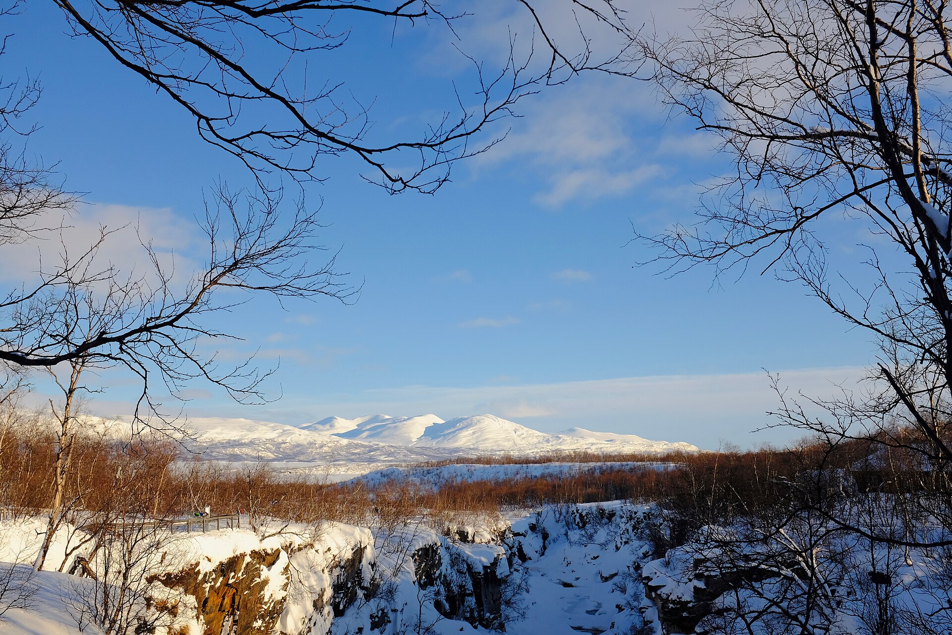
5. Nigardsbreen glacier viewpoint
Snapshot
Itinerary
The usual short hiking approach starts from the car park by Nigardsbrevatnet, reached by the Glacier Road inside the Nigardsbreen nature reserve. A boat may shorten the approach across the lake in season, but the final section to the glacier viewpoint still requires walking. The path crosses glacier-polished rock and marked sections, with stairs, handrails or bridges in places depending on the current route arrangement. The walk ends at the signed safe viewing area or barrier near the glacier front. It does not include walking on the glacier.
Why it is essential
Nigardsbreen gives the most accessible day-hike contact with the Jostedalsbreen landscape in this regional set. It represents the glacier side of the western fjord mountains without requiring a roped glacier tour, provided the route is limited to the marked viewpoint approach.
Equipment
- Standard hiking equipment
- Hiking shoes or boots with good grip
- Warm layer; air near the glacier can be cold
- Waterproof layer
- Map/GPS or marked-route awareness
- Trekking poles optional
- No glacier equipment is required for the viewpoint hike because the route must not go onto the ice
Hazards and notes
The main hazard is the glacier itself. Official and safety sources stress following signs and barriers. Walking in front of or onto the glacier without a qualified guide is unsafe because of calving ice, unstable glacier margins and sudden glacial-river surges. The nature reserve also has protection rules, including restrictions on damaging vegetation, moving rocks and camping. Wet polished slabs can be slippery.
GPX / KML links
| Source | URL | Format | Notes |
|---|---|---|---|
| Outdooractive Nigardsbreen route | outdooractive.com | GPX/KML/FIT via platform | Platform terms apply. Downloadable route source found; reuse terms not confirmed |
| Wikiloc Nigardsbreen Glacier Trail | wikiloc.com | GPS track | Wikiloc terms apply. User-generated GPS track found; not authoritative |
| HorizonRando Nigardsbreen guide | horizonrando.fr | GPX source page | Site terms not fully reviewed. Downloadable GPX/source page found; secondary source only |
Sources
- Official Jostedal / Breheimsenteret access and safety information
- HorizonRando Nigardsbreen guide
- Outdooractive Nigardsbreen route
- Fjords.com Nigardsbreen safety and access context
- Wikimedia Commons photo page
Region-level sources
| Source | Use | URL |
|---|---|---|
| Jostedalsbreen National Park / official information | Park-level context | jostedalsbreen.no |
| Fjord Norway — Jostedalsbreen context | Glacier and area context | fjordnorway.com |
| Morotur official route database | Sunnmøre / Geiranger route source | morotur.no |
| UT.no / DNT route database | Skåla and Norway-wide route source | ut.no |
| Wikimedia Commons | Photo source | commons.wikimedia.org |