Regional overview
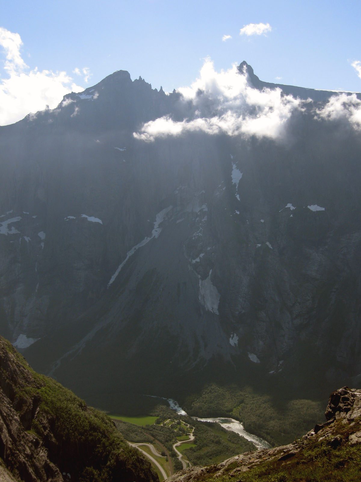
Northern Norway’s Arctic mountain coast combines sea-level trailheads, sharp island summits, white-sand beaches, glacial valleys, and fjordside alpine terrain. Lofoten is dominated by short but steep mountain paths rising directly above fishing villages and beaches; Vesterålen offers broader coastal ridges and historic routes between settlements; the Lyngen Alps add higher, more glaciated mountains around Lyngenfjord.
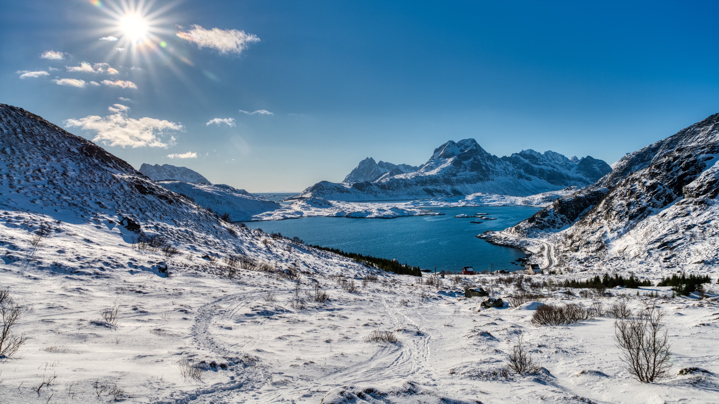
The normal hiking season is short. Many routes are best from late spring or early summer to early autumn, with lingering snow possible into June and fast-changing weather year-round. The region’s routes are often low in absolute altitude but serious in character because of steep terrain, exposure, wet rock, boggy approaches, and limited shelter.
Access is usually by car, ferry, or sparse bus services. Several classic hikes start near small settlements or minor roads, but public transport should be checked against current timetables before publication. In protected areas, drone restrictions, dog-leash rules, and grazing livestock or reindeer should be treated carefully.
Selection rationale
The five hikes were selected to represent the region rather than one island group: two Lofoten classics, one Vesterålen coastal-mountain route, and two Lyngen Alps glacier or glacial-lake walks. The selection covers an iconic viewpoint, a beach-and-summit route, a historic coastal traverse, a glacial lake, and a glacier-valley approach.
Summary table
| # | Hike | Country | Route type | Distance | Gain | Max elevation | Difficulty |
|---|---|---|---|---|---|---|---|
| 1 | Reinebringen | Norway | Out-and-back | 2.0 km from trailhead; 5.0 km with longer approach variant | 480 m | 484 m | Medium / steep |
| 2 | Ryten and Kvalvika Beach | Norway | Out-and-back / variant loop | 7.5–10.1 km depending on start and beach variant | 460–770 m | 543 m | Moderate to challenging |
| 3 | Dronningruta / The Queen’s Route | Norway | Loop | 12.3–16 km depending on variant | 665–900 m; higher on one GPS source | 448–450 m | Demanding |
| 4 | Blåisvatnet / Blåvatnet | Norway | Out-and-back | 8.0–9.5 km depending on source | 170–213 m | 189–193 m | Easy to moderate, rocky |
| 5 | Steindalsbreen glacier approach | Norway | Out-and-back | 12.4 km official; variants 11.6–13.8 km | 470–580 m | 480–566 m depending on source | Moderate |
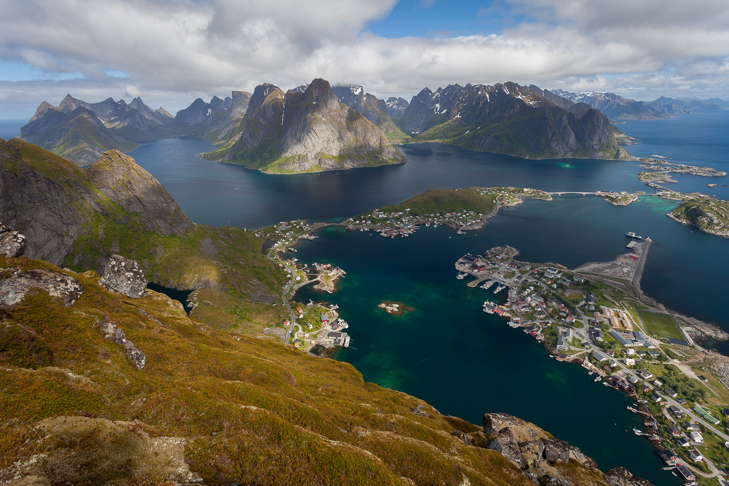
1. Reinebringen
Snapshot
Itinerary
The route starts near the Ramsviktunnelen trailhead and climbs steeply on the stone stairway built into the mountainside. The ascent is direct, with limited distance but sustained height gain. The path reaches the Reinebringen viewpoint above Reine, Reinefjorden, and the surrounding Lofoten peaks. Return follows the same stair route to the trailhead.
Why it is essential
Reinebringen is one of Lofoten’s defining viewpoint hikes. It is short but visually concentrated: a steep ascent from near sea level to a famous panorama over Reine, the fjord, and jagged coastal mountains. Its popularity and recognisability make it an essential but heavily used route.
Equipment
Mountain hiking equipment: sturdy boots or hiking shoes with good grip, weatherproof layer, warm layer, water, food, map/GPS, and sun protection. Trekking poles may help on the approach but are less useful on the stair sections. In shoulder seasons, hat, gloves, and an extra insulating layer are recommended.
Hazards and notes
The route is steep, crowded in high season, and not suitable as a winter hike. The official page states that Reinebringen is not recommended in winter and is not recommended for children or dogs. There is no water on the route, and the stone stairway should be followed to avoid erosion and rockfall-prone shortcuts.
GPX / KML links
| Source | URL | Format | Notes |
|---|---|---|---|
| HorizonRando — Reinebringen | horizonrando.fr | GPX | Terms not clearly stated on GPX file page; download found; reuse terms unresolved. Source page: horizonrando.fr/reinebringen |
| HorizonRando — Reinebringen P2 approach | horizonrando.fr | GPX | Terms not clearly stated on GPX file page; download found; reuse terms unresolved |
| Topo GPS — Reinebringen | topo-gps.com | Online route / GPX download | Platform terms not resolved; source route found; direct reuse needs terms check |
Sources
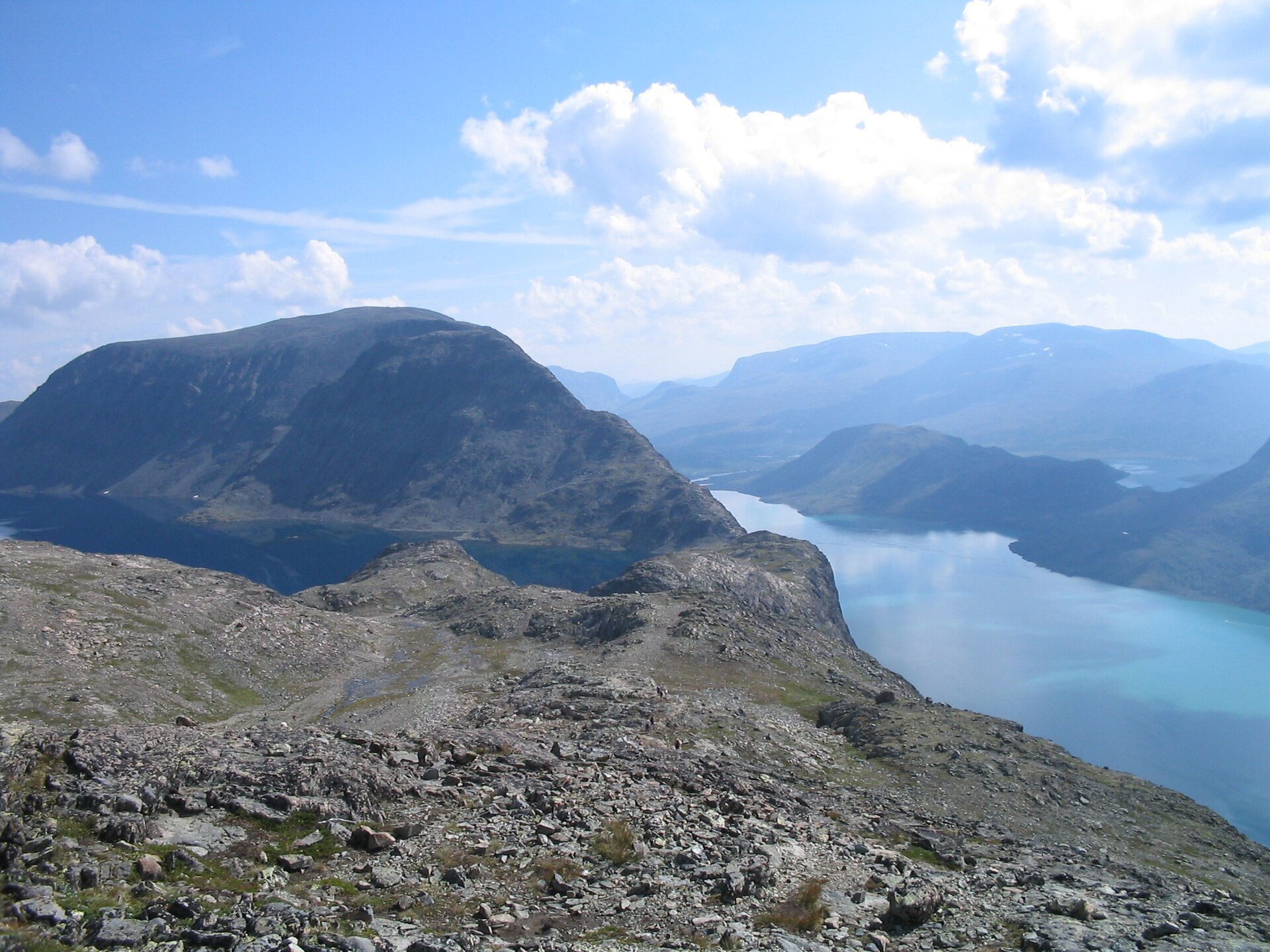
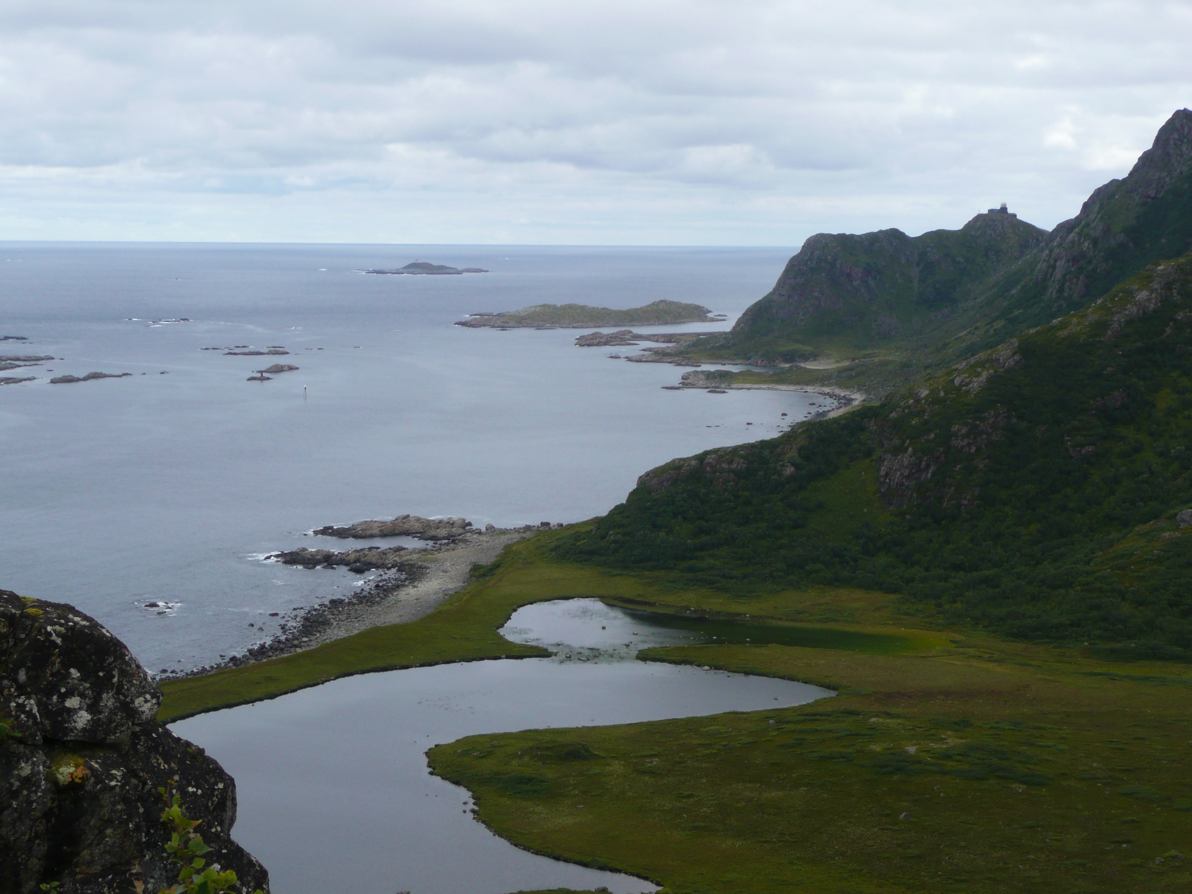
2. Ryten and Kvalvika Beach
Snapshot
Itinerary
The hike starts from the Fredvang or Innersand side and follows the path toward Einangen and Forsvatnet. From the trail junction, one branch climbs towards Ryten, reaching the summit plateau above Kvalvika. The route gives the classic high view over the beach, the Atlantic coast, and the surrounding Lofoten mountains. For the combined version, the route returns to the junction and descends to Kvalvika Beach before climbing back to the outward path.
Why it is essential
Ryten and Kvalvika combine two of Lofoten’s signature elements: a coastal mountain summit and a remote white-sand beach framed by dark cliffs. The route is also representative of Lofoten’s current trail-management pressures, because Kvalvika and Ryten are heavily visited and lie within Lofotodden National Park.
Equipment
Mountain hiking equipment: sturdy boots, weatherproof layer, warm layer, water, food, map/GPS, and sun protection. Trekking poles are useful on the boggy and descending sections. In early or late season, carry hat, gloves, and extra insulation. Snow travel equipment may be needed outside the normal snow-free season.
Hazards and notes
The Ryten viewpoint has steep cliff edges, and the descent to Kvalvika can be awkward in wet conditions. Visit Lofoten notes that drones are not permitted in Lofotodden National Park and that dogs must be kept on a leash from 1 April to 15 November under Flakstad regulations. The Summer 2025 trail-construction notice between Forsvatnet and Kvalvika should be checked again for 2026 publication.
GPX / KML links
| Source | URL | Format | Notes |
|---|---|---|---|
| HorizonRando — Ryten | horizonrando.fr | GPX | Terms not clearly stated on GPX file page; download found; reuse terms unresolved. Source page: horizonrando.fr/ryten |
| Komoot — Ryten and Kvalvika route | komoot.com | Online route / GPX behind account workflow | Komoot terms apply; source route found; reuse unclear and account may be required for GPX |
| Visit Lofoten — Kvalvika and Ryten | visitlofoten.com | Official route description | Website terms not treated as route-file licence; official description verified; no standalone GPX found on page |
Sources
3. Dronningruta / The Queen’s Route
Snapshot
Itinerary
Dronningruta links Stø and Nyksund in a coastal mountain loop. The route can be started from either settlement. Official guidance recommends taking the mountain section towards Stø and the coastal section towards Nyksund because of the steep sections. From Stø, the commonly described circuit follows the coast towards Skipssanden and Langvaddalen, then climbs inland before crossing the high ground around Finngamheia and returning over the ridges towards Stø.
Why it is essential
Dronningruta is the representative Vesterålen entry in this Arctic selection. It combines a historic route between fishing settlements, mountain viewpoints, coastal walking, marked DNT-style wayfinding, and cultural associations with Queen Sonja’s 1994 visit.
Equipment
Mountain hiking equipment: sturdy boots, weatherproof layer, warm layer, food, water, map/GPS, navigation backup, and trekking poles. A headtorch is recommended for late starts or shoulder-season walks. Gloves and a hat are sensible outside midsummer.
Hazards and notes
The route includes steep ground, fixed ropes on some sections, scree, exposed-feeling terrain, and weather-sensitive navigation. Wet rock and mud can make the coastal and descent sections more serious. The route should not be treated as an easy coastal walk despite its modest maximum elevation.
GPX / KML links
| Source | URL | Format | Notes |
|---|---|---|---|
| Topo GPS — Dronningruta | topo-gps.com | Online route / GPX download | Platform terms not resolved; source route and GPX download found; reuse unclear |
| UT.no — Dronningruta i Vesterålen | ut.no | Online route / source map | DNT/UT terms need checking; strong official-style route source; standalone GPX not confirmed |
| Dronningruta official site | dronningruta.no | Route description | Website terms not treated as route-file licence; route verified; no GPX found on official page |
Sources
- Dronningruta official site
- Dronningruta route description
- UT.no — Dronningruta i Vesterålen
- Arctic Norway — The Queen’s Route
- Topo GPS — Dronningruta
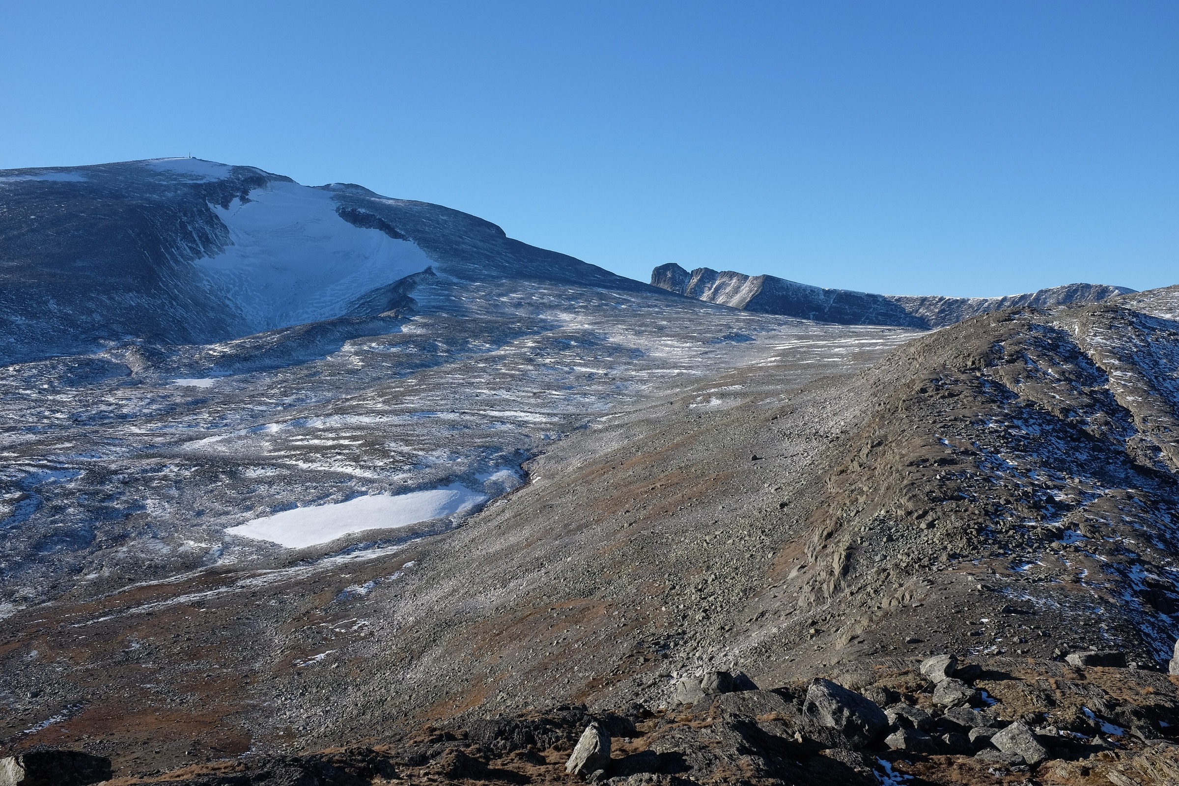
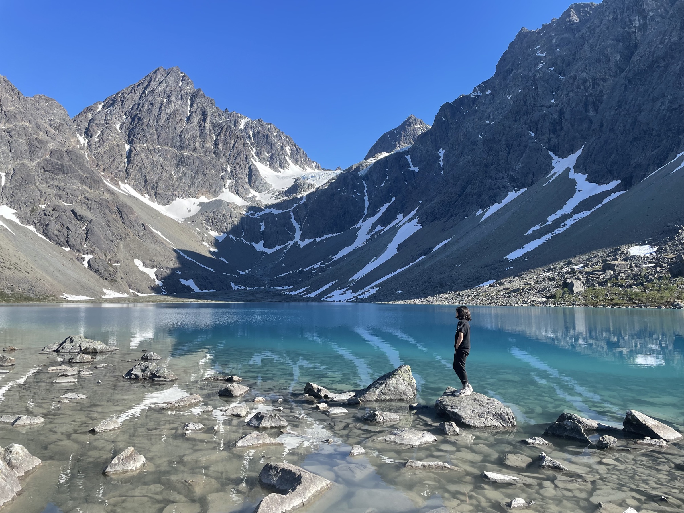
4. Blåisvatnet / Blåvatnet
Snapshot
Itinerary
The route starts from the marked parking area in Sør-Lenangen and follows a direct path towards Blåisvatnet. The first part uses easier ground, boardwalks, and marked sections through low terrain. The final approach crosses a stony riverbed and boulder-strewn ground before reaching the lake below Lenangsbreen.
Why it is essential
Blåisvatnet is the accessible glacial-lake hike in the Lyngen part of the region. The route reaches a highly distinctive blue lake beneath glacier and moraine scenery without requiring glacier travel, making it a strong counterpart to the steeper island summit hikes.
Equipment
Standard to light mountain hiking equipment: sturdy shoes or boots, weatherproof layer, warm layer, water, food, map/GPS, and sun protection. Trekking poles can help on the boulder and riverbed sections. Warm clothing is important even in summer because of wind and cold air near the lake.
Hazards and notes
The route is not technically difficult, but the final rocky section requires careful footing. Early season snow or lake ice can change the character of the walk. Weather can deteriorate quickly, and the open valley gives limited shelter. Do not step onto unstable snow, lake ice, or glacial terrain.
GPX / KML links
| Source | URL | Format | Notes |
|---|---|---|---|
| Outdooractive — Hike to Blåvatnet / The Blue Lake | outdooractive.com | Online route / source map | Outdooractive terms apply; route source found; standalone GPX availability and reuse not confirmed |
| The Photo Hikes — Blåisvatnet | thephotohikes.com | Route description; page states GPX available from activity map | Terms not resolved; route-file lead found; direct GPX URL not captured |
| Wikiloc — Blåisvatnet route | wikiloc.com | GPS track source | Wikiloc terms apply; route source found; reuse unclear and login may be required |
Sources
5. Steindalsbreen glacier approach
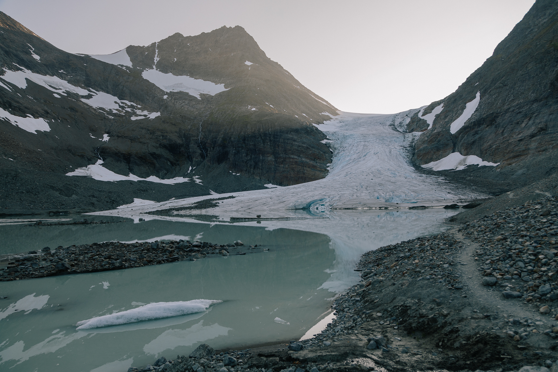
Snapshot
Itinerary
The route starts near Akselstua / IMA Tursenter by route 868 and follows a tractor road and path into Steindalen. The first part climbs before the valley opens into flatter terrain towards Steindalshytta. From the hut area, the route continues through the valley towards the glacier foreland and then climbs the moraine to viewpoints near Steindalsbreen.
Why it is essential
Steindalsbreen provides the glacier-valley entry for the Lyngen Alps without requiring technical glacier travel. The route combines valley walking, moraine terrain, glacier history signs, and close views of one of Lyngen’s accessible glacier fronts.
Equipment
Mountain hiking equipment: sturdy boots, weatherproof layer, warm layer, food, water, map/GPS, navigation backup, and trekking poles. Extra warm clothing is recommended near the glacier. Glacier equipment is not required for the described hiking route because the route should stop before glacier travel. Do not enter the glacier without a qualified guide, rope skills, and appropriate equipment.
Hazards and notes
The moraine section is steeper and rougher than the lower valley. Steindalsbreen itself must not be entered without glacier experience. Visit Lyngenfjord lists protected-area rules including no drone flights, no e-bikes, use of fixed fire pits, grazing sheep and reindeer, and dog-leash requirements.
GPX / KML links
| Source | URL | Format | Notes |
|---|---|---|---|
| Outdooractive — Steindalsbreen Glacier | outdooractive.com | Online route; GPX/KML/FIT controls shown | Outdooractive terms apply; source route found; route-file reuse unclear |
| The Photo Hikes — Steindalsbreen | thephotohikes.com | Route description; page states GPX available from activity map | Terms not resolved; route-file lead found; direct GPX URL not captured |
| Wikiloc — Steindalsbreen | fr.wikiloc.com | GPS track source | Wikiloc terms apply; route source found; reuse unclear and login may be required |
Sources
- Visit Lyngenfjord — Steindalsbreen Glacier
- Outdooractive — Steindalsbreen Glacier
- The Photo Hikes — Steindalsbreen
Region-level sources
| Source | Use | URL |
|---|---|---|
| Visit Lofoten — Reinebringen official hiking page | Reinebringen official route | visitlofoten.com |
| Visit Lofoten — Kvalvika and Ryten official hiking page | Ryten and Kvalvika official route | visitlofoten.com |
| Dronningruta official route site | Dronningruta official site | dronningruta.no |
| Dronningruta route description | Dronningruta route description | dronningruta.no |
| Arctic Norway / NordNorge — Dronningruta | Dronningruta third-party guide | nordnorge.com |
| UT.no — Dronningruta i Vesterålen | Dronningruta DNT-style route | ut.no |
| Visit Lyngenfjord — Blåisvatnet | Blåisvatnet official route | visit-lyngenfjord.com |
| Visit Lyngenfjord — Steindalsbreen | Steindalsbreen official route | visit-lyngenfjord.com |
| Outdooractive — Blåvatnet and Steindalsbreen route pages | Outdooractive route source | outdooractive.com |
| HorizonRando — Reinebringen and Ryten GPX sources | HorizonRando GPX source | horizonrando.fr |
| Topo GPS — Reinebringen and Dronningruta route-file sources | Topo GPS route-file source | topo-gps.com |
| Wikimedia Commons image sources | Image source | commons.wikimedia.org |