Regional overview
Rondane, Dovrefjell and Trollheimen form a broad central Norwegian mountain belt: dry, open high plateaux in Rondane; higher, wind-exposed Dovrefjell around Snøhetta; and more varied, western-influenced Trollheimen, where sharp peaks, lake basins and deep valleys meet older DNT hut routes.
Rondane is Norway’s oldest national park and contains ten 2,000 m peaks, with Rondeslottet the highest at 2,178 m. It is also important wild-reindeer habitat.
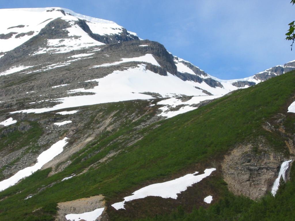
Dovrefjell is dominated by Snøhetta, 2,286 m, the highest mountain in Dovrefjell and the highest Norwegian summit outside Jotunheimen. The area has major ecological sensitivity because of wild reindeer.
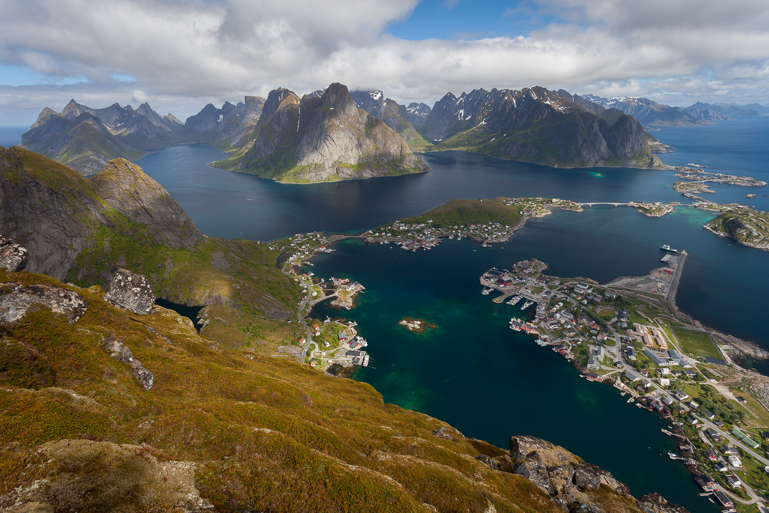
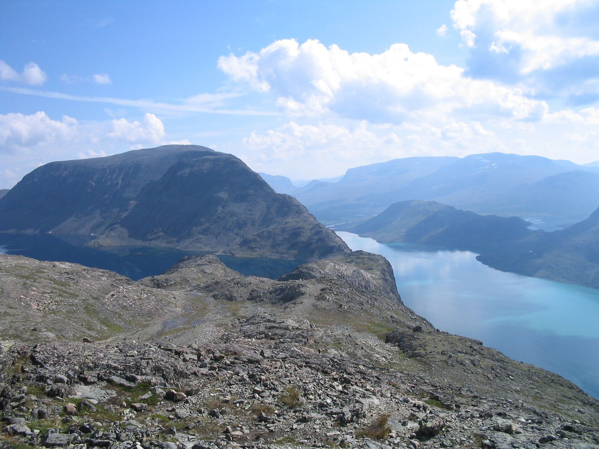
Trollheimen has a different character: greener valleys, prominent peaks such as Innerdalstårnet and Trollhøtta, long hut-to-hut routes, and a classic Triangle route between Gjevilvasshytta, Jøldalshytta and Trollheimshytta.
The normal walking season is roughly June or July to September, later on the highest and rockiest routes. Early summer snow, rapid weather changes, boulder fields, reindeer-protection restrictions, and hut/access logistics are the main planning issues.
Selection rationale
These five hikes were selected to represent the region’s main hiking identities: Rondane’s highest summit, Dovrefjell’s highest summit, Dovrefjell’s accessible reindeer-viewpoint walk, Trollheimen’s iconic Innerdalen valley, and a demanding Trollheimen Triangle high route over Trollhøtta.
Summary table
| # | Hike | Country | Route type | Distance | Gain | Max elevation | Difficulty |
|---|---|---|---|---|---|---|---|
| 1 | Rondvassbu – Rondeslottet via Vinjeronden | Norway | Out-and-back | 12.9 km | 1,224 m | 2,178 m, Rondeslottet | Strenuous |
| 2 | Reinheim – Snøhetta | Norway | Out-and-back | 12.9 km | 946 m | 2,286 m, Snøhetta Stortoppen | Hard |
| 3 | Viewpoint Snøhetta / Tverrfjellet | Norway | Out-and-back | 3.1 km | 147 m | Area high point around Tverrfjellet, 1,248 m; exact route high point unresolved | Moderate |
| 4 | Innerdalen – Eiriksvollen | Norway | Point-to-point | 15.4 km | 706 m | Not verified | Hard |
| 5 | Jøldalshytta – Trollheimshytta via Trollhøtta | Norway | Point-to-point hut-to-hut | 20.3 km | 1,274 m | Trollhøtta 1,616 m; route database maximum c. 1,636 m not reconciled | Strenuous |
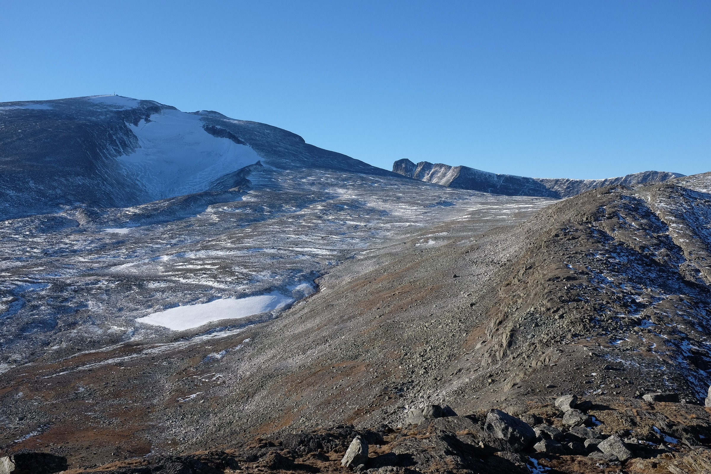
1. Rondvassbu – Rondeslottet via Vinjeronden
Snapshot
Itinerary
The route starts at Rondvassbu and climbs north into the central Rondane massif. It first gains Vinjeronden, a 2,044 m summit on the approach to Rondeslottet, then continues over rocky high ground to Rondeslottet, the highest mountain in Rondane. The return follows the same line back to Rondvassbu. The route is short in distance but serious in character because of sustained ascent, boulder fields, exposed ridge sections and high-mountain weather.
Why it is essential
Rondeslottet is the highest summit in Rondane and one of the defining walks of the national park. Rondane’s central lake-and-summit topography makes this route one of the clearest single-day ways to experience the park’s high, dry, rocky mountain character.
Equipment
- Sturdy mountain boots
- Warm layer
- Waterproof shell
- Gloves and hat outside stable midsummer
- Food and water
- Map/GPS
- Navigation backup
- Headtorch
- Trekking poles useful for descent, but may be awkward on boulder sections
Hazards and notes
- Extensive loose rock and boulder fields
- Exposed to rapid weather changes
- Early-season snow can make ridge and boulder-field travel more serious
- Dogs marked as not allowed on the cited route record
- Reindeer sensitivity in Rondane should be checked locally before departure
GPX / KML links
| Source | URL | Format | Notes |
|---|---|---|---|
| AllTrails route record | alltrails.com | Source map / route database record | Use as source-route reference. Replace with own GPX/KML later |
| Wikimedia Commons / Wikidata geodata | commons.wikimedia.org | KML/geodata point reference, not full walking route | Useful only for summit georeference |
Sources
- AllTrails — Rondvassbu to Rondeslottet via Vinjeronden
- Wikipedia — Rondane National Park
- Wikimedia Commons — Rondeslottet from Veslesmeden
- Wikimedia Commons — Rondeslottet 01
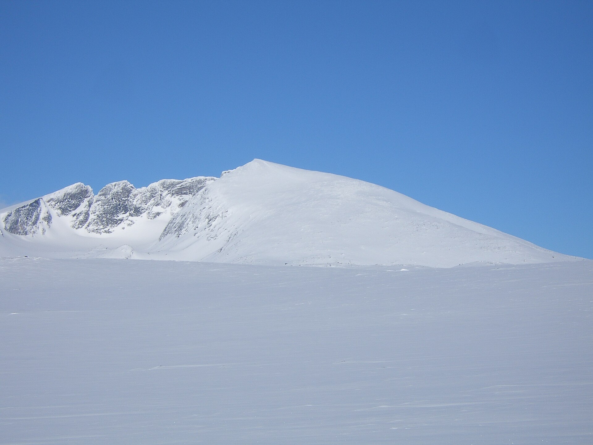
2. Reinheim – Snøhetta
Snapshot
Itinerary
The route climbs from Reinheim towards Snøhetta on a marked Dovrefjell mountain route. It is a rocky high-mountain walk rather than a technical climb when conditions are dry and snow-free. The highest summit, Stortoppen, reaches 2,286 m.
Why it is essential
Snøhetta is Dovrefjell’s landmark summit and the highest Norwegian mountain outside Jotunheimen. Its position above the Dovrefjell plateau makes it the defining high-mountain walk of the region.
Equipment
- Sturdy boots with good grip
- Warm layers
- Waterproof shell
- Hat and gloves
- Map/GPS
- Navigation backup
- Food and water
- Headtorch
- Microspikes may be needed if snow remains
Hazards and notes
- Sensitive wild-reindeer country
- Avoid disturbing reindeer and give animals a wide berth
- Check current access advice, especially during calving/rearing periods
- Upper mountain is exposed to wind and poor visibility
- Avoid in strong wind, fog or early-season snow
- Traverses over more complex Snøhetta tops are not included
GPX / KML links
| Source | URL | Format | Notes |
|---|---|---|---|
| AllTrails route record | alltrails.com | Source map / route database record | Use as source-route reference. Replace with own GPX/KML later |
| Wikimedia Commons / Wikidata Snøhetta geodata | commons.wikimedia.org | KML/geodata point reference, not full walking route | Useful only for summit georeference |
Sources
- AllTrails — Reinheim to Snøhetta
- Wikipedia — Snøhetta
- Wikimedia Commons — Snøhetta
- Wikimedia Commons — Dovre gryta Snöhetta Vesttoppen 2253 Midttoppen 2278
3. Viewpoint Snøhetta / Tverrfjellet
Snapshot
Itinerary
This short walk climbs from the Hjerkinn/Dovrefjell side towards the Viewpoint Snøhetta pavilion, a built viewpoint associated with the Norwegian Wild Reindeer Centre. The route is primarily a viewpoint and interpretation walk rather than a long mountain hike.
Why it is essential
The hike is short, but it gives accessible views towards Snøhetta and represents Dovrefjell’s wild-reindeer conservation story. The pavilion is an important architectural and interpretive site in the Dovrefjell landscape.
Equipment
- Hiking shoes
- Weatherproof layer
- Warm layer
- Water
- Map/GPS
- More protective clothing in cold or windy weather
Hazards and notes
- Short but exposed to Dovrefjell weather
- Snow, ice or wind can make the walk less casual outside normal season
- Avoid disturbing reindeer and follow current site guidance
GPX / KML links
| Source | URL | Format | Notes |
|---|---|---|---|
| AllTrails route record | alltrails.com | Source map / route database record | Use as source-route reference. Replace with own GPX/KML later |
| Tverrfjellet reference page | en.wikipedia.org | Mountain/geodata reference, not route file | Useful only for area/elevation context |
Sources
- AllTrails — Snøhetta utsiktspunkt
- Wikipédia FR — Viewpoint Snøhetta
- Wikipedia — Tverrfjellet (Dovre)
- Wikimedia Commons — Snøhetta
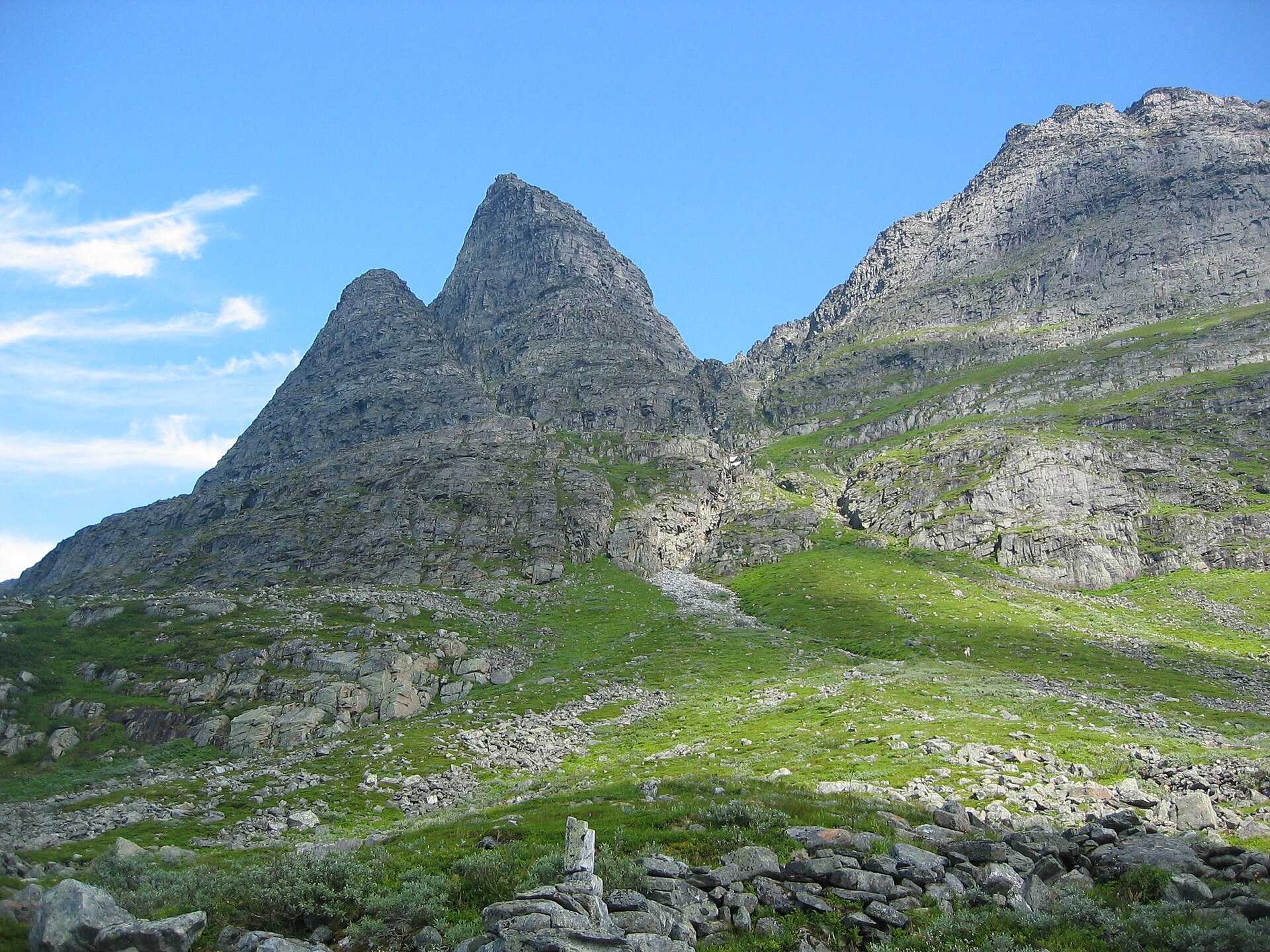
4. Innerdalen – Eiriksvollen
Snapshot
Itinerary
This point-to-point route follows the Innerdalen side of Trollheimen towards Eiriksvollen, linking valley scenery, lakes, rivers and mountain views. The route gives access to one of Trollheimen’s signature valley landscapes without treating Innerdalstårnet itself as a normal hiking summit.
Why it is essential
Innerdalen is one of Trollheimen’s signature valleys, framed by the pyramidal Innerdalstårnet. Innerdalstårnet itself rises to 1,452 m and is associated with climbing routes, so this catalogue entry selects the valley route rather than the technical summit.
Equipment
- Sturdy boots
- Waterproof layer
- Warm layer
- Food
- Water
- Map/GPS
- Navigation backup
- Trekking poles useful for a longer valley day
- Headtorch recommended if transport or hut logistics make the day long
Hazards and notes
- Rough, wet or boggy ground possible
- Weather can deteriorate quickly
- Innerdalstårnet summit is not included and should not be treated as a normal day hike
- Point-to-point access, onward transport and road restrictions need local verification
GPX / KML links
| Source | URL | Format | Notes |
|---|---|---|---|
| AllTrails route record | alltrails.com | Source map / route database record | Use as source-route reference. Replace with own GPX/KML later |
| Wikimedia Commons / Wikidata Innerdalstårnet geodata | commons.wikimedia.org | KML/geodata point reference, not full walking route | Useful only for landmark georeference |
Sources
- AllTrails — Innerdalen to Eiriksvollen (TNM25)
- Wikipédia FR — Innerdalstårnet
- Wikimedia Commons — Innerdalstårnet cows
- Wikimedia Commons — Innerdalstårnet
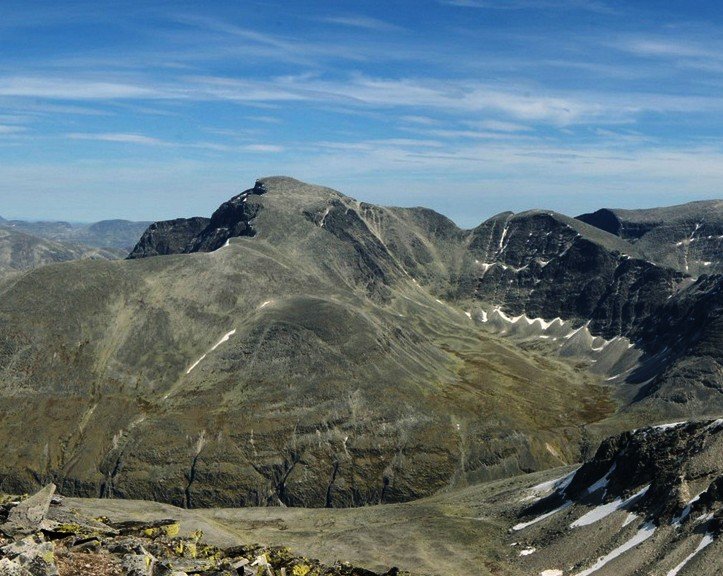
5. Jøldalshytta – Trollheimshytta via Trollhøtta
Snapshot
Itinerary
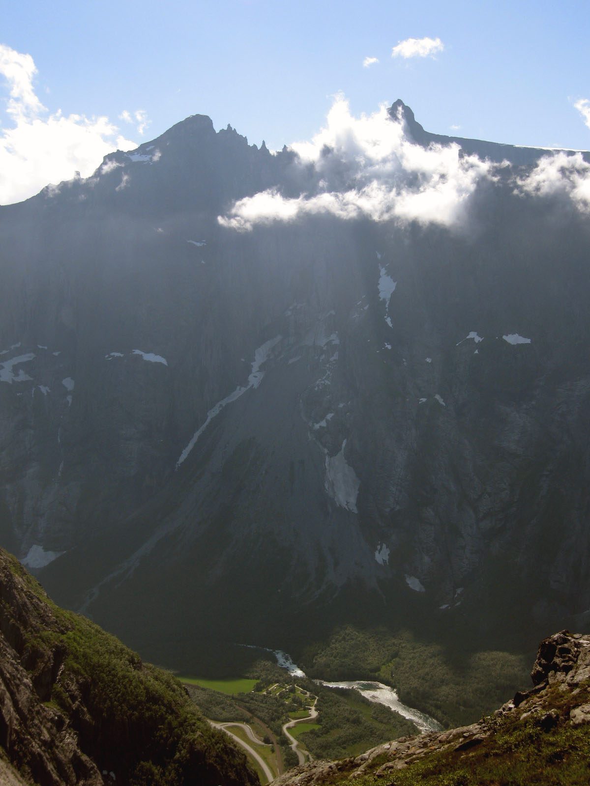
This is the demanding high-level variant between Jøldalshytta and Trollheimshytta, crossing the Trollhøtta massif. The route is a long point-to-point mountain day with substantial ascent and exposed rocky terrain.
Why it is essential
The route forms one of the most dramatic one-day sections of the classic Trollheimen Triangle system. Trollhøtta is a major Trollheimen summit on the border of Trøndelag and Møre og Romsdal; it has three peaks, with the highest at 1,616 m, and Jøldalshytta and Trollheimshytta lie on opposite sides of the massif.
Equipment
- Sturdy boots
- Warm layers
- Waterproof shell
- Gloves and hat
- Navigation backup
- Food
- Water
- Headtorch
- Emergency layer
- Trekking poles may help on long descents
- Hut booking or camping equipment may be needed depending on wider itinerary
Hazards and notes
- Serious long mountain day
- Steep, rocky and airy terrain
- Weather exposure
- Dogs marked as not allowed on the cited route record
- Winter or snow-covered conditions can make ridges much more serious
- Assumes normal summer hiking conditions only
GPX / KML links
| Source | URL | Format | Notes |
|---|---|---|---|
| AllTrails route record | alltrails.com | Source map / route database record | Use as source-route reference. Replace with own GPX/KML later |
| Wikimedia Commons / Wikidata Trollhetta geodata | commons.wikimedia.org | KML/geodata point reference, not full walking route | Useful only for summit georeference |
Sources
- AllTrails — Signatur Trollheimen etappe 2: Jøldalshytta to Trollheimshytta via Trollhetta
- Wikipedia — Trollhøtta
- Wikimedia Commons — Trollheimen mnt Trollhetta
- Wikimedia Commons — Category: Trollhetta
Region-level sources
| Source | Use | URL |
|---|---|---|
| AllTrails — Rondvassbu to Rondeslottet via Vinjeronden | Rondeslottet source map | alltrails.com |
| AllTrails — Reinheim to Snøhetta | Snøhetta source map | alltrails.com |
| AllTrails — Snøhetta utsiktspunkt | Viewpoint Snøhetta source map | alltrails.com |
| AllTrails — Innerdalen to Eiriksvollen | Innerdalen source map | alltrails.com |
| AllTrails — Jøldalshytta to Trollheimshytta via Trollhetta | Trollhøtta source map | alltrails.com |
| Wikipedia — Rondane National Park | Rondane context | en.wikipedia.org |
| Wikipedia — Snøhetta | Snøhetta context | en.wikipedia.org |
| Wikipedia — Tverrfjellet (Dovre) | Tverrfjellet context | en.wikipedia.org |
| Wikipédia FR — Viewpoint Snøhetta | Pavilion context | fr.wikipedia.org |
| Wikipédia FR — Innerdalstårnet | Innerdalstårnet context | fr.wikipedia.org |
| Wikipedia — Trollhøtta | Trollhøtta context | en.wikipedia.org |
| Wikimedia Commons — Rondslottet category | Rondeslottet geodata | commons.wikimedia.org |
| Wikimedia Commons — Snøhetta category | Snøhetta geodata | commons.wikimedia.org |
| Wikimedia Commons — Innerdalstårnet category | Innerdalstårnet geodata | commons.wikimedia.org |
| Wikimedia Commons — Trollhetta category | Trollhetta geodata | commons.wikimedia.org |