Regional overview
This region combines the granite high mountains of the Spanish Sistema Central with the colder, more isolated summits and glacial landforms of the northern Sistema Ibérico. Gredos and Guadarrama offer cirques, high cols, granite slabs, pinewoods, lakes, and summit ridges; Urbión and Moncayo add glacial lagoons, high moorland, forested slopes, and exposed summit domes.
The main hiking centres are Hoyos del Espino / La Plataforma for Gredos, Puerto de Cotos and Manzanares el Real for Guadarrama, Vinuesa / Laguna Negra for Urbión, and the Santuario del Moncayo / Fuente de los Frailes area for Moncayo. Public transport is strong around Madrid’s Guadarrama routes, while Gredos, Urbión, and Moncayo are generally more car-dependent, with seasonal parking or access controls in some areas.
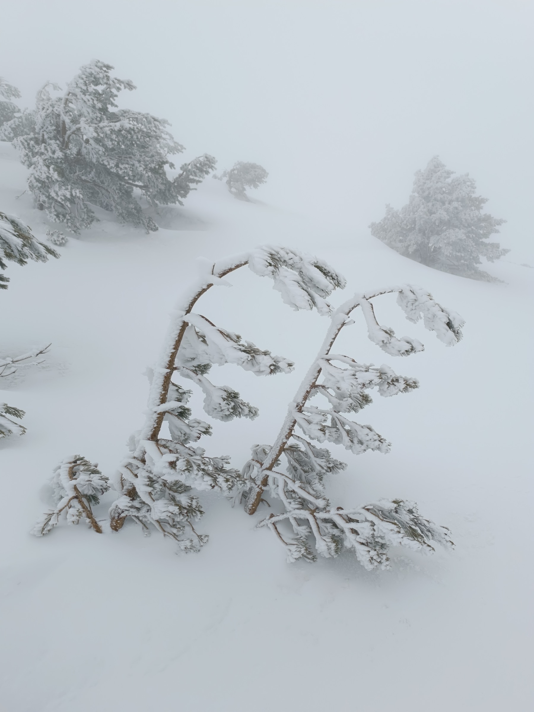
The best general season is late spring to autumn, although early summer snow can remain on high north-facing sections. In winter, several of these routes become serious high-mountain outings: Peñalara, Gredos, Urbión, and especially Moncayo can have ice, wind, fog, and avalanche-prone or corniced terrain. Official sources repeatedly warn that snow and poor visibility change the seriousness of these routes.
Selection rationale
These five hikes were selected to balance the region: one Gredos cirque-and-lake classic, two contrasting Guadarrama classics, one Urbión glacial-lake and source-of-the-Duero route, and the highest summit of the Sistema Ibérico. The list favours widely recognised routes with official or semi-official route information, reusable photo candidates, and at least some traceable GPX/KML or source-map material.
Summary table
| # | Hike | Country | Route type | Distance | Gain | Max elevation | Difficulty |
|---|---|---|---|---|---|---|---|
| 1 | Laguna Grande de Gredos, PR-AV 17 | Spain | Out-and-back | 12.8 km | c. +580 m | 2,170 m | Moderate; high-mountain in snow |
| 2 | Pico Peñalara from Puerto de Cotos | Spain | Out-and-back | 10.2 km | +610 m | 2,428 m | Moderate-strenuous |
| 3 | La Pedriza by El Yelmo | Spain | Circular | 11.6–15 km | +833–1,000 m | 1,598–1,714 m | Moderate-strenuous |
| 4 | Laguna Negra, Pico Urbión and Nacimiento del Duero | Spain | Loop / lollipop | 12.5–13.4 km | c. +670 m | 2,228 m | Strenuous mountain hike |
| 5 | Cumbre del Moncayo / Pico San Miguel, AG-1 | Spain | Out-and-back | 9.8–12.3 km | c. +730 m | 2,315 m | Strenuous; serious in winter |
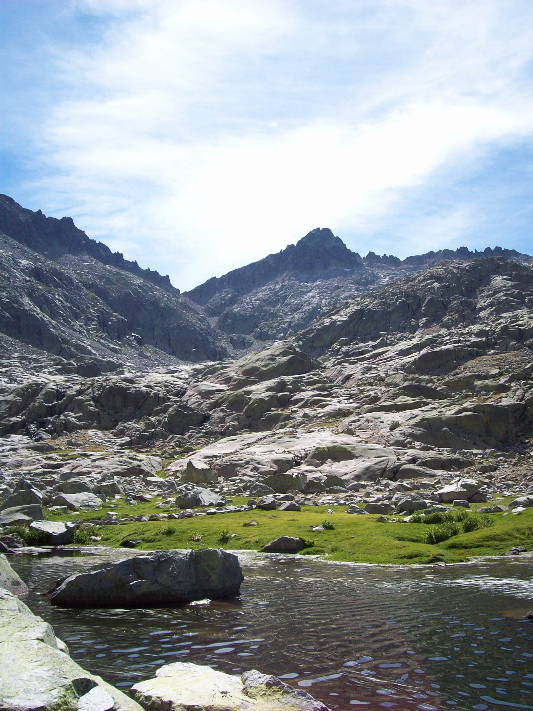
1. Laguna Grande de Gredos, PR-AV 17
Snapshot
Itinerary
The route leaves La Plataforma and follows the marked PR-AV 17 towards the high granite basin of Gredos. It climbs steadily to the Prado de las Pozas and then to Los Barrerones, the high point of the approach. From there, the path descends into the Circo de Gredos, with views towards Laguna Grande, the Refugio Elola area, and the Almanzor massif. The return follows the same line, requiring a second climb back to Los Barrerones before descending to La Plataforma.
Why it is essential
This is the classic non-technical approach into the most famous high-mountain cirque of Gredos. It gives direct access to the Laguna Grande basin, views of the Almanzor group, and the characteristic granite, water, and alpine meadow scenery of the range.
Equipment
- Sturdy boots
- Warm layer
- Waterproof layer
- Map/GPS
- Water
- Food
- Sun protection
- Trekking poles recommended
- Winter traction equipment when snow or ice is present
Hazards and notes
Snow, wind slabs, ice, and fog can make the route serious from late autumn into spring. The upper section is exposed to weather and visibility problems. The route lies in protected mountain terrain; walkers should stay on marked paths and follow local signage.
GPX / KML links
| Source | URL | Format | Notes |
|---|---|---|---|
| Official PR-AV 17 route leaflet | patrimonionatural.org | PDF map / route description | Official source; route-file reuse terms not separately stated. Suitable as verification source; not a GPX. |
| TerraNostrum PR-AV 17 page | terranostrum.es | GPX download advertised | Terms not confirmed; route-file reuse unresolved. |
| Wikiloc route source | wikiloc.com | GPX via platform | Subject to Wikiloc terms / user content; reuse unresolved. |
External links
- Patrimonio Natural — Casa del Parque de Sierra de Gredos
- Official PR-AV 17 route leaflet
- TerraNostrum — Senda de la Laguna Grande
- Wikiloc — Plataforma de Gredos to Laguna Grande PR-AV 17
2. Pico Peñalara from Puerto de Cotos
Snapshot
Itinerary
The route starts at Puerto de Cotos and follows the marked official route towards the Peñalara massif. It climbs through the lower forest and open slopes, then continues on a mountain path towards the broad summit ridge. The final section reaches Pico Peñalara, the highest point of the Sierra de Guadarrama, before returning by the same route.
Why it is essential
Peñalara is the highest summit of the Guadarrama range and one of the most recognised day hikes near Madrid. The route combines accessibility from Puerto de Cotos with high-mountain views, protected alpine habitats, and a clear summit objective.
Equipment
- Sturdy boots
- Warm layer
- Waterproof layer
- Navigation backup
- Water
- Food
- Sun protection
- Trekking poles recommended
- Winter mountain equipment when snow or ice is present
Hazards and notes
The national park classifies the route for advanced hikers. Winter conditions can make it unsuitable for inexperienced walkers without specific technical equipment. Dogs must be kept on a lead. Group-size restrictions and authorisation rules apply to larger groups in sensitive areas.
GPX / KML links
| Source | URL | Format | Notes |
|---|---|---|---|
| Sierra de Guadarrama National Park | parquenacionalsierraguadarrama.es | GPX | Official download; GPX-specific reuse terms not separately stated. Attribution recommended. |
| Sierra de Guadarrama National Park | parquenacionalsierraguadarrama.es | KML | Official download; KML-specific reuse terms not separately stated. Attribution recommended. |
| Official park Wikiloc page | wikiloc.com | Platform route / GPX source | Subject to Wikiloc/platform terms; useful verification source. |
External links
- Sierra de Guadarrama National Park — Route PNSG-032
- Official GPX
- Official KML
- Wikiloc — Pico Peñalara
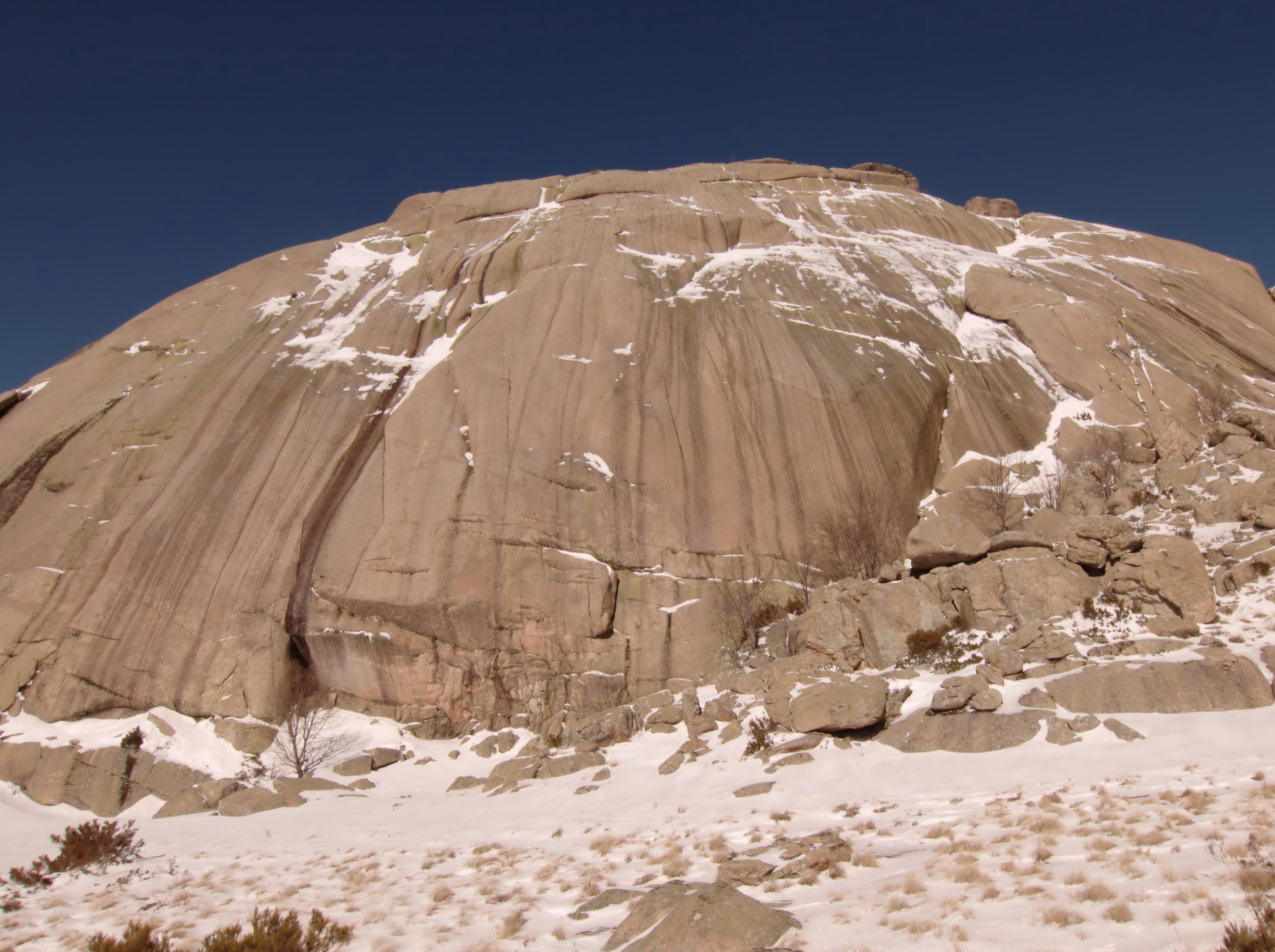
3. La Pedriza by El Yelmo
Snapshot
Itinerary
The route starts from the Manzanares el Real / El Tranco side of La Pedriza and follows marked paths into the granite landscape below El Yelmo. Depending on variant, it either reaches the El Yelmo area as a scenic circular route or continues higher towards the summit sector. The route passes through characteristic granite slabs, tors, boulders, and pine / scrub terrain before descending back towards Manzanares el Real.
Why it is essential
La Pedriza is one of the emblematic granite landscapes of Guadarrama, and El Yelmo is its most recognisable dome. This hike represents the lower, rockier, more labyrinthine side of the range, contrasting strongly with the open high ridge of Peñalara.
Equipment
- Sturdy boots with good grip
- Water
- Sun protection
- Warm layer
- Waterproof layer
- Map/GPS
- Trekking poles where useful
- Extra water in summer
Hazards and notes
The granite terrain can be confusing, with slabs, boulder fields, and path junctions. Heat is a serious issue in summer. Access to La Pedriza is regulated at times, with parking controls and seasonal vehicle restrictions. Some summit variants around El Yelmo may involve hands-on rock steps; these should be avoided in wet, icy, or very windy conditions unless the party is confident on exposed granite.
GPX / KML links
| Source | URL | Format | Notes |
|---|---|---|---|
| Comunidad de Madrid route page | comunidad.madrid | Source map / route profile | Official regional page; route-file licence not separately stated. Good verification source; direct GPX unresolved. |
| Rutas Parques Nacionales PDF | rutasparquesnacionales.es | PDF with GPS/map data advertised | Terms not confirmed; useful source route; reuse unresolved. |
| Wikiloc example route | wikiloc.com | Platform GPX source | Subject to Wikiloc/user-content terms; reuse unresolved. |
External links
- Comunidad de Madrid — Senda circular Pedriza-Yelmo
- Rutas Parques Nacionales — Circular a La Pedriza con ascensión al Yelmo
- Wikiloc — Circular al Yelmo, La Pedriza
- Sierra de Guadarrama National Park — La Pedriza geology
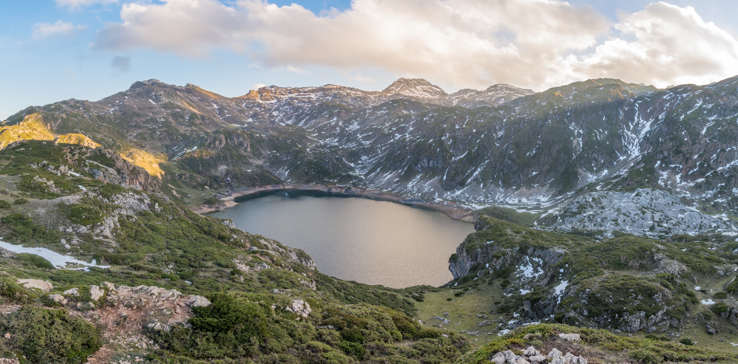
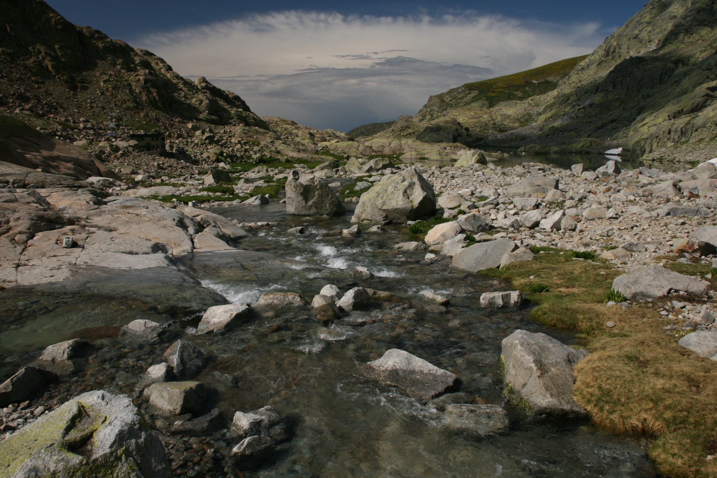
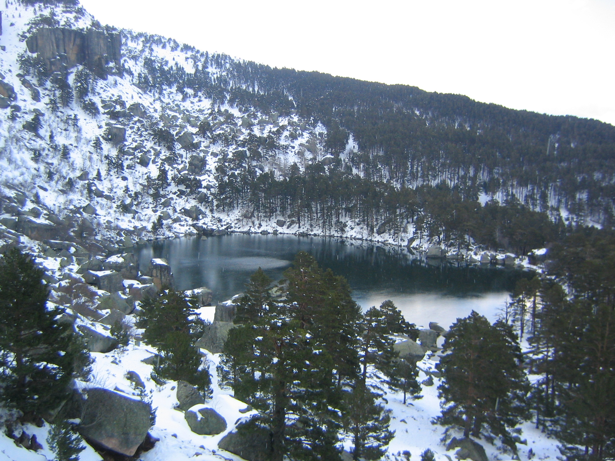
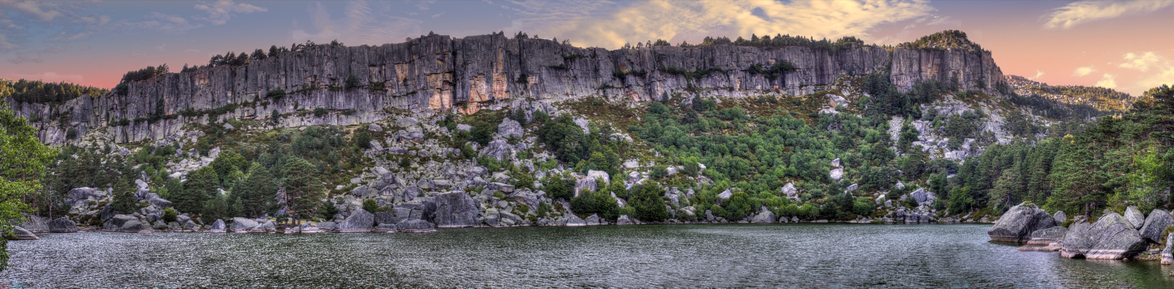
4. Laguna Negra, Pico Urbión and Nacimiento del Duero
Snapshot
Itinerary
The route starts from the Laguna Negra area, or from Paso de la Serrá when vehicle access is restricted. It climbs above Laguna Negra, then continues through the glacial high country towards Laguna Larga and the Urbión summit area. The summit of Pico Urbión gives access to one of the symbolic high points of the Sistema Ibérico, close to the source area of the Duero. Depending on the chosen line, the return can include Laguna Helada and a broader circuit of the upper glacial basins.
Why it is essential
This hike links the best-known lake of the Urbión massif, a set of glacial landforms, the summit of Pico Urbión, and the source area of one of Iberia’s major rivers. It is the most representative high-level day hike in the Urbión sector.
Equipment
- Sturdy boots
- Warm layer
- Waterproof layer
- Map/GPS
- Food
- Water
- Sun protection
- Trekking poles recommended
- Winter traction may be necessary when snow or ice is present
Hazards and notes
The climb above Laguna Negra can be steep and rough, especially in wet, icy, or snowy conditions. The high plateau and summit area are exposed to fog, wind, and navigation difficulty. Vehicle access to Laguna Negra can be restricted in summer and busy periods, with parking lower down and shuttle or walking access from Paso de la Serrá.
GPX / KML links
| Source | URL | Format | Notes |
|---|---|---|---|
| TerraNostrum route page | terranostrum.es | GPX download advertised | Terms not confirmed; route-file reuse unresolved. |
| TerraNostrum GPX file | terranostrum.es | GPX | Terms not confirmed; download found; reuse unresolved. |
| Komoot route page | komoot.com | Platform route | Subject to Komoot terms; useful secondary verification. |
External links
- Patrimonio Natural — Laguna Negra y Circos Glaciares de Urbión
- TerraNostrum — Laguna Negra, Pico Urbión
- TerraNostrum GPX file
- Komoot — Laguna Negra and Pico Urbión
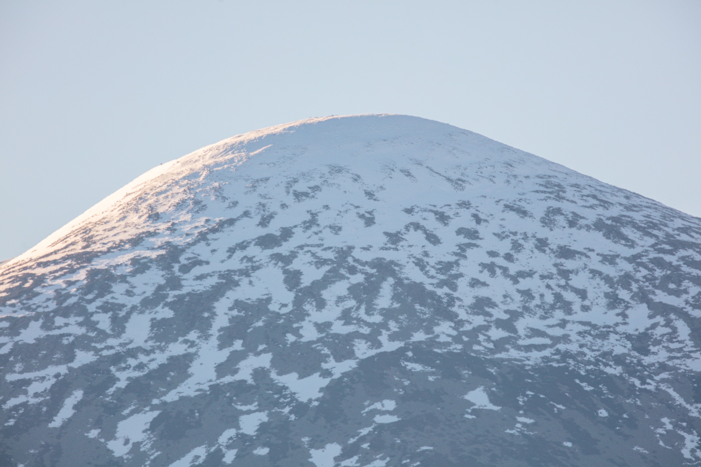
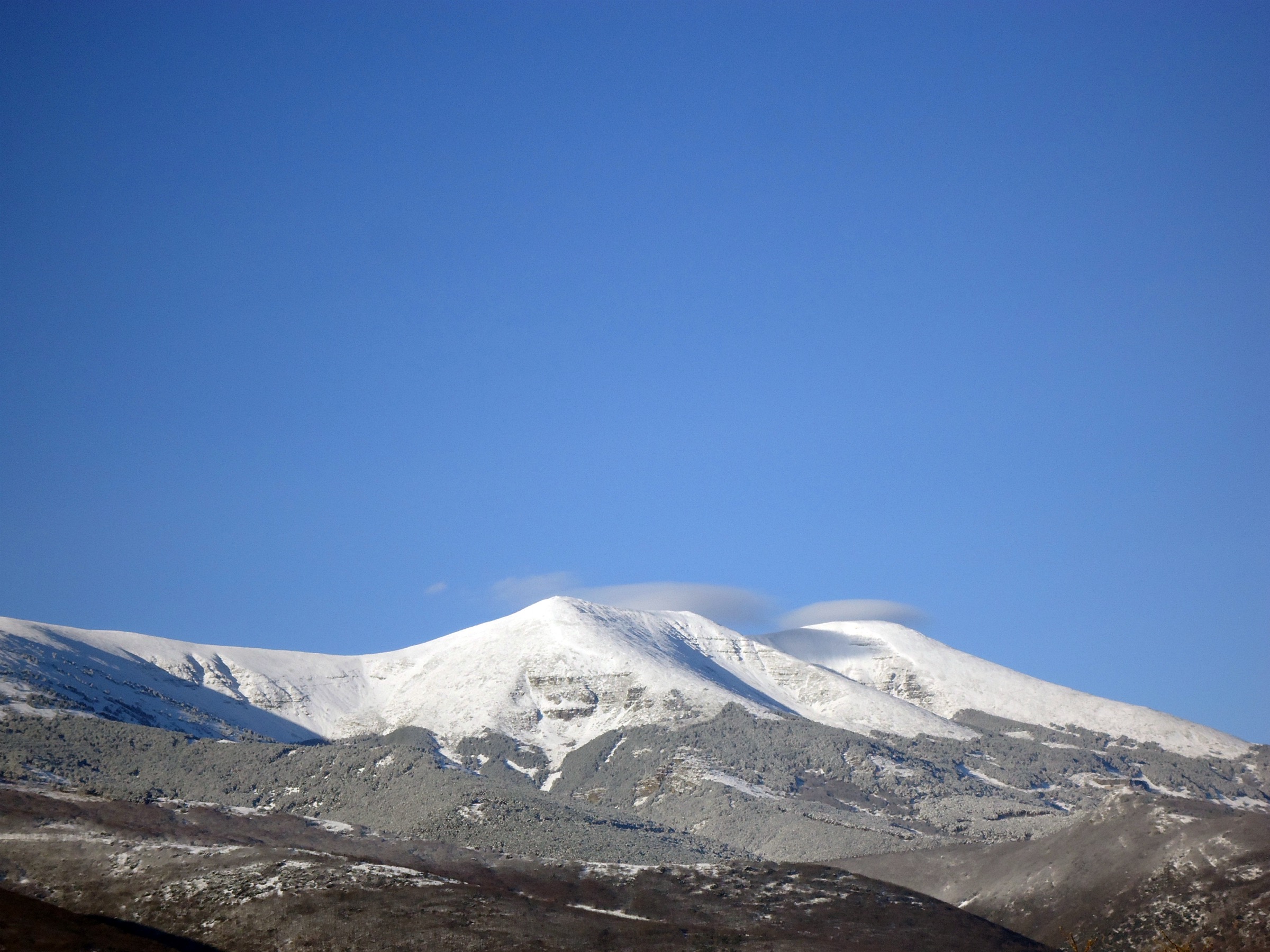
5. Cumbre del Moncayo / Pico San Miguel, AG-1
Snapshot
Itinerary
The AG-1 route climbs from the Santuario del Moncayo / Fuente de los Frailes sector towards the Circo de San Miguel. The path passes through forest, then open scrub and stonier ground, before reaching the higher ridge area near Cerro de San Juan and the final summit section. Pico San Miguel, commonly referred to as the summit of Moncayo, is the highest point of the Sistema Ibérico. The descent normally follows the ascent route.
Why it is essential
Moncayo is the culminating summit of the Sistema Ibérico and an isolated mountain visible across a wide area of Aragón, Castilla y León, and Navarra. The route is a defining summit hike for the whole Sistema Ibérico portion of this region.
Equipment
- Sturdy boots
- Windproof layer
- Waterproof layer
- Warm layer
- Gloves and hat outside summer
- Navigation backup
- Food
- Water
- Sun protection
- Winter equipment and experience when snow or ice is present
Hazards and notes
The upper Moncayo is highly exposed to wind, fog, snow, and ice. Official safety material warns that the summit can be difficult in poor visibility and that winter ascent is strongly discouraged for walkers without winter-mountain experience. The steep upper scree / stony sections require care in descent.
GPX / KML links
| Source | URL | Format | Notes |
|---|---|---|---|
| Red Natural de Aragón, AG-1 | rednaturaldearagon.com | Official route page | Official source; route-file terms not separately stated. Good verification source. |
| Red Natural de Aragón, AG-1 WGS84 | rednaturaldearagon.com | GPX | Official GPX download; reuse terms not separately stated. Attribution recommended. |
| Montaña Segura route 108 | visor.montanasegura.com | Source map / route page | Official safety-route source; terms not separately stated. Good verification source. |
| Montaña Segura GPX | visor.montanasegura.com | GPX | Terms not separately stated; route file found; attribution recommended. |
| Montaña Segura KML | visor.montanasegura.com | KML | Terms not separately stated; route file found; attribution recommended. |
External links
- Red Natural de Aragón — AG-1 Cumbre del Moncayo
- Red Natural de Aragón — AG-1 official GPX
- Montaña Segura — Route 108
- Montaña Segura GPX
- Montaña Segura KML
External links
| Source | URL |
|---|---|
| Sierra de Gredos — Patrimonio Natural Casa del Parque | patrimonionatural.org |
| Sierra de Gredos — Official PR-AV 17 leaflet | patrimonionatural.org |
| Sierra de Guadarrama National Park — Route PNSG-032 | parquenacionalsierraguadarrama.es |
| Sierra de Guadarrama National Park — Official GPX | parquenacionalsierraguadarrama.es |
| Sierra de Guadarrama National Park — Official KML | parquenacionalsierraguadarrama.es |
| La Pedriza — Comunidad de Madrid route page | comunidad.madrid |
| La Pedriza — Rutas Parques Nacionales PDF | rutasparquesnacionales.es |
| Sierra de Guadarrama National Park — La Pedriza geology | parquenacionalsierraguadarrama.es |
| Urbión — Patrimonio Natural Laguna Negra y Circos Glaciares | patrimonionatural.org |
| Urbión — TerraNostrum route page | terranostrum.es |
| Urbión — TerraNostrum GPX | terranostrum.es |
| Urbión — Komoot route | komoot.com |
| Moncayo — Red Natural de Aragón AG-1 | rednaturaldearagon.com |
| Moncayo — Red Natural de Aragón AG-1 GPX | rednaturaldearagon.com |
| Moncayo — Montaña Segura route 108 | visor.montanasegura.com |
| Moncayo — Montaña Segura GPX | visor.montanasegura.com |
| Moncayo — Montaña Segura KML | visor.montanasegura.com |