Regional overview
Bulgaria’s high mountain hiking is split between several distinct ranges. Rila is the highest, with Musala at 2,925.4 m, the highest summit in Bulgaria and the Balkan Peninsula. Pirin is sharper and rockier, with marble ridges, glacial lakes and Vihren at about 2,914 m, inside Pirin National Park.
The Balkan Mountains, or Stara Planina, form Bulgaria’s long east–west backbone. Central Balkan National Park reaches 2,376 m at Botev Peak and contains reserves, waterfalls and steep-sided mountain valleys. The Rhodopes are lower and more wooded, with karst features, natural bridges, gorges, caves and cultural landscapes rather than high alpine summits. The Wonderful Bridges are natural arches in the Western Rhodopes at about 1,450 m.
The main summer walking season is normally June or July to September in the high mountains. Snow can linger into early summer in Rila and Pirin, and the Seven Rila Lakes commonly freeze from October until before June. Afternoon storms, exposed ridges, poor visibility and limited water on upper routes are recurring safety issues.
Selection rationale
The five hikes below balance the region’s highest summit, the most famous glacial-lake circuit, Pirin’s classic summit ascent, a Rhodope karst landmark, and a Central Balkan waterfall-and-hut approach beneath Botev Peak.
Summary table
| # | Hike | Sub-region | Route type | Distance | Gain | Max elevation | Difficulty | Photos |
|---|---|---|---|---|---|---|---|---|
| 1 | Musala from Yastrebetz | Rila / Borovets | Lift-assisted out-and-back | 14.8 km | 705 m | 2,925.4 m | Hard | Commons image verified |
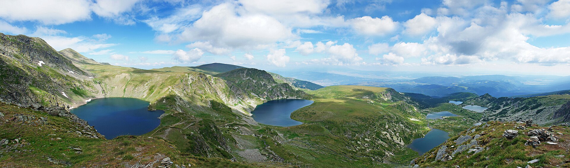
| 2 | Seven Rila Lakes circuit | North-west Rila | Loop | 8.4 km | 537 m | c. 2,551 m | Hard | Commons image verified |
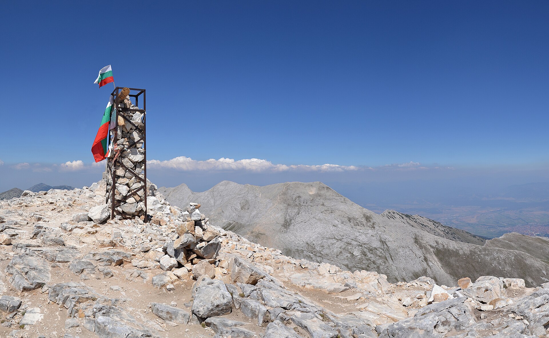
| 3 | Vihren Peak from Vihren Hut | Pirin / Bansko | Loop | 8.0 km | 973 m | c. 2,914 m | Hard | Commons image verified |
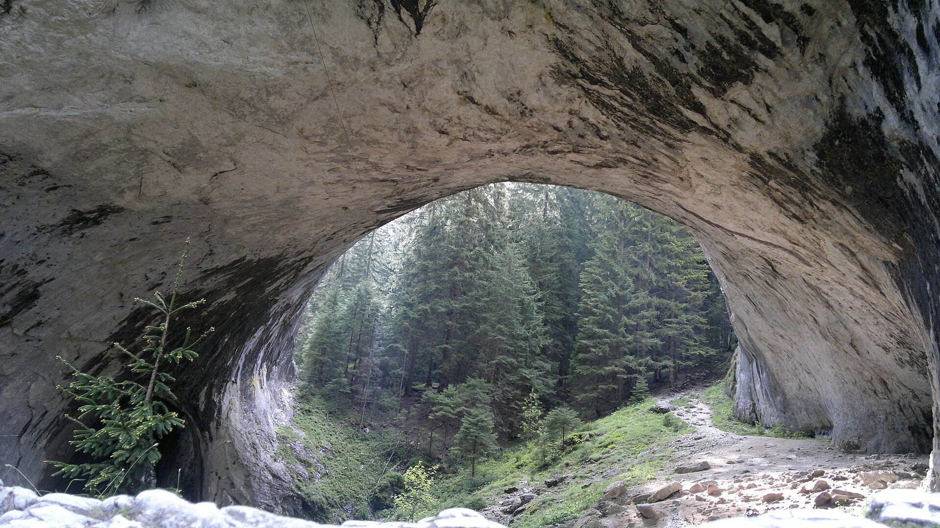
| 4 | Wonderful Bridges to Kabata Hut | Western Rhodopes | Out-and-back / short traverse | 3.9 km one-way; c. 7.7 km return | 265 m one-way | c. 1,450 m | Moderate | Commons image verified |
| 5 | Panitsite to Rai Hut and Raysko Praskalo | Central Balkan / Botev south | Out-and-back | c. 19 km return | 843 m one-way | c. 1,700 m | Hard | Commons category found; individual file licence unresolved |
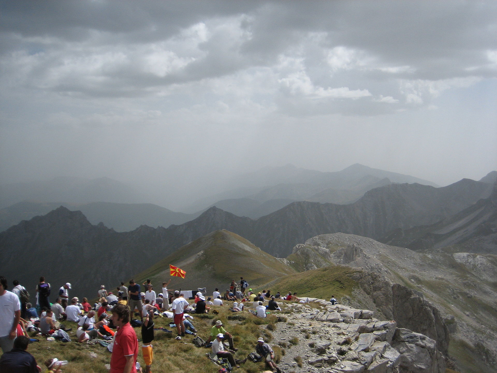
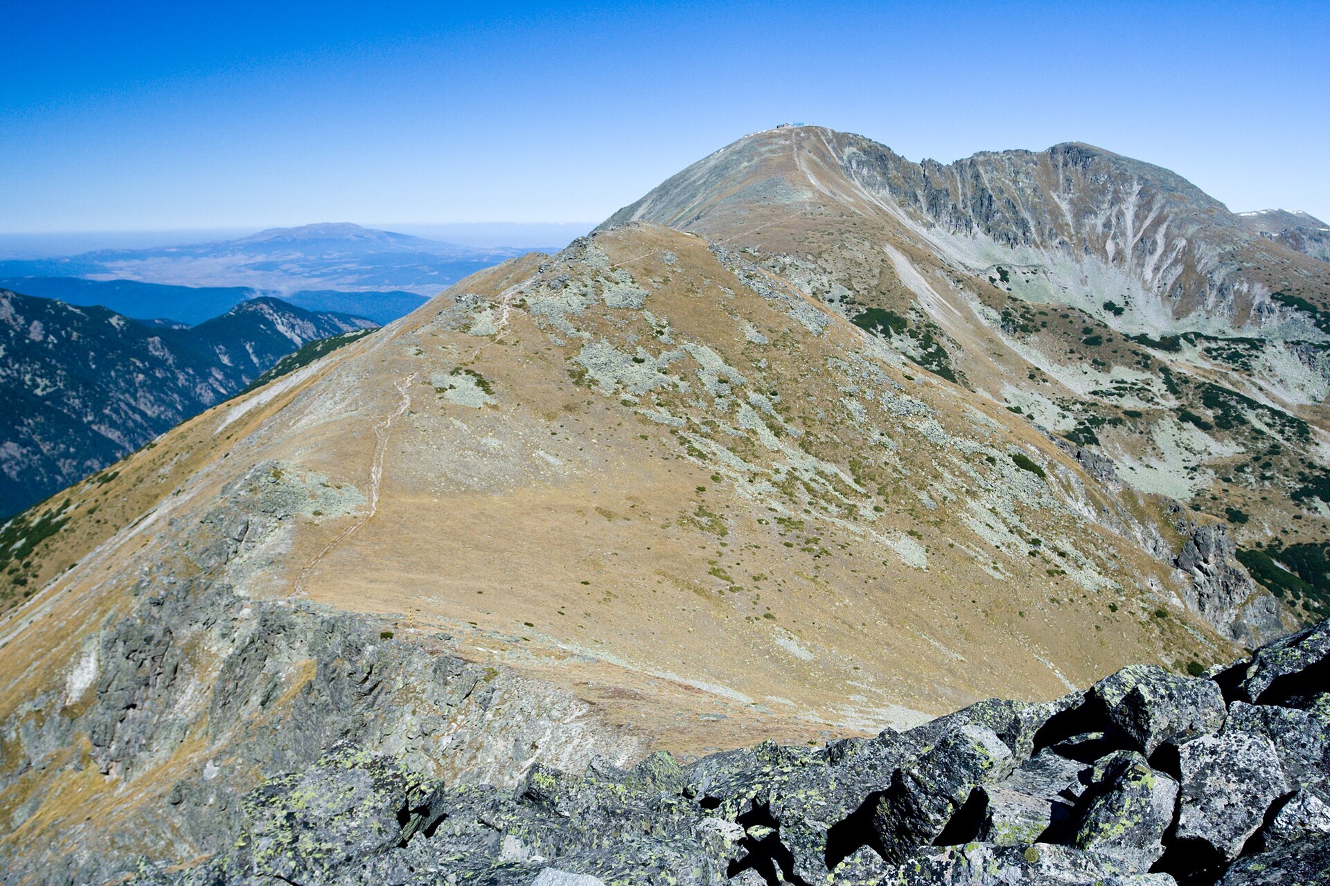
1. Musala from Yastrebetz
Snapshot
Itinerary
From the Yastrebetz gondola upper station, the route follows the high Rila track south-east towards Musala Hut and the Musala Lakes. It then climbs past the upper lakes and the Everest shelter area before the final steeper section to Musala. The return follows the same line to Yastrebetz.
Why it is essential
Musala is the highest summit in Bulgaria, Rila and the Balkan Peninsula, and the Yastrebetz approach makes it feasible as a demanding day hike without starting from the valley floor. The route also includes the Musala Lakes area, a high glacial-lake basin in Rila.
Equipment
- Sturdy boots
- Weatherproof layer
- Warm layer
- Water
- Food
- Sun protection
- Map/GPS
- Navigation backup
- Hat and gloves outside high summer
Hazards and notes
The route reaches the highest terrain in Bulgaria. Snow, ice, low cloud and thunderstorms can make the upper section serious. Gondola schedules are a key access constraint. The final summit section is more exposed to wind and weather than the approach track.
GPX / KML links
| Source | URL | Format | Notes |
|---|---|---|---|
| AllTrails: Yastrebetz – Musala | alltrails.com | Source map / route page | AllTrails terms not checked; use only as source reference unless route-file export rights are checked |
| OpenStreetMap / Waymarked Trails | Unresolved | Source map | ODbL likely applies to OSM-derived data; not checked here. Manual GPX creation still required |
Sources
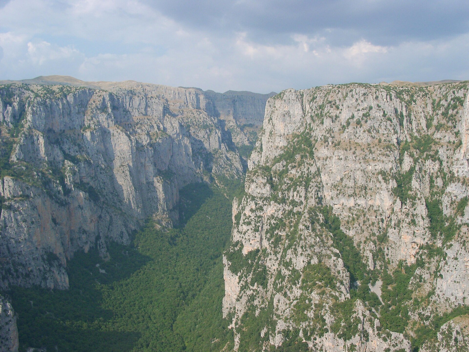
2. Seven Rila Lakes circuit
Snapshot
Itinerary
The circuit starts near the upper lift station and Rila Lakes Hut, then links the lower lakes with the higher cirque. The route passes Fish Lake, Trefoil, The Twin, The Kidney and The Eye, with the usual high viewpoint above the basin reached near the upper part of the circuit. The route returns by descending through the lake basin to the hut area.
Why it is essential
The Seven Rila Lakes are Bulgaria’s most visited group of glacial lakes, set between about 2,100 m and 2,500 m in north-west Rila. The hike is the region’s classic lake-cirque walk and gives a compact introduction to Rila’s granite high-mountain landscape.
Equipment
- Sturdy boots
- Weatherproof layer
- Warm layer
- Water
- Food
- Sun protection
- Map/GPS
- Navigation backup
- Trekking poles useful on eroded or loose descents
Hazards and notes
The area is very popular in summer. Weather can deteriorate quickly; outside summer, the lakes freeze and snow can persist until June. Stay on marked paths to reduce erosion around the lake basins.
GPX / KML links
| Source | URL | Format | Notes |
|---|---|---|---|
| AllTrails: Seven Rila Lakes | alltrails.com | Source map / route page | AllTrails terms not checked; use only as source reference unless route-file export rights are checked |
| E4 / Bulgarian mountain trail context | wikipedia.org | Long-distance trail source context | Not a GPX source for this exact day loop; manual GPX creation required |
Sources
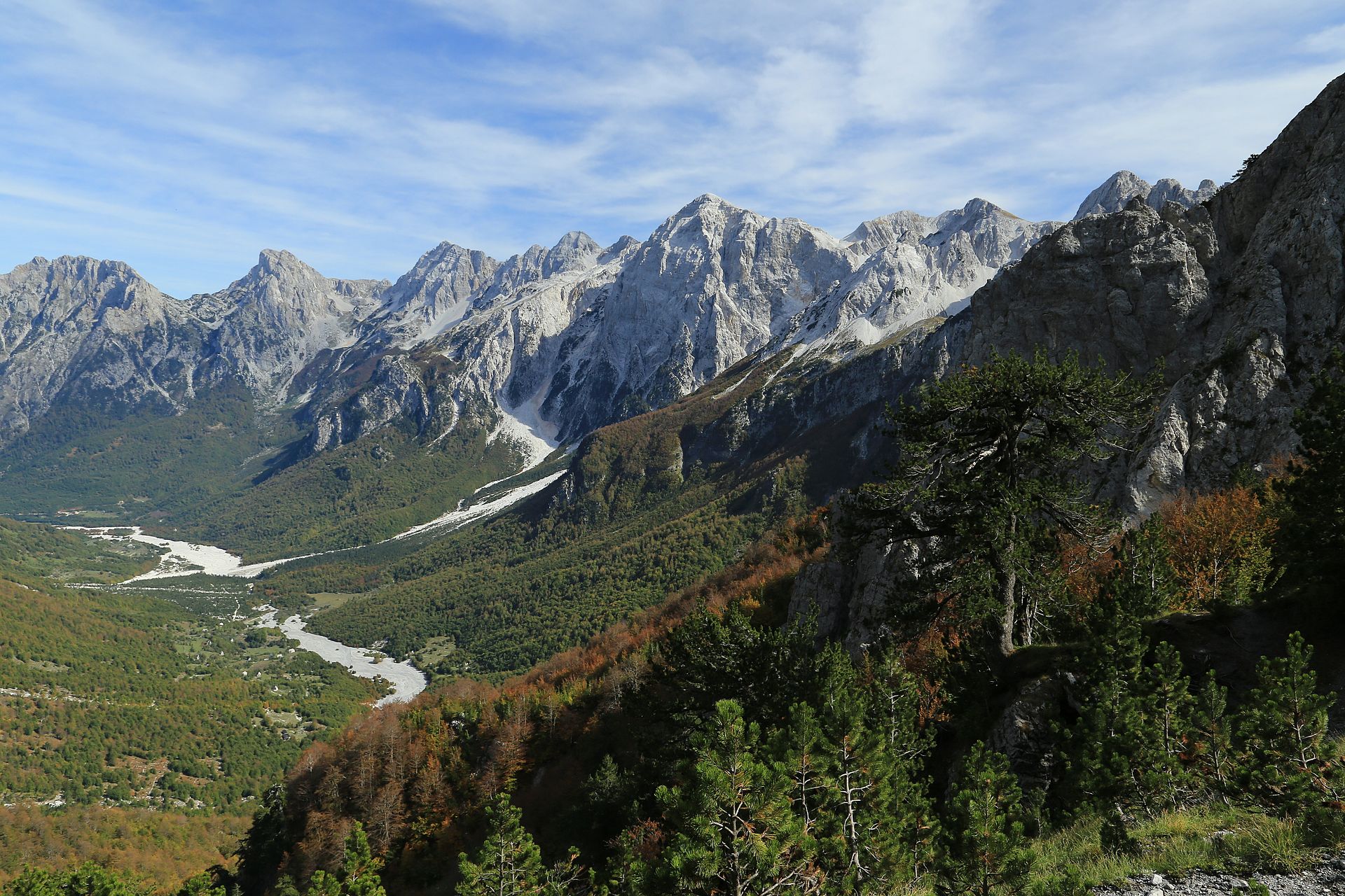
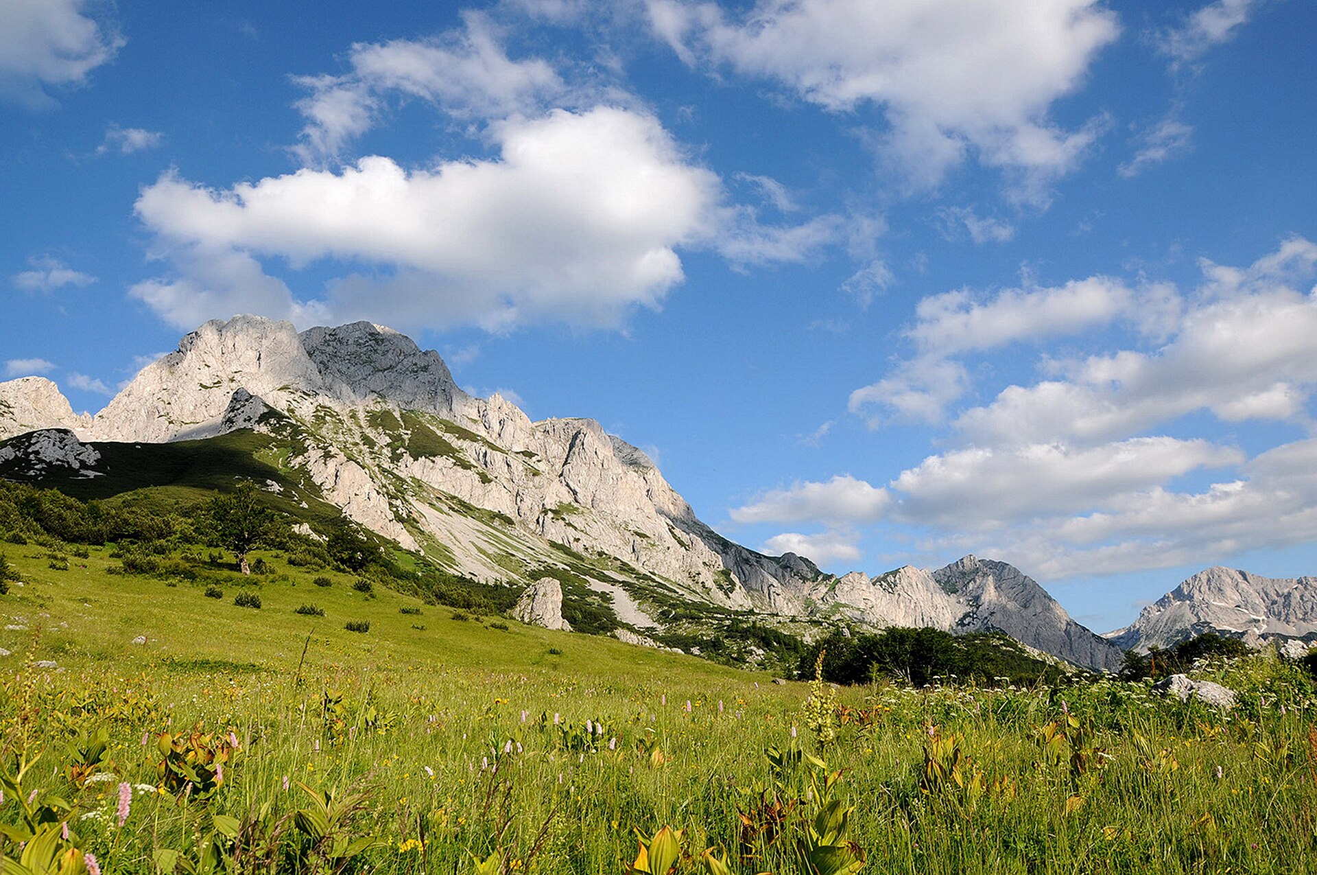
3. Vihren Peak from Vihren Hut
Snapshot
Itinerary
The route starts at Vihren Hut and climbs into Pirin’s open marble terrain. The standard circuit reaches the summit of Vihren and returns by a different line to the hut, avoiding the longer Koncheto ridge traverse. The climb is steep and rocky, with some hands-on movement near the upper mountain in normal summer conditions.
Why it is essential
Vihren is the highest peak in the Pirin Mountains and the second-highest summit in Bulgaria. The route gives the most direct day-hike experience of Pirin’s high marble landscape without committing to the more exposed Koncheto ridge.
Equipment
- Sturdy boots
- Trekking poles recommended
- Weatherproof layer
- Warm layer
- Sun protection
- Water
- Food
- Map/GPS
- Navigation backup
- Microspikes if snow remains
Hazards and notes
The route is steep, rocky and weather-sensitive. Early-season snow can make the upper section significantly more serious. The longer Vihren–Kutelo–Koncheto variant is not included here because it adds exposure and ridge commitment.
GPX / KML links
| Source | URL | Format | Notes |
|---|---|---|---|
| AllTrails: Vihren Peak | alltrails.com | Source map / route page | AllTrails terms not checked; use only as source reference unless route-file export rights are checked |
| E4 / Pirin main-ridge context | wikipedia.org | Long-distance trail source context | Not a GPX source for this exact loop; manual GPX creation required |
Sources
4. Wonderful Bridges to Kabata Hut
Snapshot
Itinerary
The hike begins at the Wonderful Bridges area, where secure paths cross and pass beneath the larger natural arch. From the huts, the route continues through Western Rhodope conifer forest towards Kabata Hut. The return variant retraces the same route to the natural bridges.
Why it is essential
The Wonderful Bridges are one of the Rhodopes’ most recognisable karst landmarks: two natural rock bridges in the Erkyupriya valley, with the larger arch about 96 m long and up to 45 m high. The site is also one of Bulgaria’s 100 National Tourist Sites. This hike represents the lower, wooded, karst character of the Rhodopes rather than Bulgaria’s alpine summit terrain.
Equipment
- Hiking shoes or boots
- Weatherproof layer
- Water
- Food
- Map/GPS
- Sun protection
Hazards and notes
The bridge area contains steep rock, cave-like passages and wet stone. Stay on secure paths. Nearby caves are not all developed for tourist visits.
GPX / KML links
| Source | URL | Format | Notes |
|---|---|---|---|
| AllTrails: Wonderful Bridges Hut – Kabata Hut | alltrails.com | Source map / route page | AllTrails terms not checked; use only as source reference unless route-file export rights are checked |
| Wikimedia / Wikidata geographic links | commons.wikimedia.org | Site coordinate/KML context only | Not a route file; not sufficient for GPX creation |
Sources
5. Panitsite to Rai Hut and Raysko Praskalo
Photo status: Unresolved. A Wikimedia Commons category exists for Raysko Praskalo, but no individual file licence was verified in this pass. No image is shown here pending licence verification.
Snapshot
Itinerary
The route climbs from Panitsite through the southern approaches of Central Balkan National Park towards Rai Hut. From the hut area, the cliffs of Dzhendema and Raysko Praskalo dominate the upper valley. A short onward visit towards the waterfall viewpoint or base may be added if conditions, daylight and route-finding allow. The return follows the same route to Panitsite.
Why it is essential
Raysko Praskalo is a 124.5 m plunge waterfall below Botev Peak and is described as the highest permanent waterfall in Bulgaria. It lies in Dzhendema Reserve in Central Balkan National Park, with Rai Hut at about 1,435 m below the waterfall. The hike gives a day-walkable approach to the most dramatic southern face of the Balkan Mountains without requiring the full Botev summit climb.
Equipment
- Sturdy boots
- Weatherproof layer
- Warm layer
- Water
- Food
- Map/GPS
- Navigation backup
- Headtorch for a long day
- Trekking poles recommended
Hazards and notes
The route is long and remote enough to require an early start. The upper valley lies below cliffs and steep rock walls. Snowmelt, storms, fog and wet grass can affect safety. The Dzhendema Reserve status means protected-area rules should be checked before departure. The full Botev summit continuation is not included in this day-hike entry.
GPX / KML links
| Source | URL | Format | Notes |
|---|---|---|---|
| AllTrails: Panitsite – Rai Hut | alltrails.com | Source map / route page | AllTrails terms not checked; use only as source reference unless route-file export rights are checked |
| OpenStreetMap node / site context | commons.wikimedia.org | Site geometry context | OSM data terms not checked here; not sufficient for GPX creation |
Sources
- Raysko Praskalo background
- Central Balkan National Park background
- AllTrails route source
- Commons media category
Region-level sources
| Source | Use |
|---|---|
| Wikipedia: Musala, Musala Lakes, Seven Rila Lakes, Vihren, Pirin National Park, Marvelous Bridges, Raysko Praskalo, Central Balkan National Park | Background and statistics for summits, lakes, parks and landmarks |
| AllTrails route pages | Source route geometry and statistics for each of the five hikes; reuse/export terms not checked |
| OpenStreetMap / Waymarked Trails | Source map context; ODbL data terms not checked here |
| Wikimedia Commons | Licence-compatible image candidates for hikes 1–4; hike 5 file-level licence unresolved |