Regional overview
The Northern French Prealps form a set of limestone massifs west of the high Alpine chain. The Vercors is defined by cliffs, high plateaux, forested approaches and exposed balcony paths; Chartreuse by steep wooded slopes, limestone summits and protected high reserves; the Bauges by pastoral cols, wildlife reserves and compact summits; and the Aravis by steep combes, scree slopes and sharp limestone ridges.
Summer hiking is usually best from late spring or early summer to autumn, but snow can linger on high passes, shaded gullies and north-facing combes. Several of these hikes enter protected areas where dogs may be prohibited, even on a lead, and where walkers must stay on marked routes.
Access is mixed. Some trailheads, such as Col du Coq and La Clusaz / Les Confins, have seasonal or local transport options, but car access is still common. Public transport details should be rechecked close to publication because mountain bus services and lift-linked access can change seasonally.
Selection rationale
These five hikes were selected to represent the full Northern French Prealps rather than cluster around one trailhead. The list includes the highest and most iconic Vercors summit, a historic Vercors Resistance route, a classic Chartreuse summit, a major Bauges wildlife-reserve summit, and a recognised Aravis combe-and-arch route.
Summary table
| # | Hike | Sub-region | Route type | Distance | Gain | Max elevation | Difficulty |
|---|---|---|---|---|---|---|---|
| 1 | Grand Veymont from Gresse-en-Vercors | Vercors | Partial loop / out-and-back variant | 12.0 km | +1,166 m | 2,341 m | Difficult |
| 2 | Pas de l’Aiguille and Chaumailloux | Vercors | Out-and-back | 8.3 km | +581 m | 1,632 m at Pas de l’Aiguille | Moderate–difficult |
| 3 | Dent de Crolles from Col du Coq | Chartreuse | Loop / summit circuit variant | 7.0–8.1 km | +690–698 m | 2,053–2,057 m | Difficult |
| 4 | GRP Boucle du Trélod | Bauges | Loop | 12.4 km | +1,138 m | Approximately 2,181 m | Difficult |
| 5 | Trou de la Mouche from Les Confins | Aravis | Loop | 8.7–9.7 km | +930–1,050 m | 2,439–2,467 m | Difficult |
Note on route files. Provisional external route links are provided for reference. They will be replaced with internally generated route files.
1. Grand Veymont from Gresse-en-Vercors
Snapshot
Itinerary
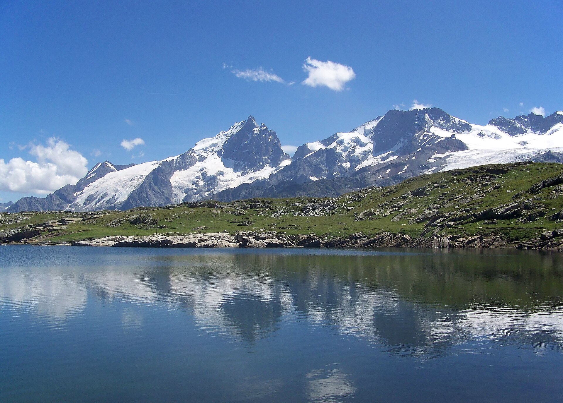
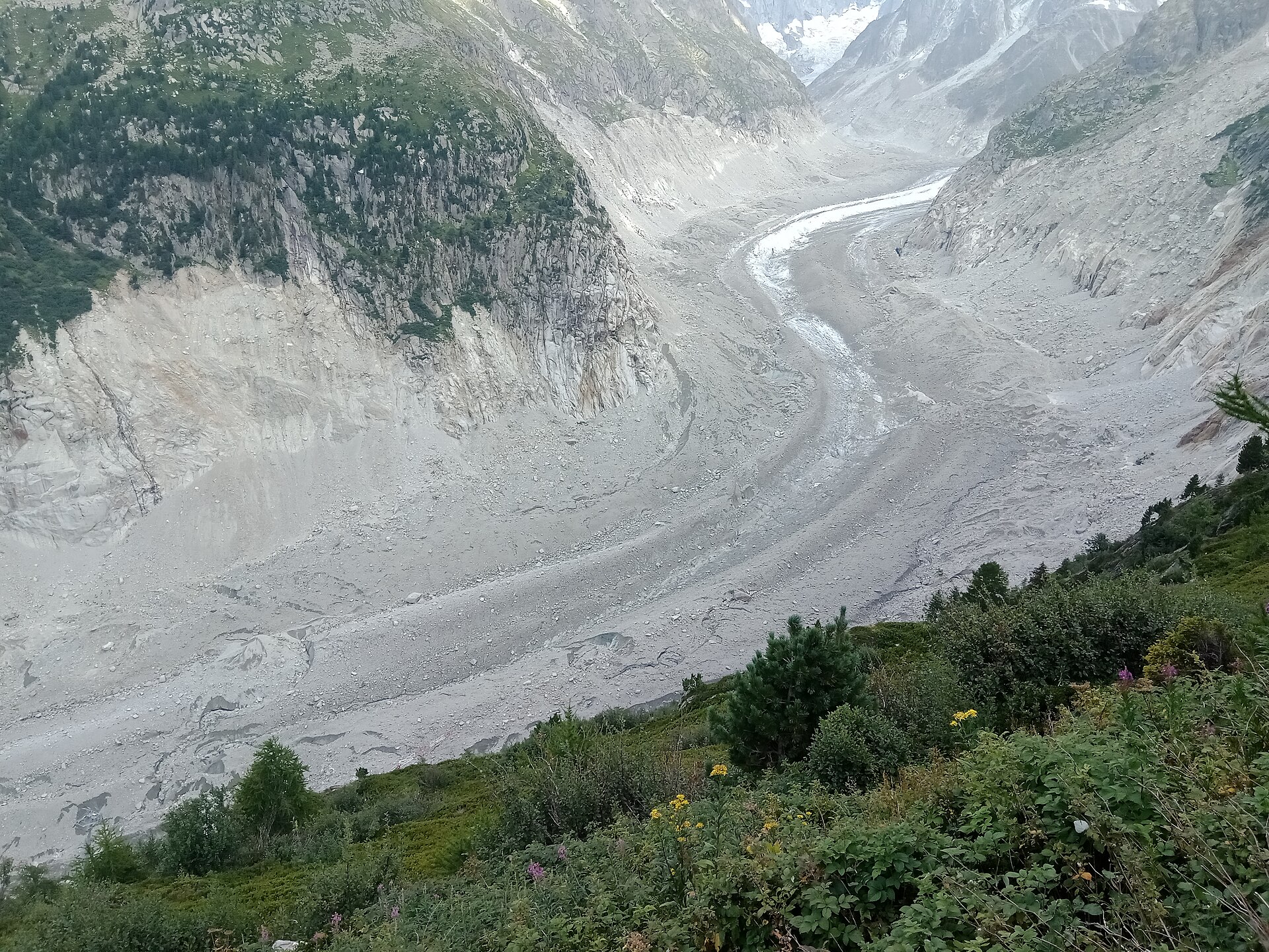
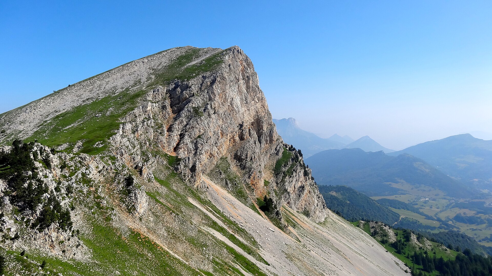
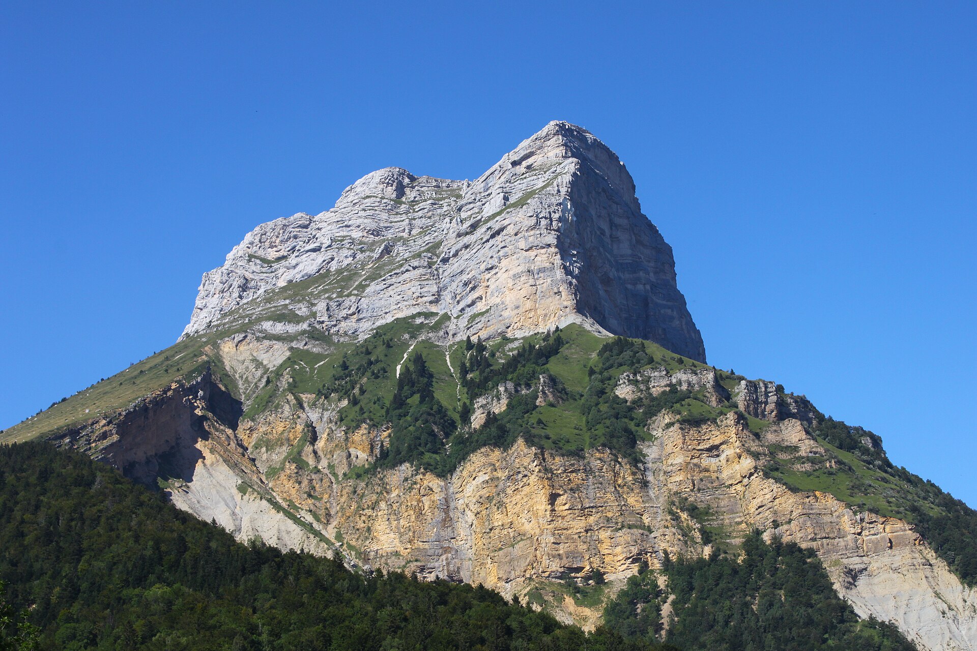
The route starts south of Gresse-en-Vercors and climbs towards the Pas de la Ville. From the pass, the line turns onto the upper limestone slopes of Grand Veymont. Grand Veymont, at 2,341 m, is the highest point of the Vercors. The Pas de la Ville approach is the most frequented and accessible route for sporty hikers, while still requiring caution above the pass. The upper section is more serious than the forest and pasture approach. The descent generally returns by the same upper route before using the lower tracks back towards Gresse-en-Vercors.
Why it is essential
Grand Veymont is the highest summit in the Vercors and gives a complete introduction to the massif: forest, pasture, limestone pass, high plateau atmosphere, ibex country and wide views towards Mont Aiguille and the high Alps.
Equipment
- Sturdy hiking boots
- Weatherproof layer
- Warm layer
- Food and water
- Sun protection
- Map/GPS
- Navigation backup
- Trekking poles recommended for the descent
- Early-season snow may require winter equipment and experience
Hazards and notes
- The upper section above Pas de la Ville is exposed and more technical than the approach.
- Use of the hands may be needed on the upper section.
- Snow, ice, cornices, wind and avalanche conditions can make the route substantially more serious in winter and spring.
- The route enters or borders the Hauts-Plateaux du Vercors reserve.
- Dogs are prohibited in the reserve, even on a lead.
- Camping, fires and picking are restricted in the reserve.
GPX / KML links
| Source | URL | Format | Notes |
|---|---|---|---|
| Visorando | visorando.com | GPX / PDF available through page controls | Direct static GPX URL not found in this pass. Replace with project-owned GPX later. |
| Plotaroute | plotaroute.com | GPX / KML / TCX / FIT / PDF available through page controls | Page states that the route can be downloaded in multiple formats. |
External links
- Trièves-Vercors — Le Grand Veymont
- Visorando — Le Grand Veymont au départ de Gresse-en-Vercors
- Plotaroute — Route 3291108
2. Pas de l’Aiguille and Chaumailloux
Snapshot
Itinerary
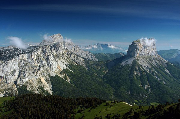
The route starts at the La Richardière parking area near the cross-country ski centre. It follows the track towards Les Fourchaux, climbs through forest, reaches the Resistance memorial and crosses, then enters open pasture and continues towards the Chaumailloux area beneath Mont Aiguille. The descent normally follows the same route. Official tourism sources describe the route as an out-and-back hike of 8.3 km with 581 m of ascent and descent, waymarked in yellow and green.
Why it is essential
Pas de l’Aiguille is both scenic and historical. It gives one of the classic approaches to the southern Vercors high plateau, with views towards Mont Aiguille, and passes a major Resistance site linked to the Second World War.
Equipment
- Hiking boots
- Weatherproof layer
- Warm layer
- Food and water
- Sun protection
- Map/GPS
- Trekking poles recommended for the gravel descent
- Early-season snow equipment if snow remains near the pass
Hazards and notes
- The route enters the Hauts-Plateaux du Vercors nature reserve.
- Dogs are prohibited in the reserve, even on a lead.
- The descent has loose gravel sections.
- Stay on marked paths and follow reserve regulations.
GPX / KML links
| Source | URL | Format | Notes |
|---|---|---|---|
| Alpes Isère / Apidae | alpes-isere.com · direct GPX | GPX | Direct GPX file. Replace with project-owned GPX later. |
| Trièves-Vercors tourism | trieves-vercors.fr · direct GPX | GPX | Same Apidae GPX exposed by the tourism page. |
| VisuGPX | visugpx.com | GPX / KML available through page controls | Direct file URL not exposed in this pass. |
| VisuGPX alternate | visugpx.com | GPX / KML available through page controls | Direct file URL not exposed in this pass. |
| Altituderando | altituderando.com | GPX available through page controls | May require account or session. |
External links
- Trièves-Vercors — Le Pas de l’Aiguille
- Alpes Isère — Le Pas de l’Aiguille
- VisuGPX — Pas de l’Aiguille
- VisuGPX — Pas de l’Aiguille alternate
- Altituderando — Pas de l’Aiguille 1632 m par Richardière
3. Dent de Crolles from Col du Coq
Snapshot
Itinerary
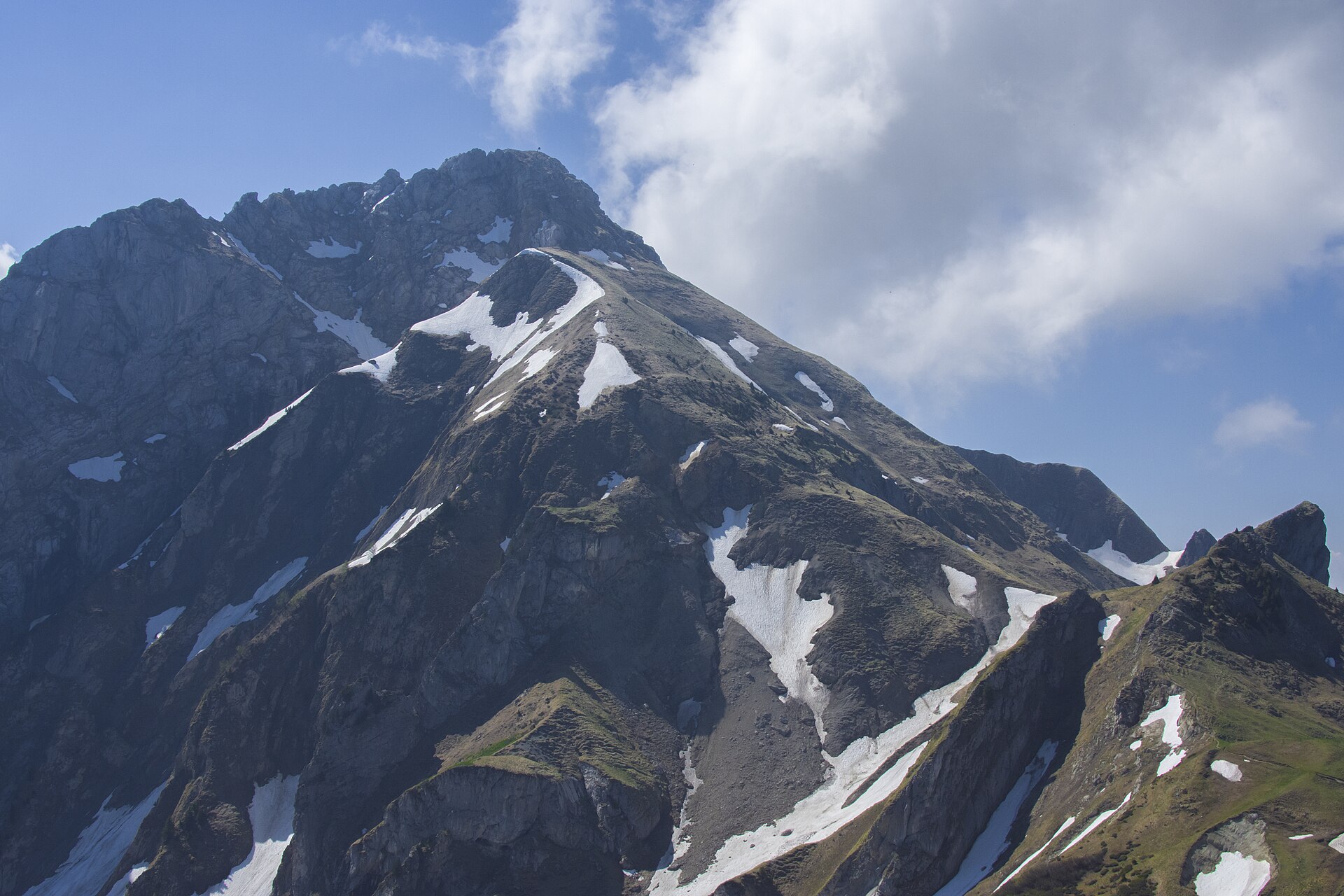
The classic route starts near Col du Coq, climbs to Col des Ayes, then reaches the upper slopes of Dent de Crolles by the Pas de l’Oeille side or by a loop variant using the Trou du Glaz and summit plateau. Route statistics vary by variant. The official tourism page lists a shorter profile with GPX/KML export, while Trace de Trail and VisuGPX describe fuller summit circuits of around 7.0–8.1 km with roughly 690–698 m of ascent.
Why it is essential
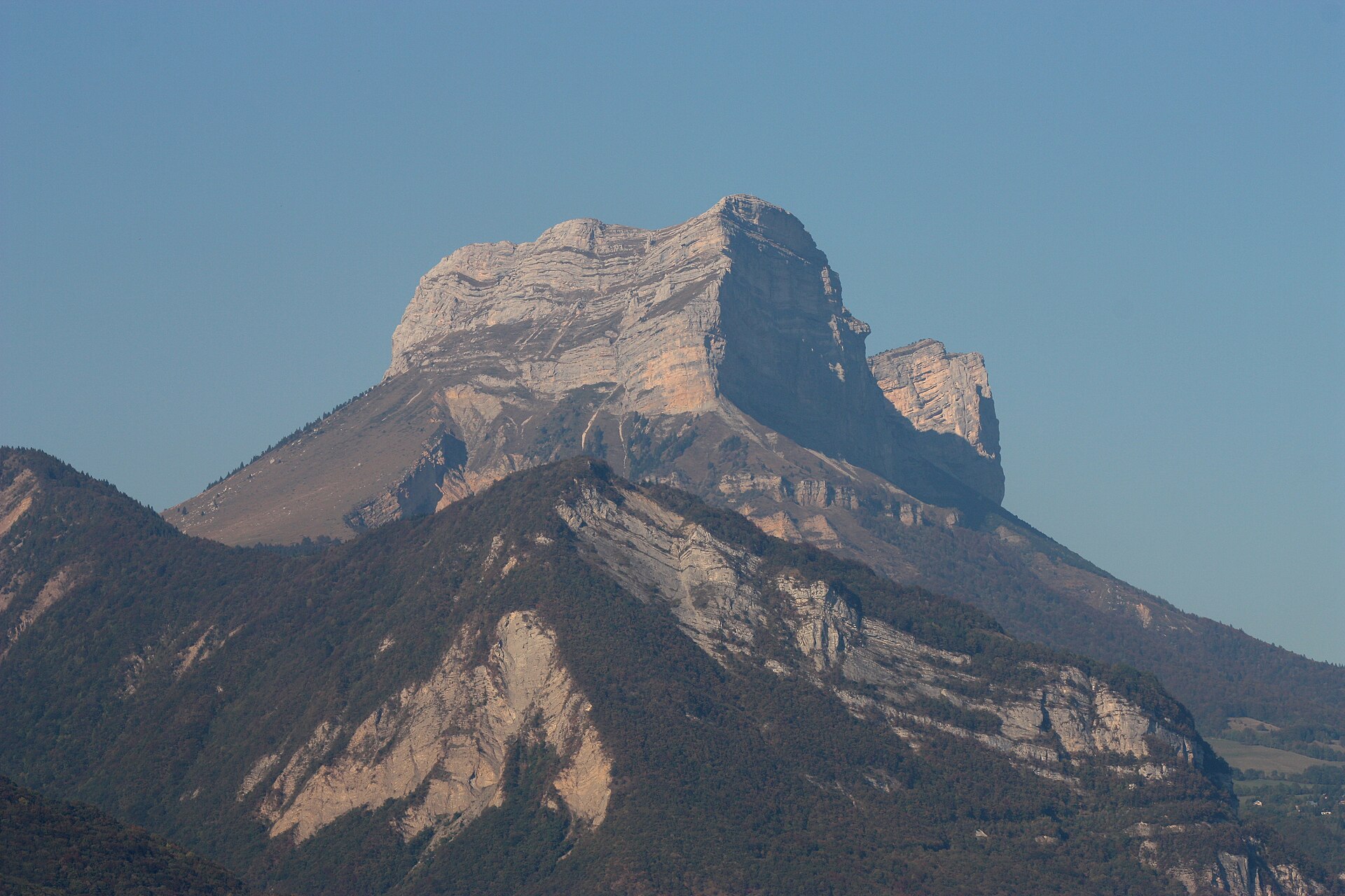
Dent de Crolles is one of the defining Chartreuse summits: close to Grenoble, prominent above the Grésivaudan valley, and representative of the massif’s limestone cliffs, caves, high pastures and protected summit plateau.
Equipment
- Sturdy boots
- Warm layer
- Waterproof layer
- Food and water
- Sun protection
- Map/GPS
- Navigation backup
- Trekking poles useful but awkward on hands-on sections
- Early-season snow or wet limestone increases seriousness
Hazards and notes
- The route includes technical passages.
- Exposed limestone terrain can be slippery when damp.
- The route enters the Hauts de Chartreuse nature reserve.
- Dogs are prohibited in the reserve, even on a lead.
- Picking is restricted.
- The official page lists seasonal opening from 1 May to 30 November subject to favourable conditions.
GPX / KML links
| Source | URL | Format | Notes |
|---|---|---|---|
| Chartreuse Tourisme / Apidae | chartreuse-tourisme.com · direct GPX | GPX | Direct GPX file. Replace with project-owned GPX later. |
| Sentier Nature | sentier-nature.com · direct GPX | GPX | Direct GPX file for Dent de Crolles from Col du Coq via Pas de l’Oeille and Trou du Glaz. |
| VisuGPX | visugpx.com | GPX / KML available through page controls | Direct file URL not exposed in this pass. |
| VisuGPX alternate | visugpx.com | GPX / KML available through page controls | Direct file URL not exposed in this pass. |
| VisuGPX alternate | visugpx.com | GPX / KML available through page controls | Direct file URL not exposed in this pass. |
| Altituderando | altituderando.com | GPX through page controls | Download may redirect to login. |
| Rando sans voiture | rando-sans-voiture.fr | GPX likely available through page controls | Search result indicated GPX download; direct file URL not exposed in this pass. |
| Randos.info | randos.info | GPX likely available through page controls | Search result indicated GPX link. |
| La Côte en Rando | la-cote-en-rando.fr | GPX likely available through page controls | Search result indicated GPX file. |
| Wikiloc | fr.wikiloc.com | GPX through Wikiloc account flow | Usually requires logged-in download. |
External links
- Chartreuse Tourisme — Dent de Crolles
- Sentier Nature — Dent de Crolles / Oeille / Glas
- VisuGPX — Dent de Crolles
- VisuGPX — Dent de Crolles alternate
- VisuGPX — Dent de Crolles alternate
- Altituderando — Dent de Crolles 2062 m par le Col du Coq et le Pas de l’OEille
- Rando sans voiture
- Randos.info — Dent de Crolles Chartreuse
- La Côte en Rando — Dent de Crolles
- Wikiloc — Dent de Crolles depuis Col de Coq, Chartreuse
4. GRP Boucle du Trélod
Snapshot
Itinerary
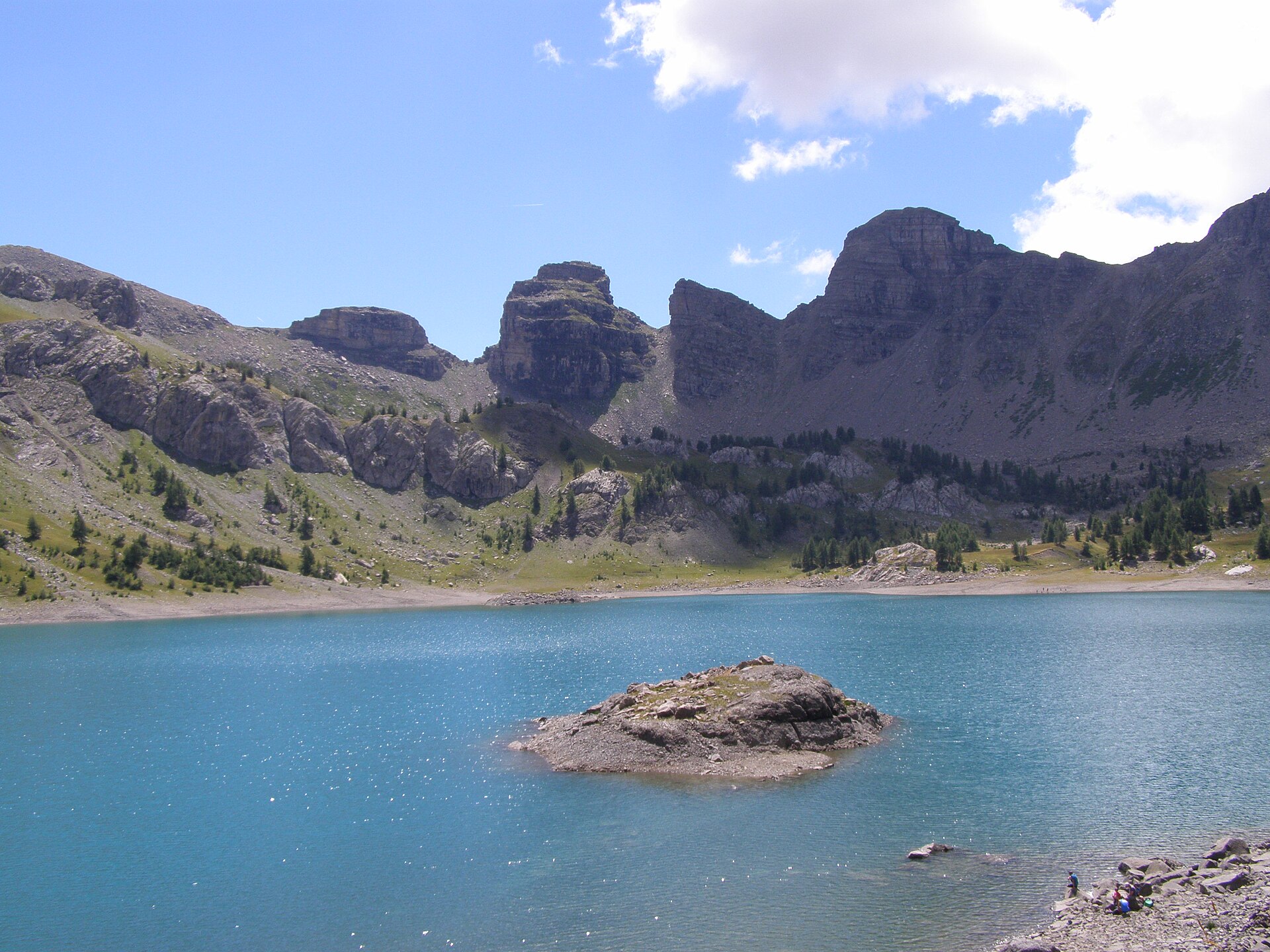
The official Rando’Bauges route starts from Parking des Cornes at Doucy-en-Bauges and follows the GRP Boucle du Trélod. It climbs through the pastoral and limestone terrain of the Hautes-Bauges towards Mont Trélod, one of the major Bauges summits above 2,000 m, before looping back to the start. The summit area gives wide views over the Bauges, Bornes, Aravis, Mont Blanc, Vanoise and Belledonne ranges.
Why it is essential
Mont Trélod is one of the emblematic Bauges summits and gives a strong sample of the massif’s character: limestone ridges, alpine pasture, wildlife management zones and broad views over the Northern French Alps.
Equipment
- Sturdy boots
- Weatherproof layer
- Warm layer
- Food and water
- Sun protection
- Map/GPS
- Navigation backup
- Trekking poles recommended
- Snow or ice outside the summer season can make the route more serious
Hazards and notes
- The route enters the Réserve Nationale de Chasse et de Faune Sauvage des Bauges.
- Dogs are prohibited.
- Bivouac is prohibited in the reserve.
- Walkers should remain on marked routes.
- Black grouse winter sensitivity is flagged from December to April.
- Avoid disturbing wildlife and remain on main itineraries in sensitive periods.
GPX / KML links
| Source | URL | Format | Notes |
|---|---|---|---|
| Rando’Bauges / Geotrek | rando.parcdesbauges.com · direct GPX | GPX | Direct GPX file from official Geotrek instance. Replace with project-owned GPX later. |
| Rando’Bauges / Geotrek | rando.parcdesbauges.com · direct KML | KML | Direct KML file from official Geotrek instance. Replace with project-owned KML later. |
| VisuGPX | visugpx.com | GPX / KML available through page controls | Direct file URL not exposed in this pass. |
| Komoot | komoot.com | GPX through account/app flow | Komoot route page; GPX normally requires login or app access. |
| Trails Viewer | trails-viewer.com | Likely downloadable trace | Direct GPX/KML URL not exposed in this pass. |
External links
- Rando’Bauges — GRP Boucle du Trélod
- VisuGPX — Boucle du Trélod
- Komoot — Boucle du Trélod
- Trails Viewer — Mont Trélod en boucle, Bauges
5. Trou de la Mouche from Les Confins
Snapshot
Itinerary
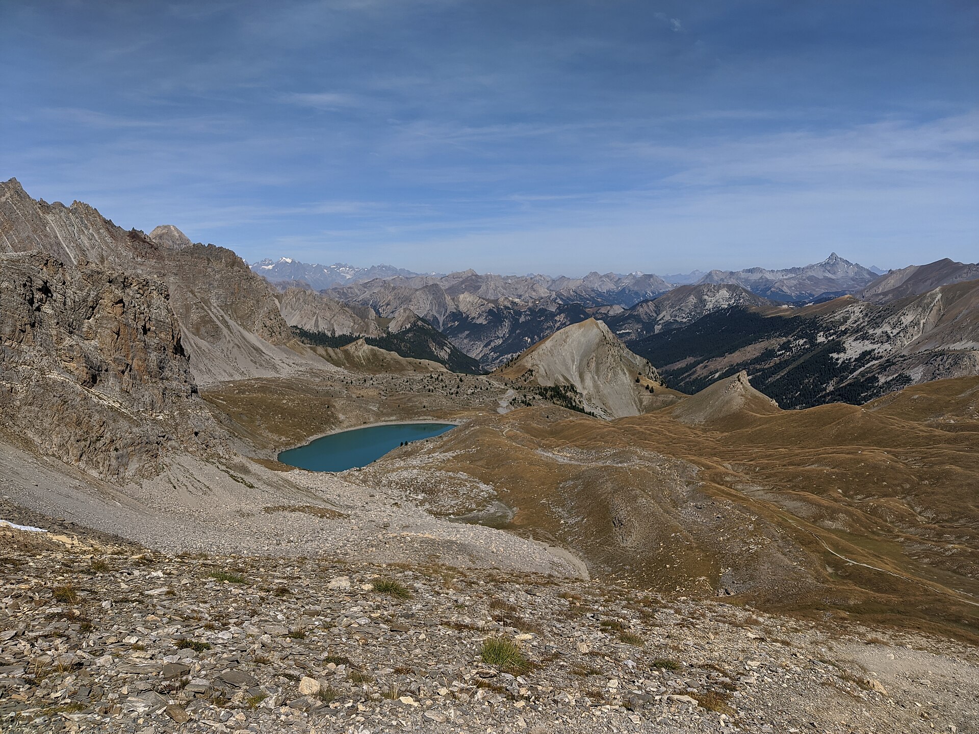
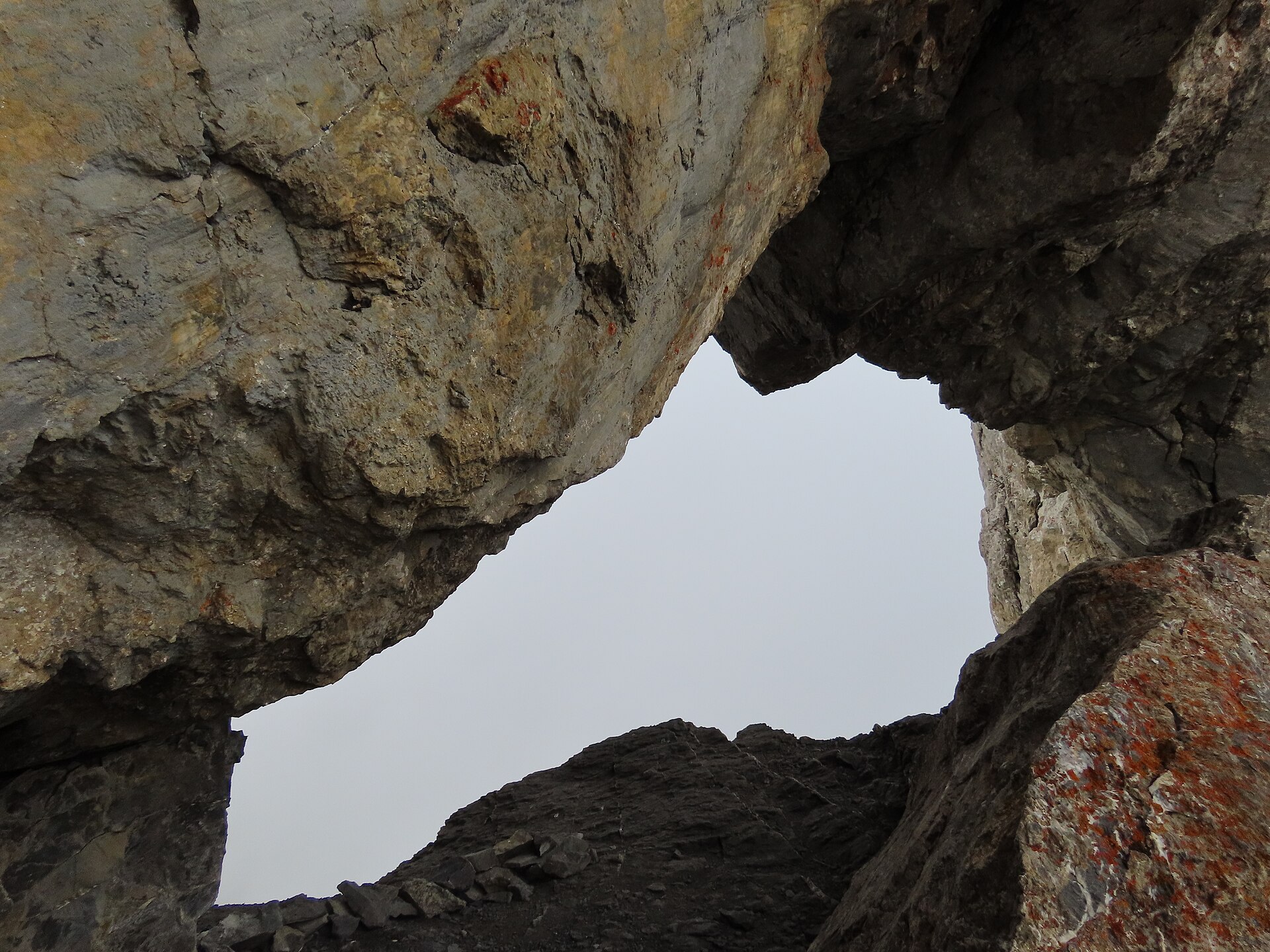
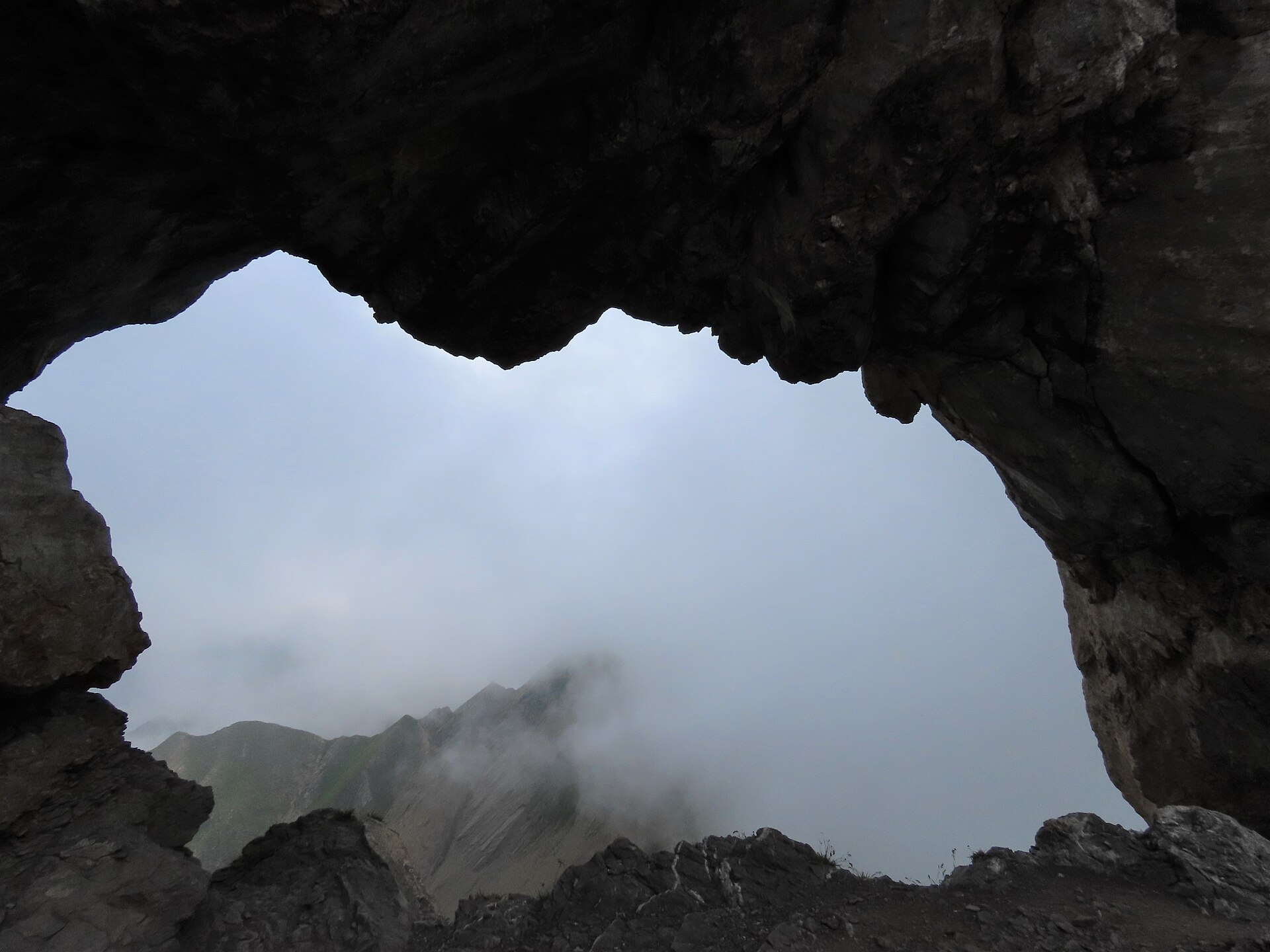
The route starts from Les Confins and enters the Aravis combes. One common circuit climbs by the Combe du Grand Crêt, reaches the Trou de la Mouche natural arch, then descends by the Combe de Paccaly. Route statistics vary between sources. Visorando gives 8.73 km, 5h25, +1,018 m and -1,014 m, while Komoot gives 9.72 km and 930 m of ascent, and Altituderando gives a 5h classic Aravis-combes route with around +1,050 m. The variation reflects route direction, trailhead handling and recorded GPS differences.
Why it is essential
Trou de la Mouche is one of the classic Aravis day hikes: steep limestone combes, high pasture, scree, a natural arch on the crest, and wide views across the surrounding pre-Alpine and Mont Blanc landscapes.
Equipment
- Sturdy boots
- Warm layer
- Waterproof layer
- Food and water
- Sun protection
- Map/GPS
- Navigation backup
- Trekking poles useful on scree
- Microspikes may be required if snow remains
Hazards and notes
- The route is steep.
- Unstable ground and scree occur near the upper combes and initial descent.
- The route is not fully waymarked despite appearing on IGN mapping.
- Map and compass or GPS navigation are recommended.
- Avoid the route in very early summer if snow remains in the combes.
GPX / KML links
| Source | URL | Format | Notes |
|---|---|---|---|
| Sentier Nature | sentier-nature.com · direct GPX | GPX | Direct GPX file. Replace with project-owned GPX later. |
| VisuGPX | visugpx.com | GPX / KML available through page controls | Direct file URL not exposed in this pass. |
| VisuGPX alternate | visugpx.com | GPX / KML available through page controls | Direct file URL not exposed in this pass. |
| Visorando | visorando.com | GPX / PDF available through page controls | Direct file URL not exposed in this pass. |
| Wikiloc | fr.wikiloc.com | GPX through Wikiloc account flow | Usually requires logged-in download. |
| Altituderando | altituderando.com | GPX likely available through page controls | Direct file URL not exposed in this pass. |
| Refuges.info | refuges.info | Route/access page | GPX not confirmed. |
External links
- Sentier Nature — Trou de la Mouche / Paccaly / Grand Crêt
- VisuGPX — Trou de la Mouche
- VisuGPX — Trou de la Mouche alternate
- Visorando — Le Trou de la Mouche en boucle
- Wikiloc — Trou de la Mouche
- Altituderando — Trou de la Mouche 2453 m
- Refuges.info — Trou de la Mouche
External links
| Source | URL |
|---|---|
| Trièves-Vercors — Le Grand Veymont | trieves-vercors.fr |
| Visorando — Le Grand Veymont | visorando.com |
| Plotaroute — Grand Veymont route | plotaroute.com |
| Trièves-Vercors — Le Pas de l’Aiguille | trieves-vercors.fr |
| Alpes Isère — Le Pas de l’Aiguille | alpes-isere.com |
| Chartreuse Tourisme — Dent de Crolles | chartreuse-tourisme.com |
| Sentier Nature — Dent de Crolles | sentier-nature.com |
| Rando’Bauges — GRP Boucle du Trélod | rando.parcdesbauges.com |
| Sentier Nature — Trou de la Mouche | sentier-nature.com |
| Visorando — Trou de la Mouche en boucle | visorando.com |