Regional overview
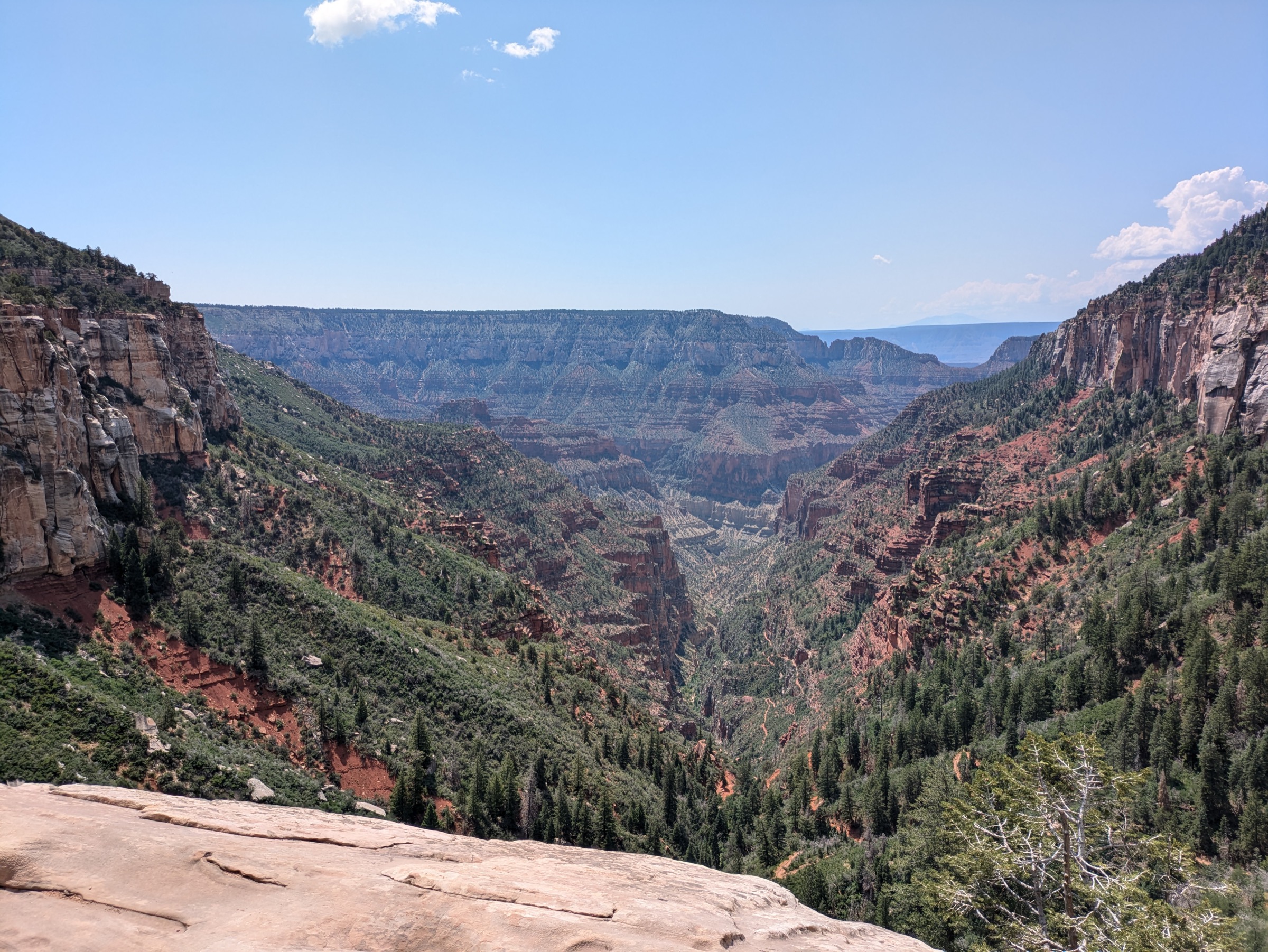
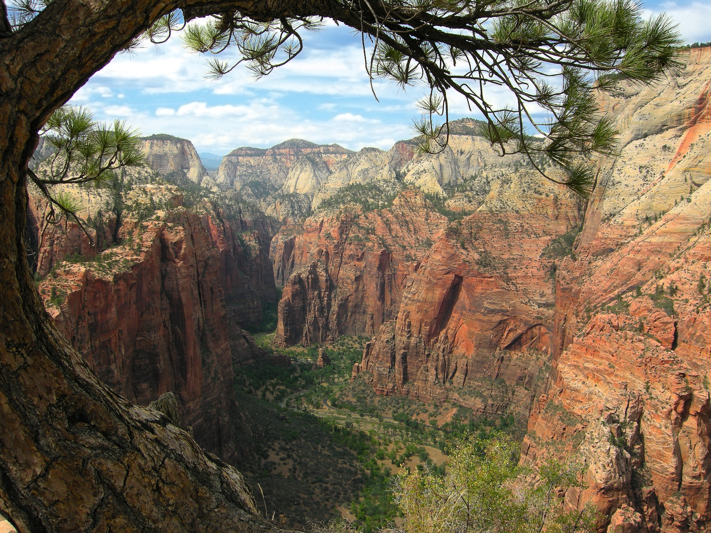
Zion / Kolob Canyons day hiking is canyon hiking. Navajo Sandstone walls, exposed constructed trails, in-river routes, mesa viewpoints, shuttle-dependent Zion Canyon access and quieter Kolob Canyons wilderness approaches all sit within a small footprint on the south-western edge of the Colorado Plateau. The park is open year-round, but individual trails are heavily conditioned by river flow, monsoon storms, rockfall closures and the seasonal shuttle system.
NPS current conditions confirm that the Zion Canyon shuttle operates from early spring to late fall, that The Narrows closes when the Virgin River is above 150 cfs or during Flash Flood Warnings, and that the long-standing East Rim / Weeping Rock route to Observation Point remains closed following the 2019 rockfall. Angels Landing requires a permit at all hours beyond Scout Lookout. Kolob Canyons is a separate car-access district about an hour from Zion Canyon.
See also: Zion and Kolob Canyons day-hikes · Grand Canyon and Kaibab Plateau, Arizona.
Selection rationale
The five hikes below cover Zion’s characteristic experiences: the exposed sandstone-fin ridge on Angels Landing, the in-river slot of The Narrows, the high rim view at Observation Point via the still-open East Mesa approach, the short east-side viewpoint on the Canyon Overlook Trail, and the finger-canyon walk to Double Arch Alcove on Taylor Creek in the Kolob district.
Summary table
| # | Hike | Country | Route type | Distance | Gain | Max elevation | Difficulty |
|---|---|---|---|---|---|---|---|
| 1 | Angels Landing via West Rim Trail | USA | Out-and-back | 7.7 km | 532 m | ~1,765 m | Strenuous, exposed |
| 2 | The Narrows bottom-up to Big Spring | USA | Out-and-back river hike | 15.0 km | 266 m | Not verified | Strenuous |
| 3 | Observation Point via East Mesa Trail | USA | Out-and-back | 11.3 km | 215 m | ~1,981 m | Moderate |
| 4 | Canyon Overlook Trail | USA | Out-and-back | 1.6 km | 47 m | Not verified | Moderate |
| 5 | Taylor Creek Trail to Double Arch Alcove | USA | Out-and-back | 8.6 km | 243 m | Not verified | Moderate |
1. Angels Landing via West Rim Trail
Snapshot

Itinerary
From The Grotto, cross the Virgin River and climb the West Rim Trail through Refrigerator Canyon and Walter’s Wiggles to Scout Lookout. Continue on the permit-only chain section along the narrow sandstone spine to Angels Landing and return the same way.
Why it is essential
Angels Landing is Zion’s defining exposed summit-view hike — a combination of built CCC/NPS trail engineering, canyon-wall exposure and one of the most famous viewpoints over Zion Canyon.
Equipment
- Grippy footwear
- Water; sun protection
- Layers; headlamp
- Angels Landing permit beyond Scout Lookout
Hazards and notes
- Severe drop-offs and a narrow two-way chain section.
- Crowding on the spine; slick rock when wet or icy.
- No water at Scout Lookout.
GPX / route file
| Source | URL | Format | Notes |
|---|---|---|---|
| NPS — Hike Angels Landing | nps.gov | Official route page | Official route stats and permit rules |
| NPS — Hike to Scout Lookout | nps.gov | Official route page | Approach stats to Scout Lookout |
| AllTrails — Angels Landing Trail | alltrails.com | Source map / proprietary trail database | Direct GPX not retrieved; do not reuse proprietary geometry directly |
Sources
2. The Narrows bottom-up to Big Spring
Snapshot

Itinerary
Walk the Riverside Walk from Temple of Sinawava, descend into the Virgin River and continue upstream through the narrow canyon. Turn around at Big Spring — the upstream limit of the day-hike zone that does not require a wilderness permit.
Why it is essential
The Narrows is Zion’s signature river-canyon hike — a slot canyon where the river itself is the route through the sandstone.
Equipment
- Closed-toe canyon shoes or sturdy footwear that can get wet
- Hiking staff or pole
- Dry bag; warm layers
- Food; carried water or water treatment
- Headlamp
Hazards and notes
- Flash floods; check the NPS current conditions and river flow before every start.
- Cold water and hypothermia risk even in summer; slippery unstable rocks.
- Water depth from ankle to chest; occasional swimming possible.
- Cyanobacteria advisory — do not drink untreated river water and avoid submerging your head.
GPX / route file
| Source | URL | Format | Notes |
|---|---|---|---|
| NPS — Hike The Narrows | nps.gov | Official route page | Route rules and permit boundary |
| NPS — Zion current conditions | nps.gov | Official closure and flow status | Check before every departure |
| AllTrails — Zion Narrows to Big Spring | alltrails.com | Source map / proprietary trail database | Direct GPX not retrieved; do not reuse proprietary geometry directly |
Sources
3. Observation Point via East Mesa Trail
Snapshot

Itinerary
Follow the East Mesa approach through forest and mesa terrain to Observation Point, a high overlook above Zion Canyon. This is distinct from the closed East Rim approach from Weeping Rock.
Why it is essential
Observation Point is the classic high viewpoint over Zion Canyon and Angels Landing, and the East Mesa approach is the practical day-hike access while the Weeping Rock route remains closed.
Equipment
- Sturdy footwear
- Water; sun protection
- Layers; offline map
- 4WD or a private shuttle may be needed to reach the trailhead
Hazards and notes
- Viewpoint edge exposure; rocky tread; limited cell service.
- Access-road issues after storms.
- AllTrails notes parking outside boundaries is illegal.
GPX / route file
| Source | URL | Format | Notes |
|---|---|---|---|
| NPS — Zion current conditions | nps.gov | Official closure page | Confirms Weeping Rock East Rim closure |
| AllTrails — East Mesa Trail to Observation Point | alltrails.com | Source map / proprietary trail database | Direct GPX not retrieved; do not reuse proprietary geometry directly |
Sources
4. Canyon Overlook Trail
Snapshot

Itinerary
Climb sandstone steps and a rocky constructed trail above Pine Creek Canyon, past ledges and alcoves, to a fenced viewpoint over lower Zion Canyon and the Towers of the Virgin.
Why it is essential
A short, high-value east-side Zion hike with historic trail engineering and one of the easiest major canyon overlooks.
Equipment
- Footwear with traction
- Water; sun protection
Hazards and notes
- Long drop-offs, mostly fenced; rocky uneven tread.
- Minimum tread width 12 in / 30.5 cm in the NPS accessibility assessment.
- Parking is extremely limited — arrive early or use overflow lots.
GPX / route file
| Source | URL | Format | Notes |
|---|---|---|---|
| NPS — Hike Canyon Overlook | nps.gov | Official route page | Official route stats |
| AllTrails — Canyon Overlook Trail | alltrails.com | Source map / proprietary trail database | Direct GPX not retrieved; do not reuse proprietary geometry directly |
Sources
5. Taylor Creek Trail to Double Arch Alcove
Snapshot

Itinerary
Follow the Middle Fork of Taylor Creek into a narrowing Kolob canyon, past the Kanarraville Fold and two early-1930s homestead cabins, to Double Arch Alcove.
Why it is essential
The best compact Kolob Canyons day hike — sandstone canyon scenery, creek crossings, geology and cultural history in a single route.
Equipment
- Shoes suitable for creek crossings
- Water — fill at the Kolob Canyons Visitor Center
- Sun protection; layers
- Waste pack-out supplies if needed
Hazards and notes
- Seasonal water crossings; icy winter tread.
- Wilderness group limit of 12 people sharing the same affiliation; no pets.
- Kolob Canyons Road can close briefly during winter storms.
GPX / route file
| Source | URL | Format | Notes |
|---|---|---|---|
| NPS — Taylor Creek Trail | nps.gov | Official route page | Official route stats and wilderness rules |
| OpenStreetMap search | openstreetmap.org | Source map | Reusable only under ODbL terms with attribution/share-alike |
Sources
Further reading
- NPS — Zion current conditions
- NPS — Hike Angels Landing
- NPS — Hike to Scout Lookout
- NPS — Hike The Narrows
- NPS — Hike Canyon Overlook
- NPS — Taylor Creek Trail
Missing data / follow-up work
- Direct GPX / KML downloads were not retrieved for any of the five routes.
- Maximum elevation is unresolved for The Narrows, Canyon Overlook and Taylor Creek to Double Arch Alcove.
- Observation Point via East Mesa route stats rely on secondary sources; an official NPS page for the East Mesa approach was not resolved in this pass.
- Public transport was verified only for the shuttle-accessed Zion Canyon stops.