Regional overview
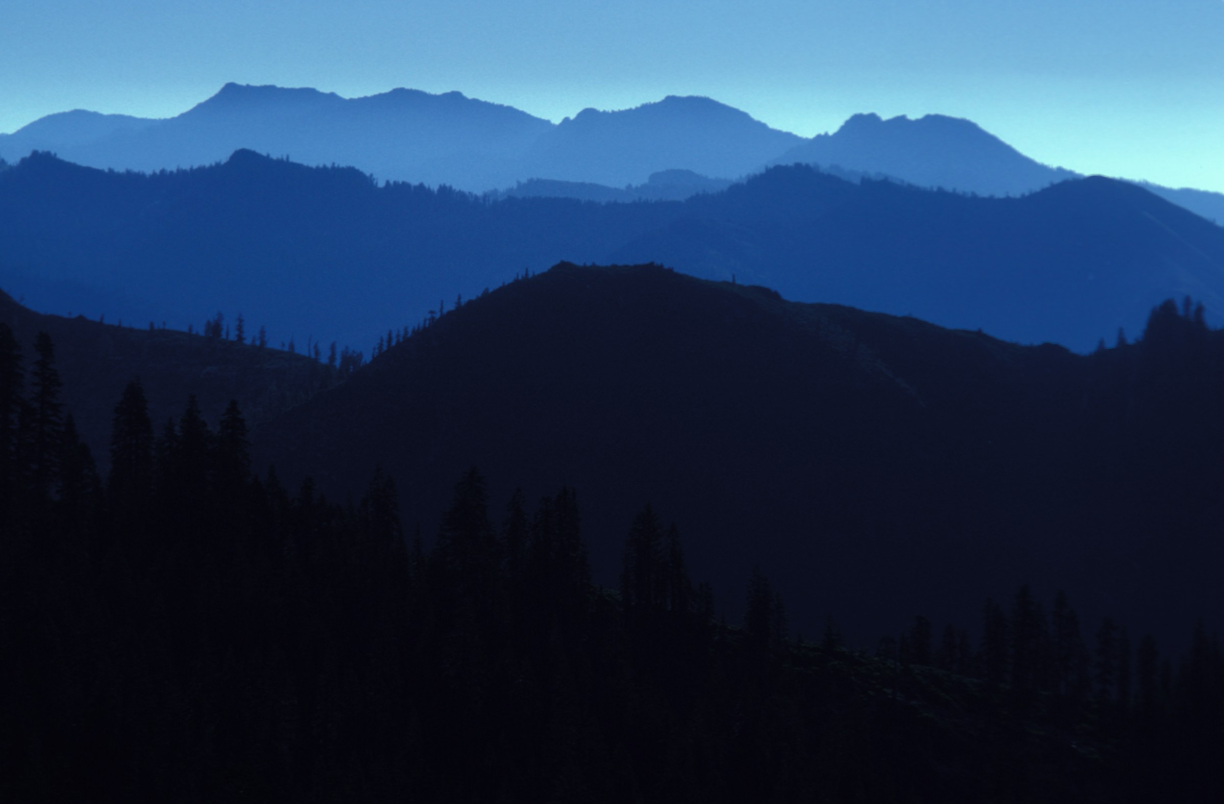
The Siskiyou Mountains form the broad, botanically rich western and central part of the Klamath–Siskiyou province, straddling southwest Oregon and far northern California. The range is older and more geologically complicated than the neighbouring volcanic Cascades, with serpentine soils, marble outcrops, old-growth forests, dry south-facing ridges and high crest country that holds snow well into spring. The Pacific Crest Trail follows much of the Siskiyou Crest, while Oregon Caves National Monument and Preserve, Cascade-Siskiyou National Monument, the Red Buttes Wilderness and adjacent national forests provide the most reliable day-hike access.
The selection below emphasises hikes that show the range’s identity rather than only its easiest outings — a high Siskiyou Crest summit, the Pilot Rock volcanic plug, the Oregon Caves high country, a Grayback Mountain scramble and the Red Buttes crest. Several trails are snow-limited, dry in late summer, or faint near summits, so the practical season is late spring through early autumn, with June to October best for the higher routes.
Access is by private vehicle from Interstate 5 at Ashland and Medford on the Oregon side, from Highway 199 through Cave Junction to the west, and from Highway 96 along the Klamath River in California. No scheduled transport reaches any of these trailheads, and several sit at the end of long gravel forest roads. Check current forest orders, monument closures and PCT conditions before travelling — recent fire seasons have reshaped access in parts of this range.
Selection rationale
The five hikes below are the essential day-hike set for the Siskiyous — geographically spread, representative of distinctive Siskiyou landscapes and documented by at least one official or durable hiking source. Grizzly Peak near Ashland is a strong easier alternative, but Mount Ashland and Pilot Rock better anchor the Siskiyou Crest. Devil’s Punchbowl in the Siskiyou Wilderness is spectacular but sits farther west in a different access pattern, and had less stable open-route documentation in this pass. Several Red Buttes and Siskiyou Wilderness destinations are better treated as backpacking or off-trail trips.
Summary
| # | Hike | Route type | Distance | Gain | Max elevation | Difficulty |
|---|---|---|---|---|---|---|
| 1 | Mount Ashland Summit Trail / Siskiyou Crest | Out-and-back or short loop | 6.3 km | 248 m | 2,296 m | Moderate to hard |
| 2 | Pilot Rock Trail | Out-and-back | 4.5 km | 260–308 m | ~1,801 m | Hard if scrambling to summit |
| 3 | Bigelow Lakes / Mount Elijah loop via Big Tree Trail | Loop | 14.8 km | 728 m | ~1,948 m | Strenuous |
| 4 | Grayback Mountain via cabin and meadow trail | Out-and-back | 10.0 km | 549 m | ~2,148 m | Hard, with summit scramble |
| 5 | Red Butte via the Pacific Crest Trail | Out-and-back | ~10.8 km | Not verified | 2,054 m | Hard |
1. Mount Ashland Summit Trail / Siskiyou Crest

Snapshot
Itinerary
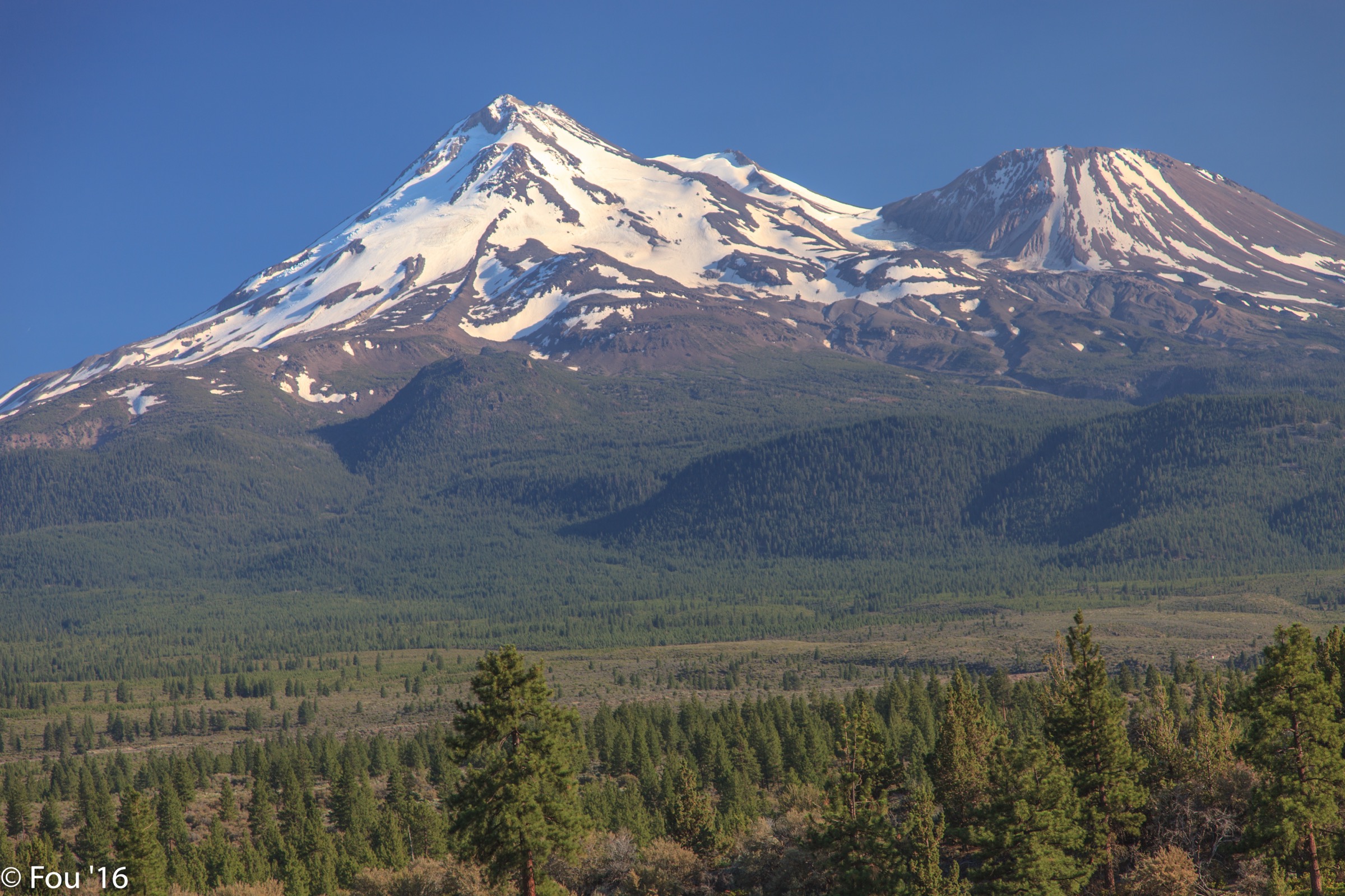
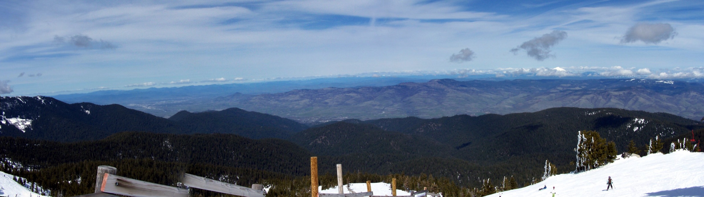
From the Mount Ashland ski area parking, the signed summit trail climbs the open alpine slope toward the summit ridge. The route is short but sustained, with loose gravel sections in places, and gives disproportionate views for its mileage: on a clear day the panorama takes in Mount Shasta, Pilot Rock, Mount McLoughlin, Pelican Butte, the Red Buttes and the Trinity Alps. A loop-style descent uses the service road across the south bowls; otherwise return by the ascent route if maintenance, visibility or conditions make the road descent unattractive.
Why it is essential
Mount Ashland is the highest Oregon summit west of the Cascade volcanic chain and one of the defining high points of the Siskiyou Crest. It is the fastest way to stand in the open crest environment that distinguishes the Siskiyous from the forested lower valleys. The hike also gives useful regional orientation — on a clear day the surrounding Klamath, Cascade and Trinity landscapes line up in a single panorama.
Equipment
- Sturdy hiking shoes with grip for loose gravel
- 1.5–2 L water and sun protection
- Wind shell and warm layer — the crest is much cooler than the valley
- Offline map for the tangle of ski-area roads, service tracks and PCT access paths
- Traction if snow or hard ice persists outside the main summer season
Hazards and notes
- Weather on the crest can be much colder and windier than Ashland or the Rogue Valley.
- Stay off ski-area infrastructure and watch for maintenance vehicles on the descent road.
- Avoid cutting fragile alpine vegetation.
- The Pacific Crest Trail is less than a mile from the ski area — extensions are possible for experienced hikers with more time.
GPX / route file
| Source | URL | Format | Notes |
|---|---|---|---|
| Mount Ashland — hiking | mtashland.com | Official description | Route description and mileage; no downloadable GPX/KML |
| Oregon Encyclopedia — Mount Ashland | oregonencyclopedia.org | Reference | Elevation and regional context |
| Pacific Crest Trail Association — maps | pcta.org | PCT context | Check PCTA data terms before extracting or redistributing |
| OpenStreetMap | openstreetmap.org | ODbL source | Usable for independent route reconstruction under ODbL |
2. Pilot Rock Trail

Snapshot
Itinerary
From the Pilot Rock Trailhead, the path climbs steadily through the Cascade-Siskiyou National Monument to the Pacific Crest Trail junction area and the base of Pilot Rock. Many hikers stop at the base, which already gives excellent views and avoids the exposed scramble above. The upper section is the crux: AllTrails and OregonHikers both flag the final approach as much more serious than the lower trail, with scrambling and exposure. Continue above the base only if the rock is dry, hands are available and there is time to reverse the route carefully.
Why it is essential
Pilot Rock is one of the most recognisable landmarks on the Siskiyou Crest. The hike is short, direct and memorable — forest approach, PCT contact, volcanic plug and long views toward Mount Ashland and Mount Shasta. It also introduces the Cascade-Siskiyou National Monument, where Klamath, Cascade and Great Basin ecological influences meet.
Equipment
- Sticky-soled hiking or approach shoes for any scramble
- Water and sun protection
- Offline map
- A helmet is reasonable for climbers or parties moving below other people on loose rock; most hikers should treat the summit scramble as optional
Hazards and notes
- The Bureau of Land Management applies a seasonal peregrine falcon closure on the south and east sides for technical climbing from 1 February to 30 July. Confirm current BLM notices before climbing or scrambling beyond the hiking route.
- Rattlesnakes, loose rock, heat and exposure are real concerns in summer.
- The lower trail is a maintained hike; the upper is exposed scrambling — treat the base as a valid turnaround.
GPX / route file
| Source | URL | Format | Notes |
|---|---|---|---|
| BLM — Cascade-Siskiyou visitor information | blm.gov | Official page | Regulatory source; no GPX/KML found |
| OregonHikers — Pilot Rock Hike | oregonhikers.org | Route description | Detailed route stats; GPX reuse not confirmed |
| AllTrails — Pilot Rock Trail | alltrails.com | Third-party track | Account required for downloads; do not redistribute without licence confirmation |
| OpenStreetMap | openstreetmap.org | ODbL source | For independent route reconstruction |
3. Bigelow Lakes / Mount Elijah loop via Big Tree Trail

Snapshot
Itinerary
The loop starts behind the Oregon Caves Visitor Center and climbs the Big Tree Trail corridor through dense forest. The National Park Service describes the larger Bigelow Lakes / Mount Elijah loop as a full-day route that uses the Big Tree Trail to reach the high country, climbing to meadows, Bigelow Lakes and Mount Elijah views before returning toward the monument. The circuit can be shortened to the Big Tree loop if weather, snow or time make the high loop unreasonable — but the full route is the essential version, connecting Oregon Caves’ marble and old-growth setting with the high Siskiyou crest-and-lake landscape.
Why it is essential
This is the most complete official day hike at Oregon Caves. It starts in lush forest, passes the largest known Douglas-fir by girth in Oregon on the Big Tree route, and climbs into open high country with views toward Mount Shasta and the surrounding wilderness. It also shows the Siskiyous’ unusual meeting of caves, marble, old growth, meadows and subalpine basins.
Equipment
- Full day-hike kit: water, food, extra layers, rain shell, sun protection, navigation
- Trekking poles for the long descent back to the monument
- Route-finding backup for the higher loop, where snow can obscure the tread outside high summer
Hazards and notes
- Oregon Caves roads are winding and remote, and services are limited.
- The loop is much more demanding than the short cave-area trails.
- Verify NPS trail conditions, cave-area closures and pet restrictions before leaving.
- Winter snow can cover the higher trails and downed trees may be present after storms.
GPX / route file
| Source | URL | Format | Notes |
|---|---|---|---|
| NPS — hiking trails at Oregon Caves | nps.gov | Official description | Distance, gain, timing and trailhead; no GPX/KML |
| NPS — Big Tree Trail | nps.gov | Official page | Approach-route details for the Big Tree segment |
| OpenStreetMap | openstreetmap.org | ODbL source | For independent route reconstruction |
4. Grayback Mountain via cabin and meadow trail

Snapshot
Itinerary
The Grayback Mountain trail climbs toward the old cabin and wildflower meadow. The shorter meadow hike is a moderate outing on its own; the essential day-hike version continues toward the mountain’s high open summit. Oregon Hiking describes the longer summit outing as a difficult 6.2-mile round trip with roughly 1,800 feet of gain, and notes that the constructed trail ends short of the top. Continue above the trail only if visibility is good and off-trail or semi-trail scrambling is acceptable. The summit area gives broad views over the Siskiyous, Oregon Caves country, the Applegate drainage and higher Klamath terrain.
Why it is essential
Grayback Mountain is one of the major high summits of the Oregon Siskiyous and a natural counterpart to Mount Ashland. Where Ashland shows a developed crest summit, Grayback shows the quieter interior range — forest, meadow, old lookout / cabin history, wildflowers and a rougher final climb.
Equipment
- Real navigation setup (not just a phone track) — the final summit approach is not a straightforward maintained trail
- Extra water: late-summer sources can be unreliable
- Long pants for brush, ticks and rougher summit terrain
- Sun protection for the exposed upper mountain
Hazards and notes
- The route depends heavily on current trail maintenance.
- Snow can linger into early summer and the upper mountain can be confusing in cloud.
- Treat the summit as optional if navigation, wildfire smoke, thunder or snow make the route uncertain.
- No route-exact open-licence photo was verified in this pass; the figure above shows the meadow section rather than the summit.
GPX / route file
| Source | URL | Format | Notes |
|---|---|---|---|
| Oregon Hiking — Grayback Mountain | oregonhiking.com | Route description | Stats and route notes; no GPX reuse confirmed |
| OpenStreetMap | openstreetmap.org | ODbL source | For independent reconstruction; final summit approach may not be a mapped maintained trail |
5. Red Butte via the Pacific Crest Trail

Snapshot
Itinerary
The PCT access at or near Cook and Green Pass follows the crest toward Red Butte, a compact introduction to the Red Buttes Wilderness — red peridotite, dry ridges, glacially carved basins and open views across the Oregon–California line. A summit spur or climber path may be required depending on the exact route chosen; treat the final approach as conditions-dependent. Carry water from the start unless seasonal sources have been confirmed. Travel Oregon notes that the area is dry in summer, and the Siskiyou Mountain Club highlights the wilderness’s sharp ridges, meadows, old growth and hazards including rattlesnakes, ticks and poison oak.
Why it is essential
Red Buttes is one of the signature wilderness high points of the Siskiyou Mountains. The hike compresses the range’s Oregon–California border character into a single day — PCT tread, red ultramafic rock, dry crest, old glacial terrain and wide Klamath–Siskiyou views. It also broadens the region beyond the easier Ashland and Oregon Caves trailheads.
Equipment
- Water beyond what the mileage suggests, especially in late summer
- Sun protection and a wind layer
- Offline maps and rocky-terrain footwear
- Expect rougher terrain than the PCT itself if attempting the summit spur
Hazards and notes
- Snow can persist well into the shoulder seasons, while summer heat and dryness can make the same route feel severe.
- Ticks, rattlesnakes, poison oak and scarce water are regional hazards.
- Elevation gain for the specific day-hike route was not verified from an official source in this pass — field-check before publishing a precise profile.
GPX / route file
| Source | URL | Format | Notes |
|---|---|---|---|
| Travel Oregon — Red Buttes Wilderness | traveloregon.com | Reference | Elevation and regional context; no route GPX |
| Siskiyou Mountain Club — Red Buttes Wilderness Area | siskiyoumountainclub.org | Reference | Access and hazard context; no GPX found |
| Pacific Crest Trail Association — maps | pcta.org | PCT context | Check PCTA data terms before extracting or redistributing |
| OpenStreetMap | openstreetmap.org | ODbL source | For independent route reconstruction |
Further reading
| Source | URL |
|---|---|
| Oregon Encyclopedia — Klamath–Siskiyou Mountains in Oregon | oregonencyclopedia.org |
| Oregon Encyclopedia — Mount Ashland | oregonencyclopedia.org |
| Mount Ashland — hiking | mtashland.com |
| BLM — Cascade-Siskiyou National Monument | blm.gov |
| BLM — Pacific Crest Trail in Oregon | blm.gov |
| OregonHikers — Pilot Rock Hike | oregonhikers.org |
| NPS — hiking trails at Oregon Caves | nps.gov |
| NPS — Big Tree Trail | nps.gov |
| Oregon Hiking — Grayback Mountain | oregonhiking.com |
| Travel Oregon — Red Buttes Wilderness | traveloregon.com |
| Siskiyou Mountain Club — Red Buttes Wilderness Area | siskiyoumountainclub.org |
| Pacific Crest Trail Association — maps | pcta.org |
| Wikimedia Commons — Category: Mount Ashland | commons.wikimedia.org |
| OpenStreetMap (ODbL 1.0) | openstreetmap.org |