Regional overview
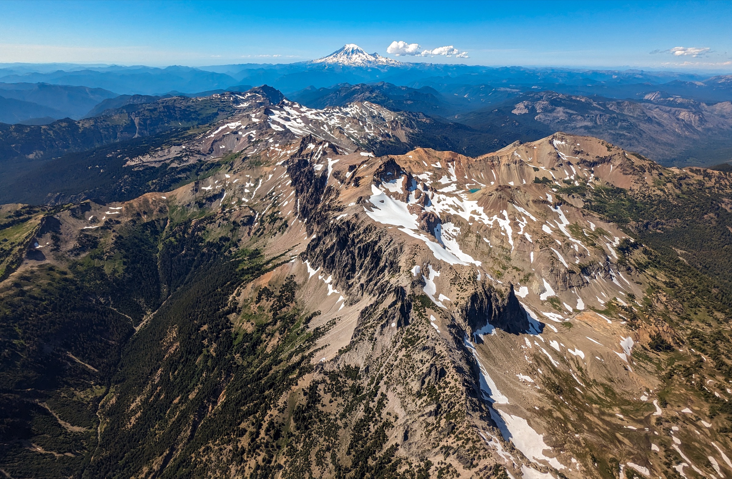
Goat Rocks Wilderness occupies the Cascade crest between Mount Rainier and Mount Adams in southern Washington — a high, fragile, heavily snow-influenced range that is not a volcano so much as the ribs of one, an eroded stratovolcano whose glacial cirques and pumice ridges now carry some of the finest alpine walking in the Pacific Northwest. The wilderness spans the Gifford Pinchot National Forest on the west and the Okanogan-Wenatchee National Forest on the east, with Old Snowy Mountain (2,417 m) as its most walked summit, Gilbert Peak (2,500 m) as its high point, and the Pacific Crest Trail threading the crest between them.
The essential day-hike character here is alpine rather than purely forested: pumice ridges, high meadows, lake basins, remnants of glaciers, and a celebrated PCT crest section. Several classic destinations that are ordinarily backpacking objectives make sense as long, strenuous day-hikes for very fit parties in stable summer conditions. Because the season is short and the terrain is fragile, the Manti-La Sal-equivalent rules on the Gifford Pinchot side include no campfires wilderness-wide during summer restrictions, no camping within 100 ft of the PCT or lakes, no camping or fires in Snowgrass Flats or the Shoe Lake basin, and closure of the Yakama Reservation to the general public except for the PCT corridor. Wilderness permits are required and are free / self-issued at trailheads; some trailheads also require a Northwest Forest Pass or day-use fee.
Snow is the planning constraint. USFS describes Goat Rocks as a July–October hiking area, with high-country snow typically lasting into late July or early August. Check snow, road, and fire conditions close to travel. One current advisory to verify by phone before travel: the USFS Trail #96 (Snowgrass) page carried an unresolved access warning during compilation reading “No hiker Access after June 9th until further notice.” Every other source — trailhead pages, forest alerts, current-year trip reports — contradicts it, but the anomaly has not been formally resolved. Ring the Cowlitz Valley Ranger District (360-497-1100) before relying on that trailhead.
See also: Stevens Pass · Snoqualmie Pass.
Selection rationale
The five walks below cover the range from valley to crest and across both flanks. Snowgrass Flat is the main west-side gateway to the alpine Goat Rocks and the natural first walk in the range. The Snowgrass–Cispus Basin–Cispus Pass traverse toward Nannie Ridge is the finest one-day sampler of the high country for very fit hikers, taking in Snowgrass, the PCT, Cispus Basin, Cispus Pass and the Sheep Lake country. Old Snowy Mountain and Elk Pass delivers Washington’s most famous PCT alpine segment and the range’s accessible classic summit. Nannie Ridge to Sheep Lake is the best Walupt-side day: a strong climb to a broad alpine ridge with Mount Adams in view. Packwood Lake is the historic lower-elevation lake classic, pairing old-growth forest, Indigenous and early Forest Service history, and a much longer season than the crest routes.
Summary table
| # | Hike | Country | Route type | Distance | Gain | Max elevation | Difficulty |
|---|---|---|---|---|---|---|---|
| 1 | Snowgrass Flat | USA | Out-and-back | 13.2 km | 488 m | 1,768 m | Moderate-hard |
| 2 | Snowgrass – Cispus Basin – Cispus Pass / Nannie Ridge traverse | USA | Long traverse / loop | 31.5 km | 914 m | 1,951 m | Hard |
| 3 | Old Snowy Mountain and Elk Pass | USA | Out-and-back with summit spur | 27.4 km | 945 m | 2,377 m | Hard |
| 4 | Nannie Ridge to Sheep Lake | USA | Out-and-back | 15.0 km | 627 m | 1,781 m | Moderate-hard |
| 5 | Packwood Lake | USA | Out-and-back | 16.1 km | 366 m | 975 m | Moderate |
1. Snowgrass Flat
Snapshot
Itinerary
Follow Snowgrass Trail #96 from the Snowgrass / Berry Patch trailhead area, cross Goat Creek in the second mile, and climb gradually through old forest into the lower Snowgrass Flat area at the Lily Basin Trail junction near 4.1 mi. Strong parties can extend toward the PCT, Bypass Trail #97, Goat Lake, or Goat Ridge; this entry treats Snowgrass Flat itself as the core day objective.
Why it is essential
The main west-side gateway to the alpine Goat Rocks — a compact tour of old forest, wildflower meadows, PCT access, and views toward the broken volcanic crest.
Equipment
- Boots or sturdy trail shoes
- Trekking poles
- Navigation, sun and insect protection
- Layered clothing
- Water treatment
- Headlamp
- Traction if snow remains
Hazards and notes
- Lingering snow and wet meadows.
- Creek crossings; storms on the crest.
- Heavy use and campsite impacts near Snowgrass Flat and Goat Lake — camping/campfires prohibited in Snowgrass Flats.
- Verify the current USFS Trail #96 access warning before relying on this trailhead.
GPX / route file
| Source | URL | Format | Notes |
|---|---|---|---|
| WTA — Snowgrass | wta.org | Route database and map | Route geometry / reuse terms unresolved |
| USFS — Trail #96 Snowgrass | fs.usda.gov | Official trail page | Route description; no GPX |
| OpenStreetMap search | openstreetmap.org | Source map | Reusable only under ODbL terms with attribution/share-alike |
Sources
2. Snowgrass – Cispus Basin – Cispus Pass / Nannie Ridge traverse
Snapshot

Itinerary
Start on Snowgrass Trail #96, cross Goat Creek, and reach Snowgrass Flats. Use Bypass Trail #97 to join the Pacific Crest Trail. Follow the PCT east and south into Cispus Basin, passing meadows and a waterfall before climbing to Cispus Pass. WTA’s long route continues toward the Nannie Ridge / Sheep Lake junction and descends toward Walupt Lake. Return-to-car variants require shuttle planning or the rough road/trail walking that WTA flags as less straightforward.
Why it is essential
The finest one-day sampler of the Goat Rocks high country for very fit hikers: Snowgrass meadows, the PCT, Cispus Basin, Cispus Pass, Sheep Lake country, and the Walupt side of the wilderness.
Equipment
- Early start
- Navigation and headlamp
- Extra layers, rain/wind shell
- Trekking poles
- Water treatment; 3+ L capacity
- Sun protection
- Traction if snow remains
- Full-day food and emergency margin
Hazards and notes
- Long mileage, remote terrain, limited bailouts.
- Lingering snow may obscure junctions and make slopes hazardous.
- Creek crossings and fragile meadows — stay on tread.
- Yakama Reservation boundary borders the PCT corridor; stay on the trail.
- Trail #96 access warning unresolved — verify by phone.
GPX / route file
| Source | URL | Format | Notes |
|---|---|---|---|
| WTA — Cispus Basin / Cispus Pass | wta.org | Route database and map | Route geometry / reuse terms unresolved |
| USFS — Trail #96 Snowgrass | fs.usda.gov | Official trail page | Route description; no GPX |
| USFS — Trail #97 Bypass | fs.usda.gov | Official trail page | PCT connector |
| OpenStreetMap search | openstreetmap.org | Source map | Reusable only under ODbL terms with attribution/share-alike |
Sources
3. Old Snowy Mountain and Elk Pass
Snapshot

Itinerary
Use Snowgrass Trail #96 to Snowgrass Flats, continue to the PCT, then climb toward Old Snowy Mountain. The summit finish is a short off-trail or use-path scramble with loose rock and some hand use. The continuation north toward Elk Pass follows an exposed PCT high route on the Goat Rocks crest — walked as the celebrated “Knife’s Edge” section. Parties can pick Old Snowy, Elk Pass or both according to conditions.
Why it is essential
Old Snowy is the accessible classic summit of the Goat Rocks, and the PCT near Elk Pass is one of Washington’s most famous high alpine trail segments — Rainier at one end of the sky, Adams at the other.
Equipment
- Sturdy footwear; helmet optional for loose-rock summit parties
- Trekking poles
- Navigation, wind/rain layers, sun protection
- Headlamp
- Water treatment (crest is dry)
- Traction / ice axe if snow remains — the Forest Service is explicit that ice axes are “always recommended” here
Hazards and notes
- Loose rock on Old Snowy and rockfall from parties above.
- Exposed PCT tread near the crest; steep snowfields in some years.
- Storms on a fully exposed rock crest; no shelter for hours in either direction.
- Limited water high on the route.
- Trail #96 access warning unresolved — verify by phone.
GPX / route file
| Source | URL | Format | Notes |
|---|---|---|---|
| WTA — Old Snowy Mountain / Elk Pass | wta.org | Route database and map | Route geometry / reuse terms unresolved |
| USFS — Trail #96 Snowgrass | fs.usda.gov | Official trail page | Route description; no GPX |
| USFS FSGeodata — National Forest System Trails | data.fs.usda.gov | Shapefile / geodatabase | Contains SNOWGRASS and PCNST geometry; US federal government work |
| OpenStreetMap search | openstreetmap.org | Source map | Reusable only under ODbL terms with attribution/share-alike |
Sources
4. Nannie Ridge to Sheep Lake
Snapshot

Itinerary
Start near the eastern end of Walupt Lake Campground and climb Nannie Ridge Trail #98 through forest to the ridge crest. Continue along the ridge with views south to Mount Adams and north to the Goat Rocks, descending / contouring to Sheep Lake, the normal day-hike turnaround. A longer PCT-loop variant returns via the Walupt Lake Trail.
Why it is essential
The best compact Walupt-side day-hike: a strong climb, broad views, an alpine lake, and access to the southern Goat Rocks without the Snowgrass crowds — and no trailhead fee.
Equipment
- Sturdy footwear
- Trekking poles
- Navigation
- Water treatment; 3 L capacity (the ridge is dry)
- Sun and insect protection
- Layers, headlamp
Hazards and notes
- Steady front-loaded climb; limited water on the ridge.
- Storms and snow patches early in the season.
- Fragile lake and meadow areas near Sheep Lake — stay on tread.
- Yakama Reservation borders the PCT north of Sheep Lake; stay on the trail.
GPX / route file
| Source | URL | Format | Notes |
|---|---|---|---|
| WTA — Nannie Ridge | wta.org | Route database and map | Route geometry / reuse terms unresolved |
| USFS — Goat Rocks Wilderness | fs.usda.gov | Official wilderness page | Confirms Walupt access to Nannie Ridge #98 |
| OpenStreetMap search | openstreetmap.org | Source map | Reusable only under ODbL terms with attribution/share-alike |
Sources
5. Packwood Lake
Snapshot

Itinerary
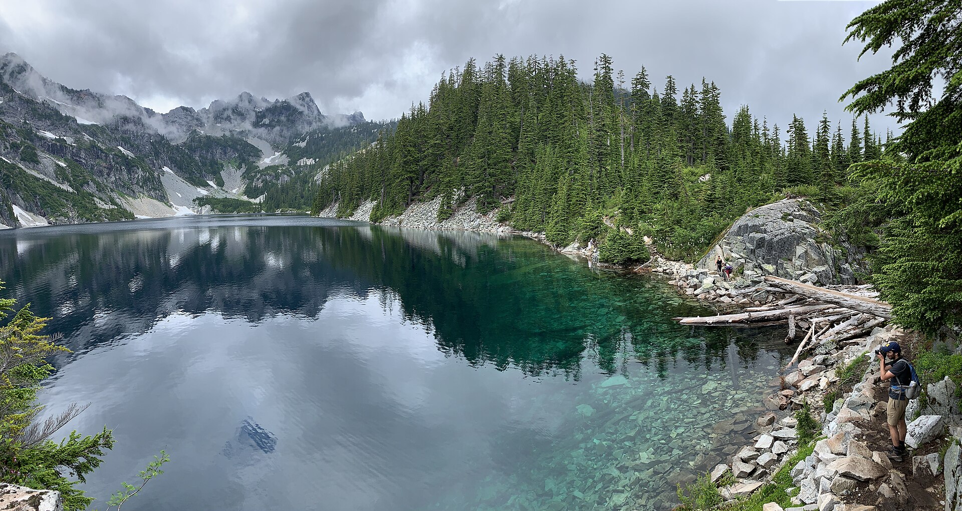
Follow Packwood Lake Trail #78 from the road-end trailhead through old-growth forest, enter Goat Rocks Wilderness, and reach Packwood Lake near the historic guard station / ranger-station area. A bridge over Lake Creek gives access to the north-shore camping area, but day hikers can turn around at the lake outlet or shore.
Why it is essential
The lower-elevation lake classic of Goat Rocks, pairing old-growth forest, a large natural lake, Indigenous and early Forest Service history, and a much longer season than the high crest routes.
Equipment
- Trail shoes or boots
- Rain layer
- Water treatment
- Insect protection
- Navigation, headlamp
Hazards and notes
- Wet forest tread, blowdown, remote lake-shore travel.
- No potable water.
- USFS motor restrictions at Packwood Lake — no motorised or mechanical watercraft.
- $5 day-use fee or valid pass; free wilderness permit at trailhead.
GPX / route file
| Source | URL | Format | Notes |
|---|---|---|---|
| WTA — Packwood Lake | wta.org | Route database and map | Route geometry / reuse terms unresolved |
| USFS — Trail #78 Packwood Lake | fs.usda.gov | Official trail page | Route description; carries lake history and geology |
| OpenStreetMap search | openstreetmap.org | Source map | Reusable only under ODbL terms with attribution/share-alike |
Sources
Further reading
- USFS — Goat Rocks Wilderness
- USFS — Gifford Pinchot Wilderness Areas
- USFS — Gifford Pinchot alerts and closures
- USFS — Gifford Pinchot fire restrictions
- USFS — Okanogan-Wenatchee alerts
- Washington Trails Association
- Pacific Crest Trail Association
- Wilderness.net — Goat Rocks Wilderness
Missing data / follow-up work
- No official or clearly reusable GPX / KML files were verified for the five routes; source links are provided for manual GPX creation or later legal review.
- WTA route geometry and map-download reuse terms remain unresolved.
- Separately sourced elevation loss is not published for these routes.
- Snowgrass Trail #96 carried an unresolved current access warning on the USFS page during compilation. Confirm with the Cowlitz Valley Ranger District (360-497-1100) before publication or travel.
- No Snowgrass-specific licence-compatible photograph at the site’s 2000 px floor was found — several regional Joe Parks candidates exist on Wikimedia Commons but are only 1280 px wide.
- No Packwood-Lake-specific reusable image was flagged in the source pass; the L8rpeace CC BY-SA 4.0 shore shot used here should be re-verified before publication.
- Cispus Basin does not yet have a route-turnaround-specific licence-compatible photograph; the Ives Peak / Cispus River basin USFS PD image used here is regional rather than pass-specific.