Regional overview
The Lake District is England’s most concentrated mountain-walking area, with rocky fells, glacial lakes, steep corries, narrow ridges and high summit plateaux. It includes Scafell Pike, England’s highest mountain, and Helvellyn, one of the most recognisable ridge-walk summits in the country. The Lake District National Park is also a UNESCO World Heritage cultural landscape.
The Pennine selections here focus on the Yorkshire Dales and North Pennines: limestone hills and caves around Pen-y-ghent, and the volcanic and geological escarpment landscape of High Cup Nick. The North Pennines route lies within a UNESCO Global Geopark / National Landscape, where route-finding, weather exposure and moorland conditions are important considerations.
Typical hiking season is late spring to early autumn, but all five routes can become serious in poor visibility, high wind, heavy rain, snow or ice. The Lake District routes in particular should be treated as mountain walks, not casual hill paths.
Selection rationale
These five hikes balance the region’s main mountain characters: England’s highest summit, a classic exposed ridge, a compact Lake District fell circuit, a Yorkshire Dales Three Peaks summit, and a North Pennines geological escarpment walk. The choices favour routes with strong official or reputable route sources, recognisable landscape value and day-hike feasibility.
Summary table
| # | Hike | Country | Route type | Distance | Gain | Max elevation | Difficulty |
|---|---|---|---|---|---|---|---|
| 1 | Scafell Pike from Wasdale via Hollow Stones | England | Out-and-back | c. 9 km return | c. 900 m | 978 m | Strenuous mountain hike |
| 2 | Helvellyn via Striding Edge and Swirral Edge | England | Loop | 12.4–13.0 km | 820–873 m | 950 m | Strenuous; Grade 1 scrambling/exposure |
| 3 | Langdale Pikes via Stickle Tarn | England | Loop | c. 9.1 km | c. 869 m | 736 m | Strenuous fell walk |
| 4 | Pen-y-ghent circular from Horton-in-Ribblesdale | England | Loop | 10–11.4 km | c. 488 m | 694 m | Moderate/strenuous hill walk |
| 5 | High Cup Nick circular from Dufton | England | Loop | 17.1 km | c. 424 m | c. 550 m | Moderate/strenuous moorland walk |
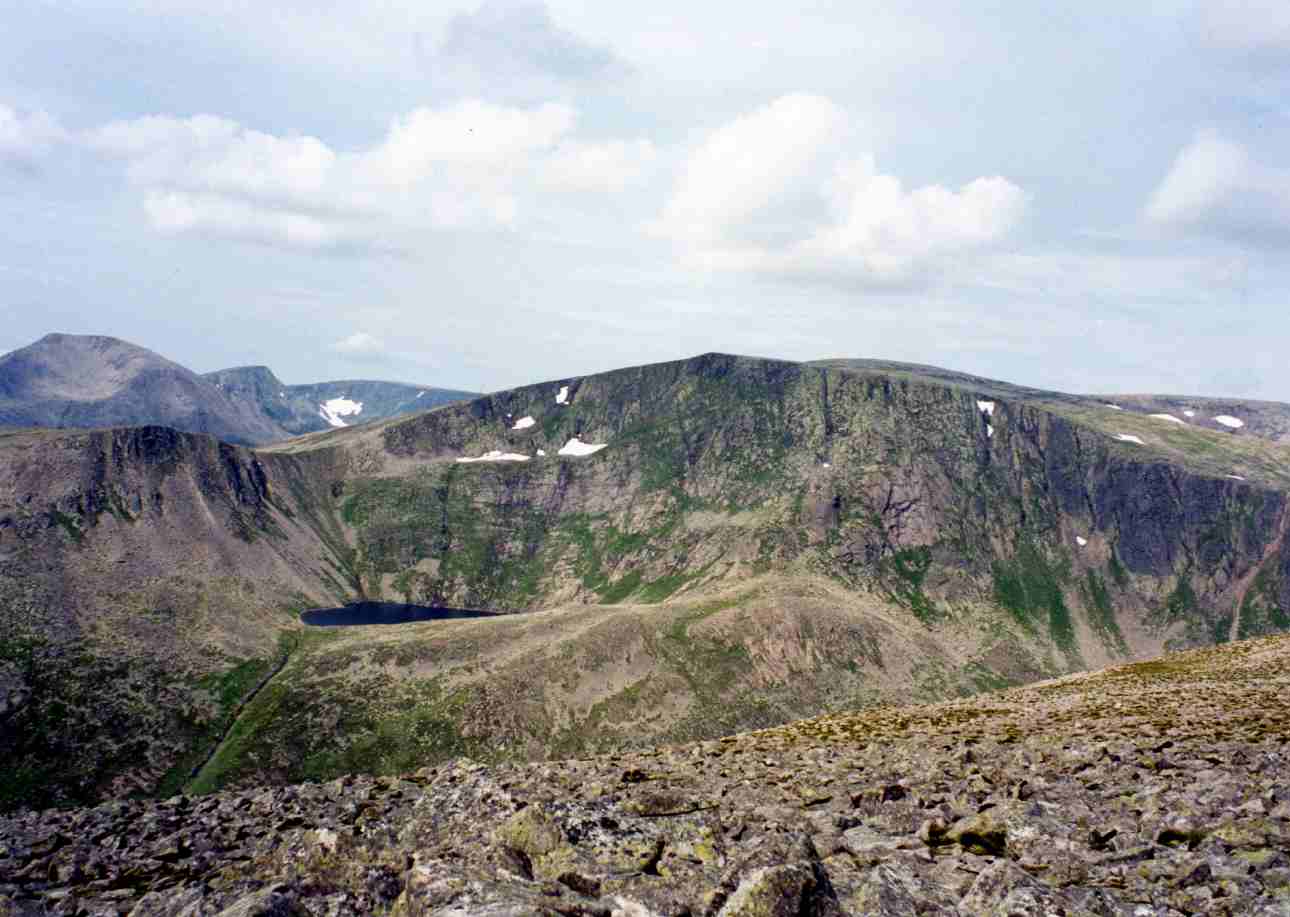
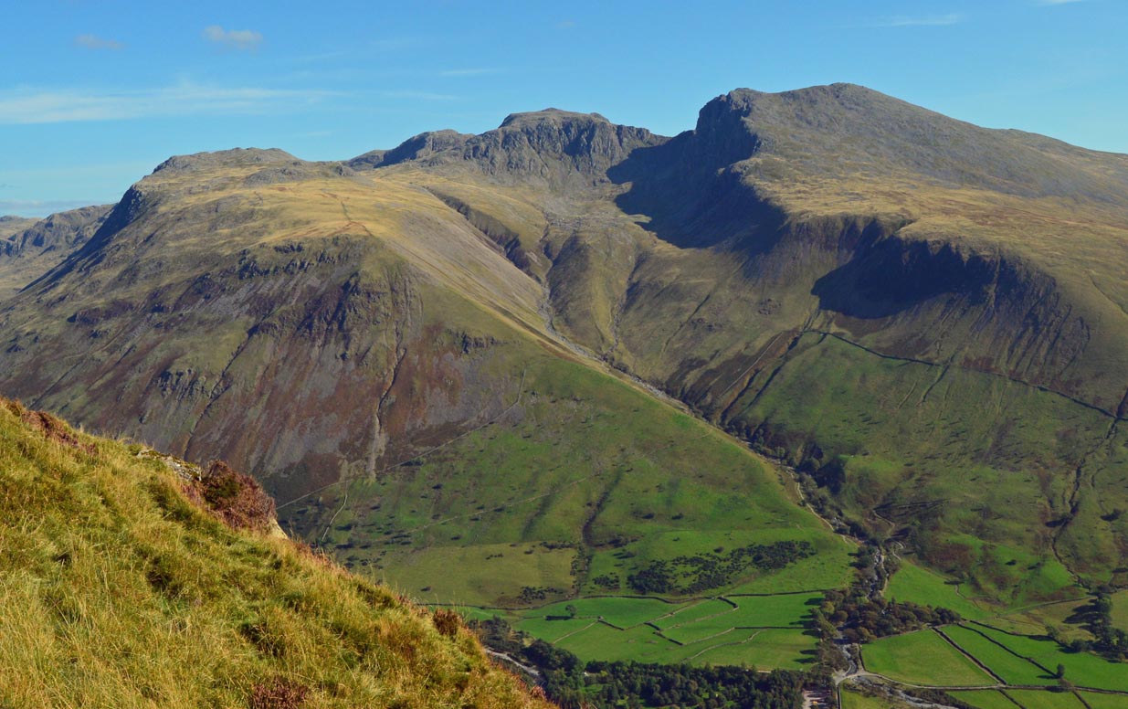
1. Scafell Pike from Wasdale via Hollow Stones
Snapshot
Itinerary
The route starts at Lake Head car park in Wasdale and follows the main path towards Lingmell Gill, then climbs towards Hollow Stones. Above Hollow Stones the path rises more steeply on rough stone and scree-like ground to Lingmell Col before the final ascent to the summit plateau of Scafell Pike. The return normally follows the same route back to Wasdale. The National Trust route description specifically warns that navigation on the summit plateau can be difficult and that Piers Gill is a serious hazard in descent if the wrong line is taken.
Why it is essential
Scafell Pike is England’s highest mountain, and the Wasdale route is the most direct established walking line to the summit. The hike represents the rugged western Lake District: stony paths, high corries, broad summit stones, views over Wastwater and a serious mountain atmosphere despite the modest altitude by Alpine standards.
Equipment
- Sturdy boots
- Waterproof layer
- Warm layer
- Map
- Compass
- GPS backup
- Food
- Water
- Headtorch
- Winter equipment may be required in snow or ice
Hazards and notes
- The route is steep, rocky and exposed to rapid weather change.
- High wind, rain, snow, cold and poor visibility are specifically noted by the National Trust.
- River crossings can become difficult in high water.
- The summit plateau requires careful navigation, especially in mist.
GPX / KML links
| Source | URL | Format | Notes |
|---|---|---|---|
| National Trust: Scafell Pike from Wasdale | nationaltrust.org.uk | Official route page / PDF map | No official GPX found in this pass |
| ScafellPike.org.uk Wasdale route | scafellpike.org.uk | Web route description/statistics | Secondary verification only |
Sources
- National Trust — Scafell Pike via Hollow Stones
- ScafellPike.org.uk — Wasdale route
- Wikimedia Commons — Scafell massif
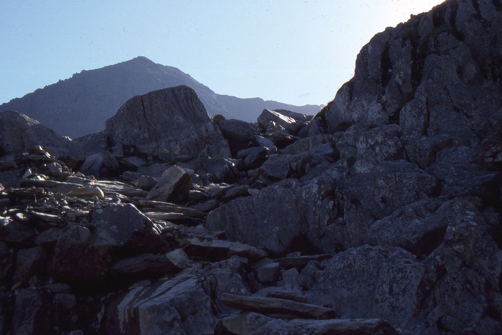
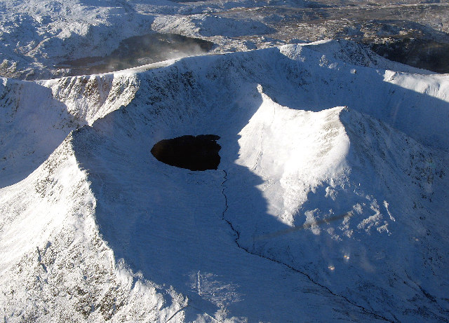
2. Helvellyn via Striding Edge and Swirral Edge
Snapshot
Itinerary
From Glenridding, the route climbs towards Greenside and Red Tarn, then reaches Hole-in-the-Wall before traversing Striding Edge. The ridge gives an exposed approach to Helvellyn’s summit plateau. Descent is normally by Swirral Edge to Red Tarn, followed by the return to Glenridding. Visit Lake District describes the route as a strenuous outing involving easy but exposed scrambling, narrow rocky ridges and a stony summit plateau.
Why it is essential
This is one of England’s classic mountain ridge walks. Striding Edge and Swirral Edge give the hike a distinctly alpine feel by British standards, while Red Tarn and the Helvellyn plateau make it a compact, memorable high-level circuit. It is essential because it represents the Lake District’s exposed ridge-walking tradition rather than only summit-bagging.
Equipment
- Sturdy boots
- Waterproofs
- Warm layer
- Gloves and hat outside midsummer
- Map
- Compass
- GPS backup
- Trekking poles may help on the approach and descent but should be stowed on scrambling sections
Hazards and notes
- The route requires a head for heights.
- Striding Edge and Swirral Edge are serious in high wind, rain, snow, verglas or poor visibility.
- The Visit Lake District route page describes Grade 1 scrambling / winter climbing terrain and recommends proper maps, compass and the knowledge to use them.
GPX / KML links
| Source | URL | Format | Notes |
|---|---|---|---|
| Visit Lake District: Helvellyn via Striding and Swirral Edges | visitlakedistrict.com | Official guide route page | No official GPX found in this pass |
| AllTrails: Helvellyn, Striding Edge and Swirral Edge Circular | alltrails.com | Source route / app route | Secondary route source |
Sources
- Visit Lake District — Helvellyn via Striding Edge and Swirral Edge
- AllTrails — Helvellyn, Striding Edge and Swirral Edge Circular
- Wikimedia Commons — Helvellyn and approaches in winter
3. Langdale Pikes via Stickle Tarn
Photo pending: no fully licence-verified image candidate found in this pass. Wikimedia/Wikipedia pages contain relevant Langdale Pikes and Pavey Ark images, but full file-level author and licence metadata was not successfully verified.
Snapshot
Itinerary
The compact route starts from the Stickle Ghyll / New Dungeon Ghyll area and climbs beside Stickle Ghyll to Stickle Tarn. From the tarn, variants continue towards Pavey Ark, Thunacar Knott, Harrison Stickle, Pike of Stickle and Loft Crag before descending to Great Langdale. National Trust verifies the lower Stickle Tarn trail, including the steep stone-pitched path and short easy scrambling sections. WalkLakes provides the longer fell-circuit statistics and route description for the Langdale Pikes.
Why it is essential
The Langdale Pikes are among the most recognisable fell groups in the Lake District. The route combines tarn scenery, steep ghyll-side ascent, rocky summits and views across Great Langdale. It also adds a cultural element: Pike of Stickle is associated with the Neolithic Langdale axe industry.
Equipment
- Sturdy boots
- Waterproofs
- Warm layer
- Navigation backup
- Food
- Water
- Trekking poles may help on the descent
Hazards and notes
- Paths are rocky, uneven and slippery when wet or icy.
- The National Trust describes the Stickle Tarn path as steep, rocky and involving short easy scrambles.
- WalkLakes notes loose and steep ground, boggy sections and the need for map-and-compass competence.
GPX / KML links
| Source | URL | Format | Notes |
|---|---|---|---|
| National Trust Stickle Tarn trail | nationaltrust.org.uk | Official trail page | Official lower-route verification only |
| WalkLakes Langdale Pikes route | walklakes.co.uk | KML/source route | Route source identified; KML link available from route page |
| OS Maps Langdale Pikes Greater Traverse | osmaps.com | GPX/source route | Longer variant, not the compact 9.1 km circuit |
Sources
- National Trust — Stickle Tarn trail
- WalkLakes — Langdale Pikes route
- OS Maps — Langdale Pikes Greater Traverse
- Wikipedia — Pike of Stickle
- Wikipedia — Pavey Ark
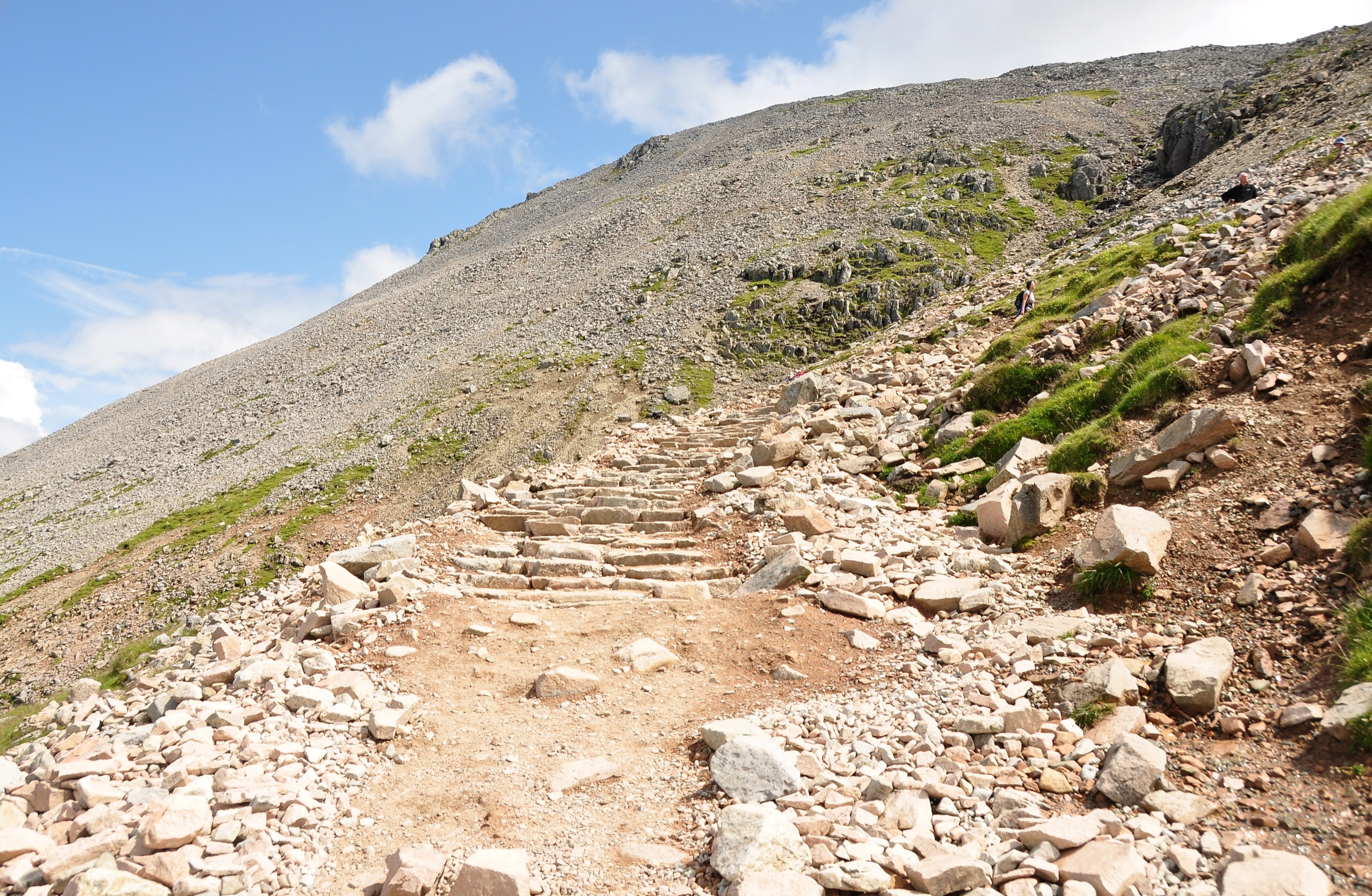
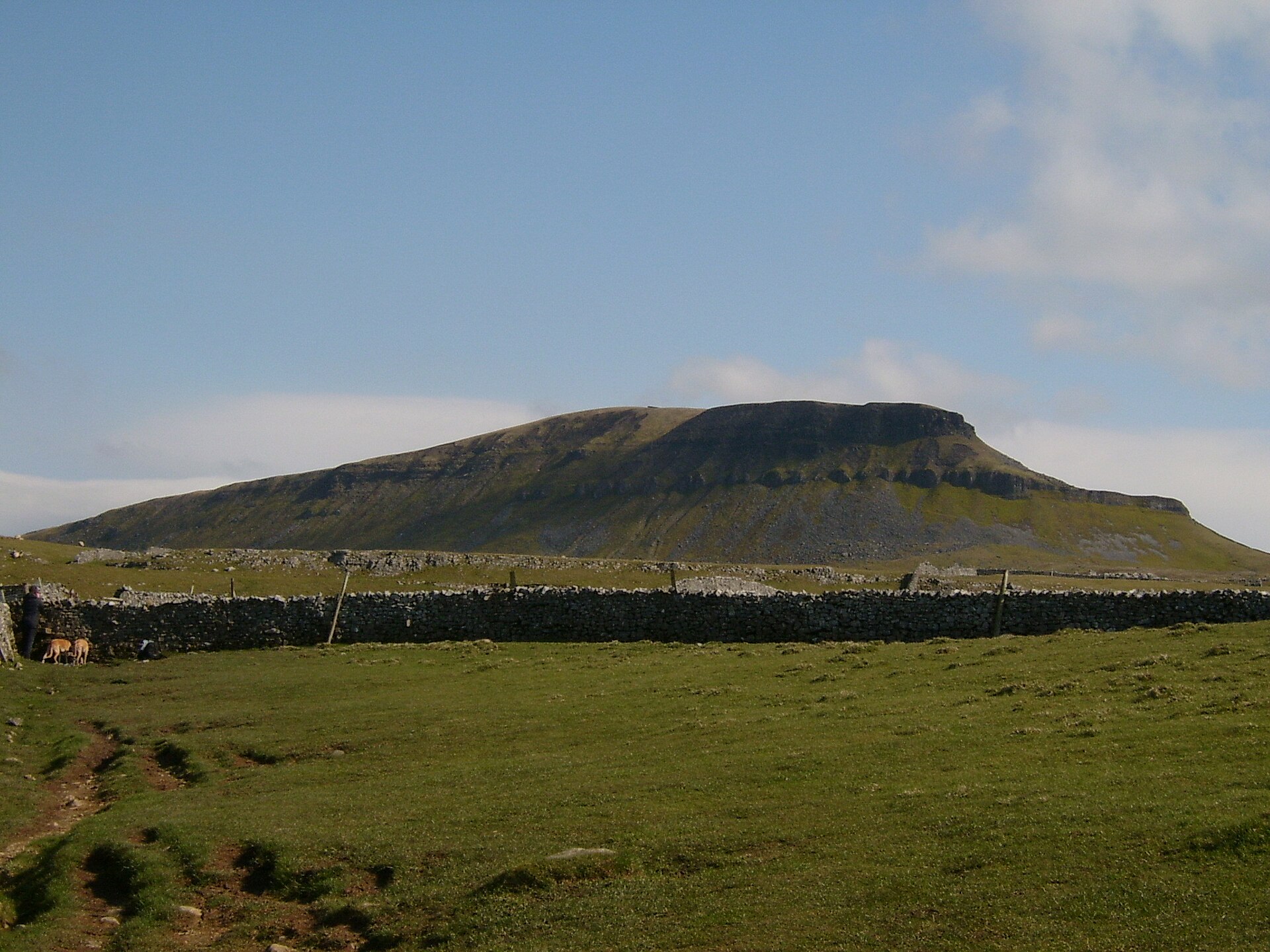
4. Pen-y-ghent circular from Horton-in-Ribblesdale
Snapshot
Itinerary
The route starts in Horton-in-Ribblesdale and climbs by Brackenbottom Scar to join the Pennine Way near the upper slopes of Pen-y-ghent. It reaches the 694 m summit, then descends northwards and returns by Horton Scar Lane, passing the limestone features of Hunt Pot and Hull Pot. Yorkshire Dales National Park lists the circuit as a 10 km classic walk from Horton with good paths, scenic value and direct rail access nearby.
Why it is essential
Pen-y-ghent is one of the Yorkshire Three Peaks and gives a compact introduction to Pennine limestone hill country: steep escarpment, open summit, potholes, walls and broad Dales views. It is a strong Pennines counterweight to the Lake District selections.
Equipment
- Boots
- Waterproof layer
- Warm layer
- Map or GPS
- Food
- Water
- Additional traction may be needed in winter or icy conditions
Hazards and notes
- The upper approach is steep and can be slippery.
- Weather can be colder and windier on the summit than in Horton.
- Yorkshire Dales National Park advises suitable equipment and notes Countryside Code responsibilities, including dog control.
GPX / KML links
| Source | URL | Format | Notes |
|---|---|---|---|
| Yorkshire Dales National Park Pen-y-ghent walk | yorkshiredales.org.uk | Official route page / downloadable PDF | Official route verification |
| Topo GPS Pen-y-ghent | topo-gps.com | GPX / ZIP | GPX source identified |
Sources
- Yorkshire Dales National Park — Pen-y-ghent walk
- Topo GPS — Pen-y-ghent
- Wikimedia Commons — Pen-y-ghent 2
5. High Cup Nick circular from Dufton
Photo pending: no fully licence-compatible image candidate verified in this pass. Wikimedia/Wikipedia images of High Cup Gill and High Cup Nick were identified, but file-level author and licence metadata was not successfully verified.
Snapshot
Itinerary
The official North Pennines geotrail offers several options from Dufton or Murton. The selected day-hike variant is the Dufton circular: it heads from the village into the North Pennines, climbs towards Great Rundale and Maize Beck, reaches High Cup Nick, then returns along the northern rim and back to Dufton. The route explores the glacial valley of High Cup Gill and the Whin Sill escarpment.
Why it is essential
High Cup Nick is one of the defining landscapes of the North Pennines: a dramatic U-shaped glacial valley cut into the Pennine escarpment, with dolerite crags, open moorland and wide views to the Eden Valley. It adds a geological and Pennine Way character that contrasts strongly with the Lake District fell routes.
Equipment
- Boots
- Waterproofs
- Warm layer
- Map
- Compass
- GPS backup
- Food
- Water
Hazards and notes
- The North Pennines source warns that the weather can be harsh, with cloud and high winds affecting visibility and safety.
- The geotrail PDF notes unmarked sections, faint paths and a steep descent near High Cup Nick.
- In poor conditions, returning the same way may be safer than attempting the full circuit.
GPX / KML links
| Source | URL | Format | Notes |
|---|---|---|---|
| North Pennines High Cup Nick Geotrail | northpennines.org.uk | Official geotrail page / PDF | Official route map/source |
| North Pennines High Cup Nick Geotrail PDF | northpennines.org.uk | PDF route map | Official route map/source |
| Walking Britain High Cup Nick from Dufton | walkingbritain.co.uk | GPX download/source route | GPX source identified |
Sources
- North Pennines — High Cup Nick Geotrail
- North Pennines — High Cup Nick Geotrail PDF
- Walking Britain — High Cup Nick from Dufton
- Wikipedia — High Cup Gill
Region-level sources
| Source | Use | URL |
|---|---|---|
| National Trust — Scafell Pike via Hollow Stones | Scafell Pike official route | nationaltrust.org.uk |
| ScafellPike.org.uk — Wasdale route | Scafell Pike secondary route source | scafellpike.org.uk |
| Visit Lake District — Helvellyn via Striding Edge and Swirral Edge | Helvellyn official guide | visitlakedistrict.com |
| AllTrails — Helvellyn, Striding Edge and Swirral Edge Circular | Helvellyn secondary route | alltrails.com |
| National Trust — Stickle Tarn trail | Langdale Pikes lower route | nationaltrust.org.uk |
| WalkLakes — Langdale Pikes route | Langdale Pikes circuit source | walklakes.co.uk |
| OS Maps — Langdale Pikes Greater Traverse | Langdale Pikes long variant | osmaps.com |
| Yorkshire Dales National Park — Pen-y-ghent | Pen-y-ghent official route | yorkshiredales.org.uk |
| Topo GPS — Pen-y-ghent | Pen-y-ghent GPX | topo-gps.com |
| North Pennines — High Cup Nick Geotrail | High Cup Nick official route | northpennines.org.uk |
| North Pennines — High Cup Nick Geotrail PDF | High Cup Nick official PDF | northpennines.org.uk |
| Walking Britain — High Cup Nick from Dufton | High Cup Nick GPX | walkingbritain.co.uk |
| Wikimedia Commons — Scafell massif | Image source | commons.wikimedia.org |
| Wikimedia Commons — Helvellyn winter | Image source | commons.wikimedia.org |
| Wikimedia Commons — Pen-y-ghent 2 | Image source | commons.wikimedia.org |